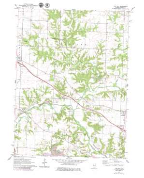
Oak Hill Topo Map Illinois
To zoom in, hover over the map of Oak Hill
USGS Topo Quad 40089g7 - 1:24,000 scale
| Topo Map Name: | Oak Hill |
| USGS Topo Quad ID: | 40089g7 |
| Print Size: | ca. 21 1/4" wide x 27" high |
| Southeast Coordinates: | 40.75° N latitude / 89.75° W longitude |
| Map Center Coordinates: | 40.8125° N latitude / 89.8125° W longitude |
| U.S. State: | IL |
| Filename: | o40089g7.jpg |
| Download Map JPG Image: | Oak Hill topo map 1:24,000 scale |
| Map Type: | Topographic |
| Topo Series: | 7.5´ |
| Map Scale: | 1:24,000 |
| Source of Map Images: | United States Geological Survey (USGS) |
| Alternate Map Versions: |
Oak Hill IL 1971, updated 1973 Download PDF Buy paper map Oak Hill IL 1971, updated 1979 Download PDF Buy paper map Oak Hill IL 1997, updated 1997 Download PDF Buy paper map Oak Hill IL 2012 Download PDF Buy paper map Oak Hill IL 2015 Download PDF Buy paper map |
1:24,000 Topo Quads surrounding Oak Hill
> Back to 40089e1 at 1:100,000 scale
> Back to 40088a1 at 1:250,000 scale
> Back to U.S. Topo Maps home
Oak Hill topo map: Gazetteer
Oak Hill: Crossings
Interchange 75 elevation 201m 659′Interchange 82 elevation 200m 656′
Oak Hill: Dams
South Pond Dam elevation 182m 597′Oak Hill: Flats
Quail Meadow elevation 204m 669′Oak Hill: Parks
Jubilee College Forest Nature Preserve elevation 179m 587′Jubilee College State Park elevation 196m 643′
Oak Hill: Populated Places
Kickapoo elevation 202m 662′Oak Hill elevation 181m 593′
Olin elevation 158m 518′
Oak Hill: Reservoirs
South Pond elevation 182m 597′Oak Hill: Streams
Fargo Run elevation 164m 538′Jubilee Creek elevation 158m 518′
Nixon Run elevation 152m 498′
Rupp Run elevation 152m 498′
West Fork Kickapoo Creek elevation 158m 518′
Oak Hill digital topo map on disk
Buy this Oak Hill topo map showing relief, roads, GPS coordinates and other geographical features, as a high-resolution digital map file on DVD:
Northern Illinois, Northern Indiana & Southwestern Michigan
Buy digital topo maps: Northern Illinois, Northern Indiana & Southwestern Michigan


