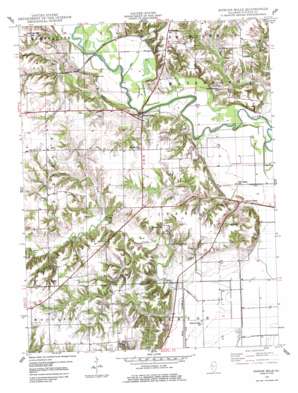
Duncan Mills Topo Map Illinois
To zoom in, hover over the map of Duncan Mills
USGS Topo Quad 40090c2 - 1:24,000 scale
| Topo Map Name: | Duncan Mills |
| USGS Topo Quad ID: | 40090c2 |
| Print Size: | ca. 21 1/4" wide x 27" high |
| Southeast Coordinates: | 40.25° N latitude / 90.125° W longitude |
| Map Center Coordinates: | 40.3125° N latitude / 90.1875° W longitude |
| U.S. State: | IL |
| Filename: | o40090c2.jpg |
| Download Map JPG Image: | Duncan Mills topo map 1:24,000 scale |
| Map Type: | Topographic |
| Topo Series: | 7.5´ |
| Map Scale: | 1:24,000 |
| Source of Map Images: | United States Geological Survey (USGS) |
| Alternate Map Versions: |
Duncan Mills IL 1948 Download PDF Buy paper map Duncan Mills IL 1948, updated 1986 Download PDF Buy paper map Duncan Mills IL 2012 Download PDF Buy paper map Duncan Mills IL 2015 Download PDF Buy paper map |
1:24,000 Topo Quads surrounding Duncan Mills
> Back to 40090a1 at 1:100,000 scale
> Back to 40090a1 at 1:250,000 scale
> Back to U.S. Topo Maps home
Duncan Mills topo map: Gazetteer
Duncan Mills: Airports
Curless Airport elevation 186m 610′Duncan Mills: Bridges
Duncan Mills Bridge (historical) elevation 134m 439′Duncan Mills: Lakes
Thomas Lake (historical) elevation 132m 433′Wheaton Lake (historical) elevation 137m 449′
Duncan Mills: Populated Places
Beaty elevation 190m 623′Duncan Mills elevation 146m 479′
Enion elevation 140m 459′
Otto (historical) elevation 144m 472′
Waterford (historical) elevation 141m 462′
Duncan Mills: Streams
East Creek elevation 137m 449′North Branch Otter Creek elevation 143m 469′
Tater Creek elevation 138m 452′
Turkey Branch elevation 140m 459′
Duncan Mills digital topo map on disk
Buy this Duncan Mills topo map showing relief, roads, GPS coordinates and other geographical features, as a high-resolution digital map file on DVD:


