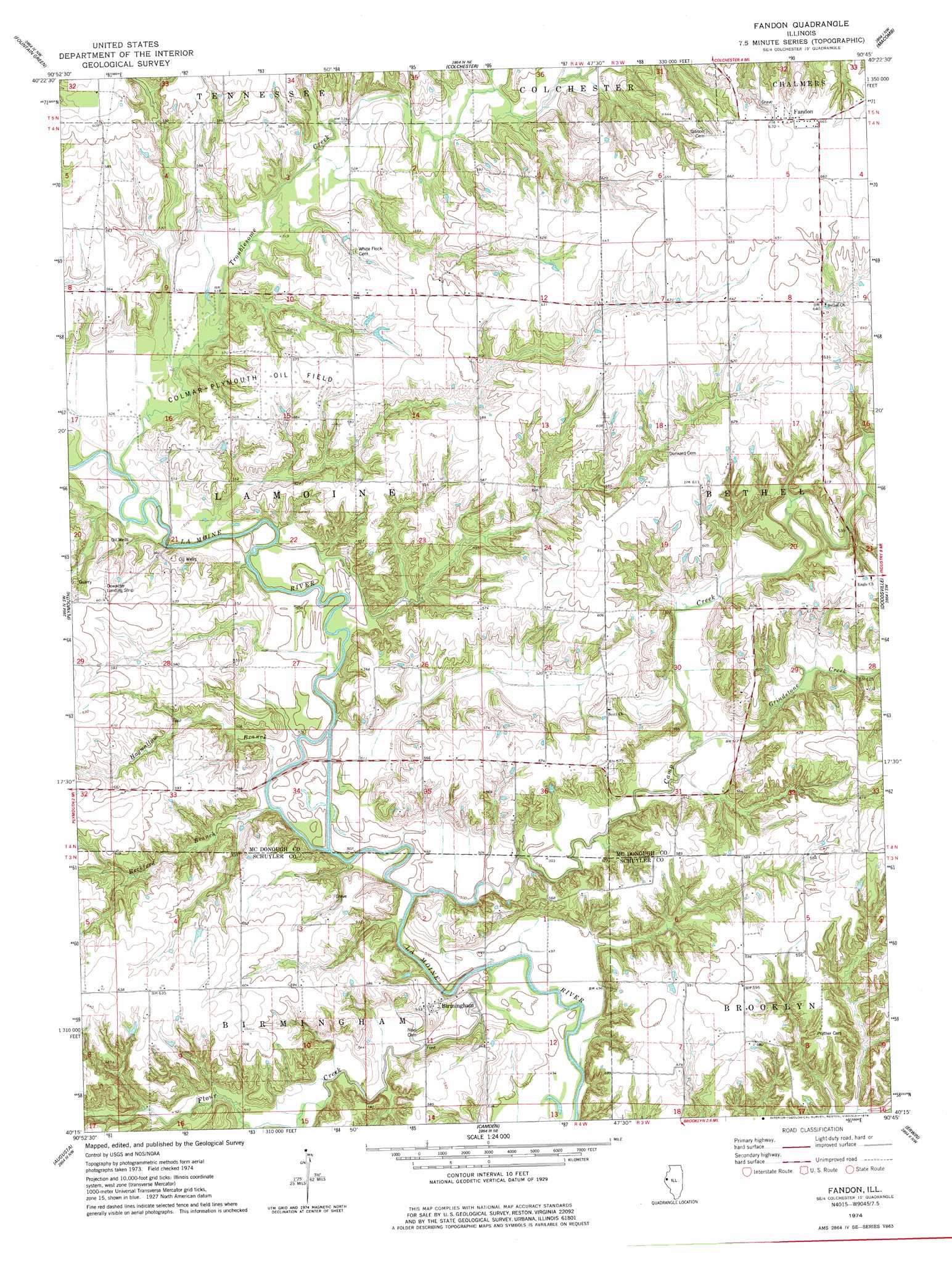
Fandon Topo Map Illinois
To zoom in, hover over the map of Fandon
USGS Topo Quad 40090c7 - 1:24,000 scale
| Topo Map Name: | Fandon |
| USGS Topo Quad ID: | 40090c7 |
| Print Size: | ca. 21 1/4" wide x 27" high |
| Southeast Coordinates: | 40.25° N latitude / 90.75° W longitude |
| Map Center Coordinates: | 40.3125° N latitude / 90.8125° W longitude |
| U.S. State: | IL |
| Filename: | o40090c7.jpg |
| Download Map JPG Image: | Fandon topo map 1:24,000 scale |
| Map Type: | Topographic |
| Topo Series: | 7.5´ |
| Map Scale: | 1:24,000 |
| Source of Map Images: | United States Geological Survey (USGS) |
| Alternate Map Versions: |
Fandon IL 1974, updated 1978 Download PDF Buy paper map Fandon IL 2012 Download PDF Buy paper map Fandon IL 2015 Download PDF Buy paper map |
1:24,000 Topo Quads surrounding Fandon
Burnside |
La Harpe |
Blandinsville |
Good Hope |
Bushnell West |
Carthage East |
Fountain Green |
Colchester |
Macomb |
Bardolph |
Bentley |
Plymouth |
Fandon |
Doddsville |
Industry |
Bowen |
Augusta |
Camden |
Erwin |
Rushville North |
Camp Point |
Clayton |
Lake Mount Sterling |
Ripley |
Rushville South |
> Back to 40090a1 at 1:100,000 scale
> Back to 40090a1 at 1:250,000 scale
> Back to U.S. Topo Maps home
Fandon topo map: Gazetteer
Fandon: Airports
Clark Airport elevation 175m 574′Dowacter Airport elevation 184m 603′
Fandon: Bridges
Cow Ford Bridge elevation 147m 482′Lamoine Bridge elevation 151m 495′
Fandon: Oilfields
Colmar-Plymouth Oil Field elevation 155m 508′Fandon: Populated Places
Birmingham elevation 161m 528′Fandon elevation 204m 669′
Fandon: Streams
Beckford Branch elevation 147m 482′Camp Creek elevation 147m 482′
Flour Creek elevation 147m 482′
Grindstone Creek elevation 153m 501′
Hogwallow Branch elevation 148m 485′
Troublesome Creek elevation 154m 505′
Williams Creek elevation 154m 505′
Fandon digital topo map on disk
Buy this Fandon topo map showing relief, roads, GPS coordinates and other geographical features, as a high-resolution digital map file on DVD: