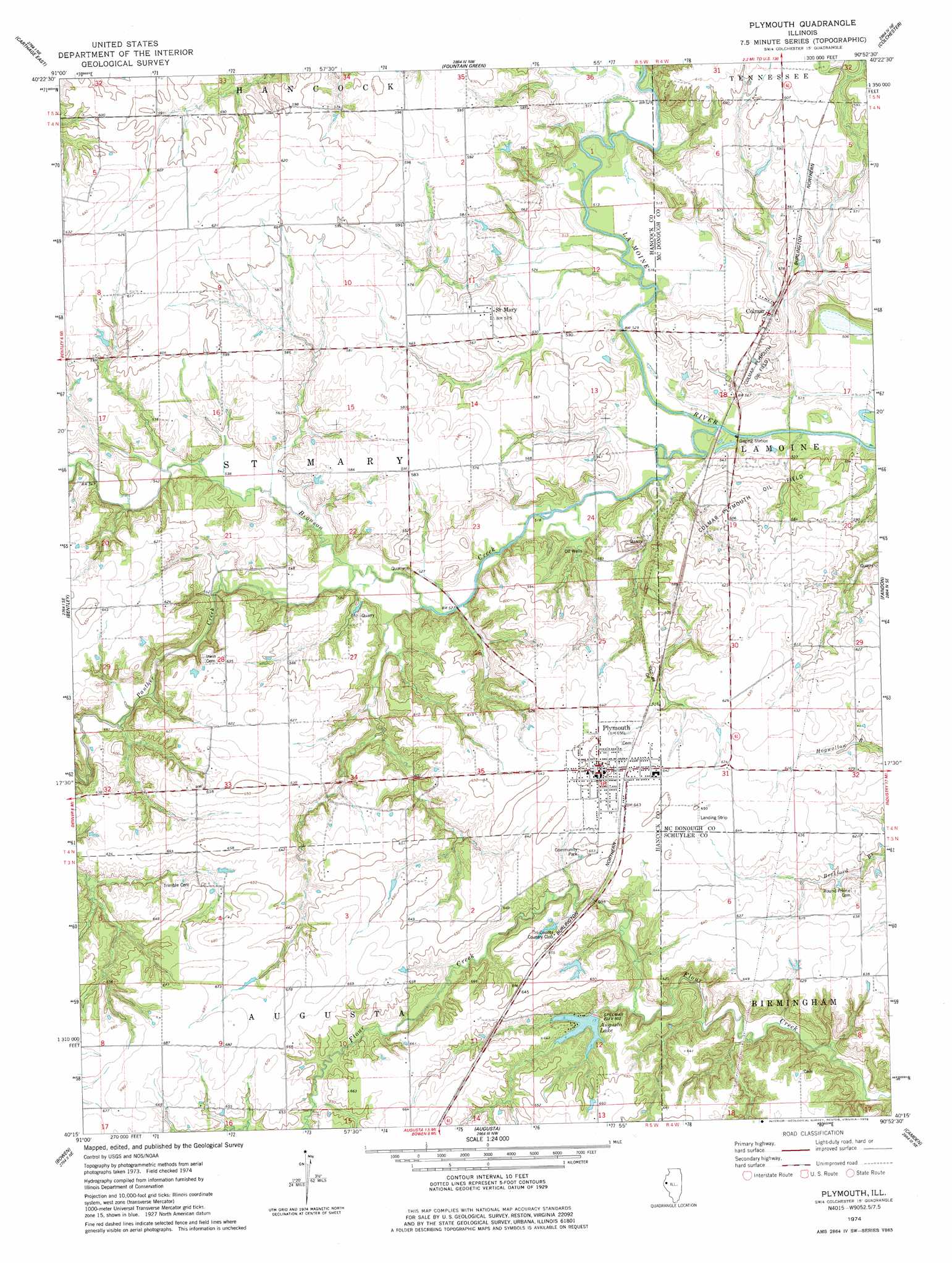
Plymouth Topo Map Illinois
To zoom in, hover over the map of Plymouth
USGS Topo Quad 40090c8 - 1:24,000 scale
| Topo Map Name: | Plymouth |
| USGS Topo Quad ID: | 40090c8 |
| Print Size: | ca. 21 1/4" wide x 27" high |
| Southeast Coordinates: | 40.25° N latitude / 90.875° W longitude |
| Map Center Coordinates: | 40.3125° N latitude / 90.9375° W longitude |
| U.S. State: | IL |
| Filename: | o40090c8.jpg |
| Download Map JPG Image: | Plymouth topo map 1:24,000 scale |
| Map Type: | Topographic |
| Topo Series: | 7.5´ |
| Map Scale: | 1:24,000 |
| Source of Map Images: | United States Geological Survey (USGS) |
| Alternate Map Versions: |
Plymouth IL 1974, updated 1978 Download PDF Buy paper map Plymouth IL 2012 Download PDF Buy paper map Plymouth IL 2015 Download PDF Buy paper map |
1:24,000 Topo Quads surrounding Plymouth
Colusa |
Burnside |
La Harpe |
Blandinsville |
Good Hope |
Carthage West |
Carthage East |
Fountain Green |
Colchester |
Macomb |
West Point |
Bentley |
Plymouth |
Fandon |
Doddsville |
Loraine |
Bowen |
Augusta |
Camden |
Erwin |
Coatsburg |
Camp Point |
Clayton |
Lake Mount Sterling |
Ripley |
> Back to 40090a1 at 1:100,000 scale
> Back to 40090a1 at 1:250,000 scale
> Back to U.S. Topo Maps home
Plymouth topo map: Gazetteer
Plymouth: Airports
Giles Griswold Airport elevation 195m 639′Plymouth: Areas
Round Prairie elevation 195m 639′Plymouth: Dams
Augusta Lake Dam elevation 184m 603′Dennis Lake Dam elevation 192m 629′
Plymouth: Lakes
Colmar Lake elevation 154m 505′Plymouth: Mines
O'Neal Quarry elevation 138m 452′Plymouth: Parks
Community Park elevation 198m 649′Plymouth: Populated Places
Colmar elevation 167m 547′Plymouth elevation 198m 649′
Saint Mary elevation 174m 570′
Plymouth: Reservoirs
Augusta Lake elevation 184m 603′Dennis Lake elevation 192m 629′
Plymouth: Streams
Bronson Creek elevation 155m 508′Panther Creek elevation 159m 521′
Plymouth digital topo map on disk
Buy this Plymouth topo map showing relief, roads, GPS coordinates and other geographical features, as a high-resolution digital map file on DVD: