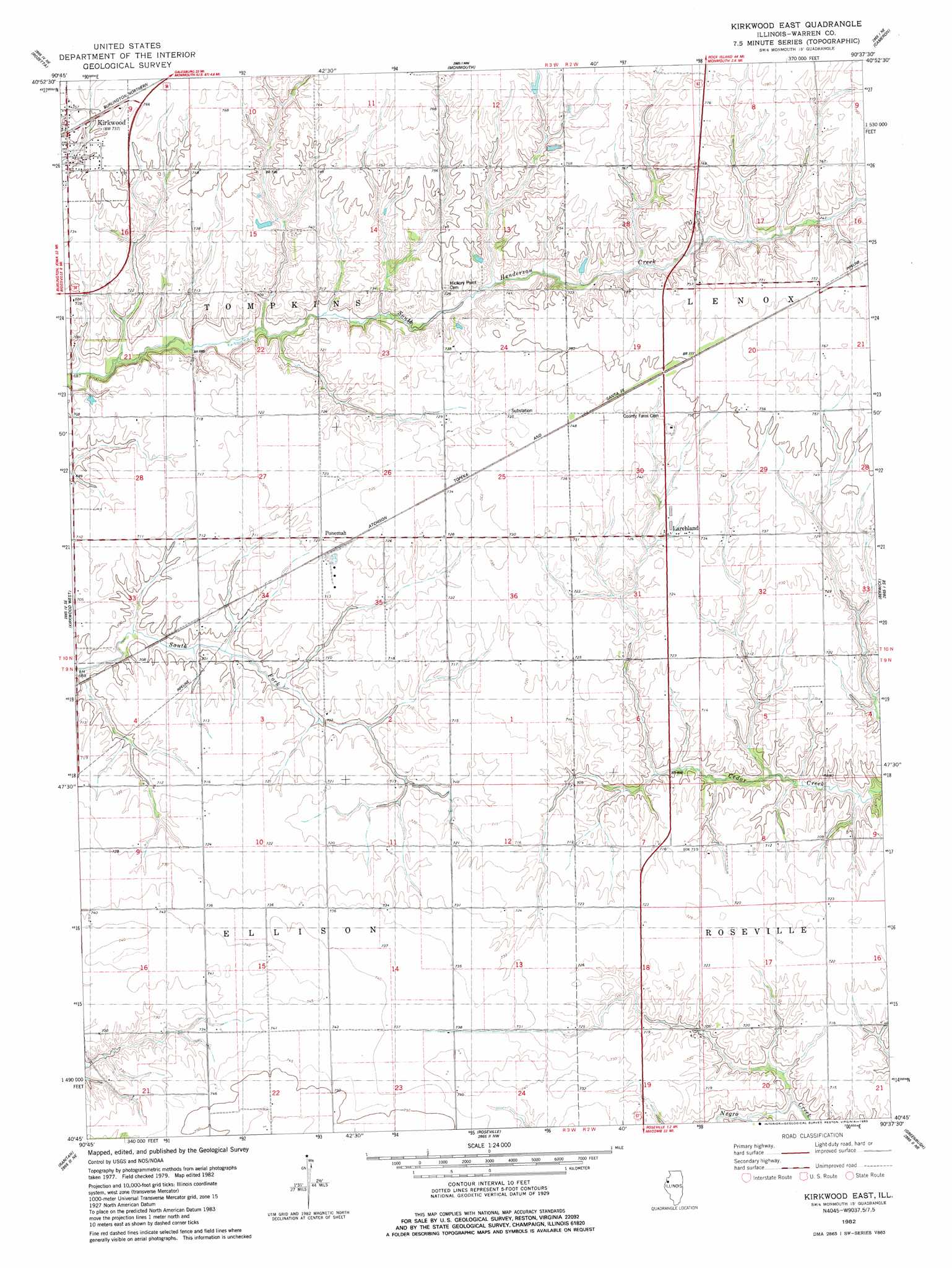
Kirkwood East Topo Map Illinois
To zoom in, hover over the map of Kirkwood East
USGS Topo Quad 40090g6 - 1:24,000 scale
| Topo Map Name: | Kirkwood East |
| USGS Topo Quad ID: | 40090g6 |
| Print Size: | ca. 21 1/4" wide x 27" high |
| Southeast Coordinates: | 40.75° N latitude / 90.625° W longitude |
| Map Center Coordinates: | 40.8125° N latitude / 90.6875° W longitude |
| U.S. State: | IL |
| Filename: | o40090g6.jpg |
| Download Map JPG Image: | Kirkwood East topo map 1:24,000 scale |
| Map Type: | Topographic |
| Topo Series: | 7.5´ |
| Map Scale: | 1:24,000 |
| Source of Map Images: | United States Geological Survey (USGS) |
| Alternate Map Versions: |
Kirkwood East IL 1982, updated 1983 Download PDF Buy paper map Kirkwood East IL 1998, updated 2000 Download PDF Buy paper map Kirkwood East IL 2012 Download PDF Buy paper map Kirkwood East IL 2015 Download PDF Buy paper map |
1:24,000 Topo Quads surrounding Kirkwood East
Keithsburg |
Seaton |
Little York |
Alexis |
North Henderson |
Oquawka |
Rozetta |
Monmouth |
Cameron |
Galesburg West |
Gladstone |
Kirkwood West |
Kirkwood East |
Berwick |
Abingdon |
Stronghurst |
Raritan |
Roseville |
Greenbush |
Avon |
La Harpe |
Blandinsville |
Good Hope |
Bushnell West |
Bushnell East |
> Back to 40090e1 at 1:100,000 scale
> Back to 40090a1 at 1:250,000 scale
> Back to U.S. Topo Maps home
Kirkwood East topo map: Gazetteer
Kirkwood East: Populated Places
Kirkwood elevation 226m 741′Larchland elevation 223m 731′
New Lancaster (historical) elevation 227m 744′
Ponemah elevation 220m 721′
Kirkwood East digital topo map on disk
Buy this Kirkwood East topo map showing relief, roads, GPS coordinates and other geographical features, as a high-resolution digital map file on DVD: