Gladstone Topo Map Illinois
To zoom in, hover over the map of Gladstone
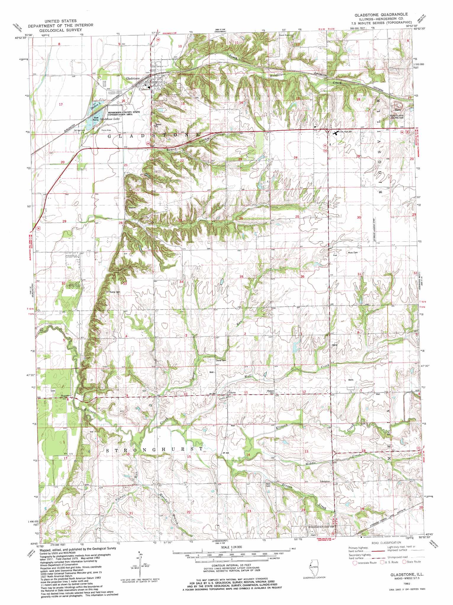
USGS Topo Quad 40090g8 - 1:24,000 scale
| Topo Map Name: | Gladstone |
| USGS Topo Quad ID: | 40090g8 |
| Print Size: | ca. 21 1/4" wide x 27" high |
| Southeast Coordinates: | 40.75° N latitude / 90.875° W longitude |
| Map Center Coordinates: | 40.8125° N latitude / 90.9375° W longitude |
| U.S. State: | IL |
| Filename: | o40090g8.jpg |
| Download Map JPG Image: | Gladstone topo map 1:24,000 scale |
| Map Type: | Topographic |
| Topo Series: | 7.5´ |
| Map Scale: | 1:24,000 |
| Source of Map Images: | United States Geological Survey (USGS) |
| Alternate Map Versions: |
Gladstone IL 1982, updated 1983 Download PDF Buy paper map Gladstone IL 2012 Download PDF Buy paper map Gladstone IL 2015 Download PDF Buy paper map |
1:24,000 Topo Quads surrounding Gladstone
Mediapolis |
Oakville |
Keithsburg |
Seaton |
Little York |
Sperry |
Kingston |
Oquawka |
Rozetta |
Monmouth |
West Burlington |
Burlington |
Gladstone |
Kirkwood West |
Kirkwood East |
Dallas City |
Lomax |
Stronghurst |
Raritan |
Roseville |
Colusa |
Burnside |
La Harpe |
Blandinsville |
Good Hope |
> Back to 40090e1 at 1:100,000 scale
> Back to 40090a1 at 1:250,000 scale
> Back to U.S. Topo Maps home
Gladstone topo map: Gazetteer
Gladstone: Airports
Seymour Landing Strip elevation 216m 708′Gladstone: Dams
Dowell Lake Dam elevation 192m 629′Gladstone: Lakes
Dutton Lake elevation 159m 521′Gladstone Lake elevation 161m 528′
Gladstone: Mines
Biggsville Quarry elevation 154m 505′Gladstone: Parks
Henderson State County Conservation Area elevation 159m 521′Gladstone: Populated Places
Gladstone elevation 167m 547′Hopper elevation 176m 577′
Olena elevation 189m 620′
Gladstone: Reservoirs
Dowell Lake elevation 192m 629′Gladstone: Streams
Deep Run elevation 170m 557′Dixson Creek elevation 180m 590′
Marshall Branch elevation 176m 577′
Middle Creek elevation 177m 580′
Nichols Run elevation 169m 554′
Wolf Creek elevation 174m 570′
Gladstone: Valleys
Bogus Hollow elevation 179m 587′Gladstone digital topo map on disk
Buy this Gladstone topo map showing relief, roads, GPS coordinates and other geographical features, as a high-resolution digital map file on DVD: