Monticello Topo Map Missouri
To zoom in, hover over the map of Monticello
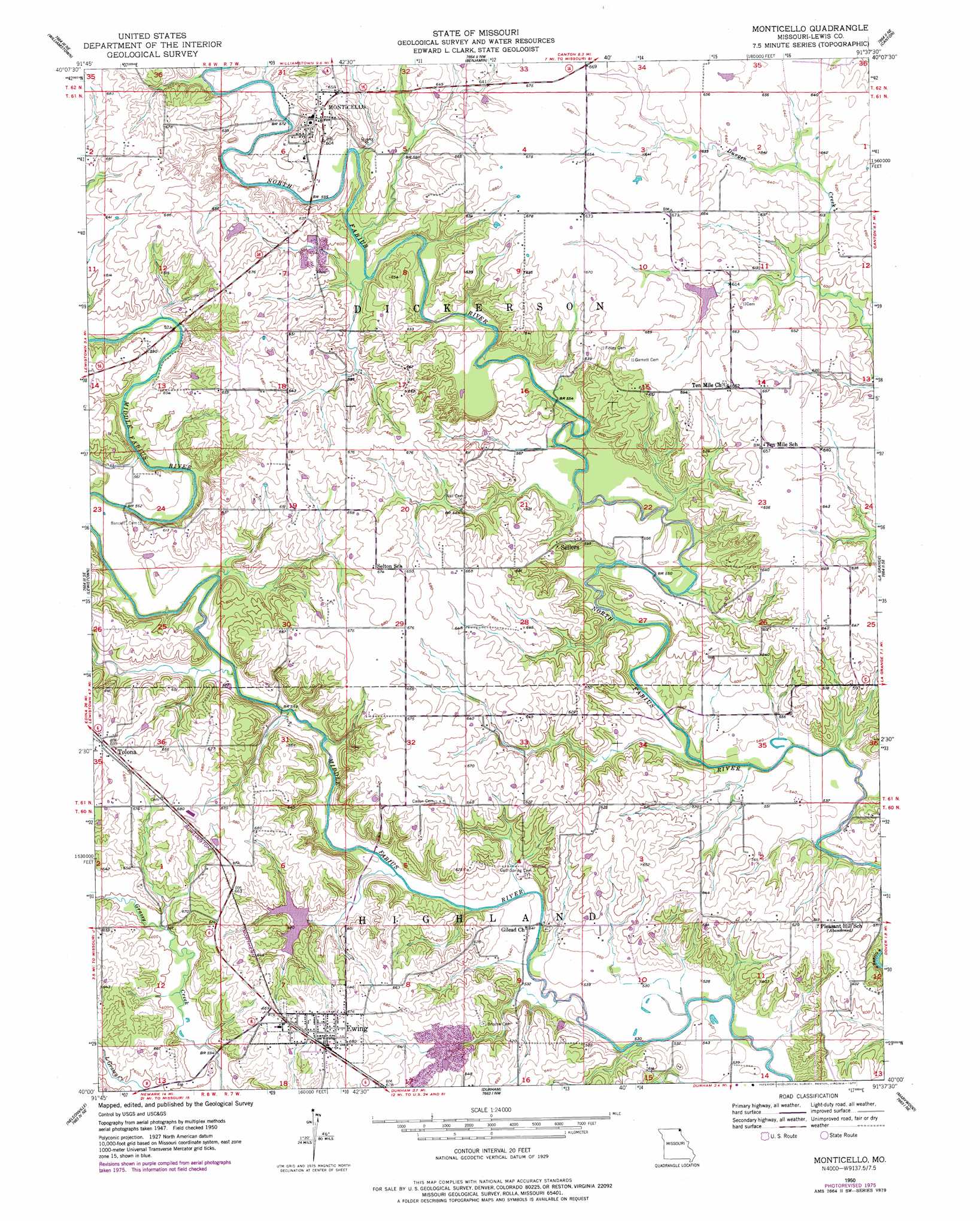
USGS Topo Quad 40091a6 - 1:24,000 scale
| Topo Map Name: | Monticello |
| USGS Topo Quad ID: | 40091a6 |
| Print Size: | ca. 21 1/4" wide x 27" high |
| Southeast Coordinates: | 40° N latitude / 91.625° W longitude |
| Map Center Coordinates: | 40.0625° N latitude / 91.6875° W longitude |
| U.S. State: | MO |
| Filename: | o40091a6.jpg |
| Download Map JPG Image: | Monticello topo map 1:24,000 scale |
| Map Type: | Topographic |
| Topo Series: | 7.5´ |
| Map Scale: | 1:24,000 |
| Source of Map Images: | United States Geological Survey (USGS) |
| Alternate Map Versions: |
Monticello MO 1950, updated 1977 Download PDF Buy paper map Monticello MO 1951 Download PDF Buy paper map Monticello MO 2012 Download PDF Buy paper map Monticello MO 2014 Download PDF Buy paper map |
1:24,000 Topo Quads surrounding Monticello
Colony |
Neeper |
Saint Patrick |
Kahoka Se |
Warsaw |
Deer Ridge |
Williamstown |
Benjamin |
Canton |
Lima |
La Belle |
Lewistown |
Monticello |
La Grange |
Long Island |
Newark |
Nelsonville |
Durham |
Maywood |
Quincy West |
Burksville |
Emden |
Philadelphia |
Palmyra |
Quincy Sw |
> Back to 40091a1 at 1:100,000 scale
> Back to 40090a1 at 1:250,000 scale
> Back to U.S. Topo Maps home
Monticello topo map: Gazetteer
Monticello: Bridges
Monticello Bridge elevation 176m 577′Steele Bridge elevation 163m 534′
Weston Bridge elevation 164m 538′
Monticello: Dams
Durgens Creek Watershed Dam Number 28 elevation 186m 610′Ewing Dam elevation 178m 583′
Monticello: Populated Places
Durgen elevation 196m 643′Ewing elevation 208m 682′
Gilead elevation 165m 541′
Monticello elevation 195m 639′
Sellers elevation 190m 623′
Ten Mile elevation 201m 659′
Tolona elevation 209m 685′
Monticello: Post Offices
Durgens Creek Post Office elevation 196m 643′Monticello: Reservoirs
Ewing Lake elevation 178m 583′Lloyd Wilson Lake elevation 186m 610′
Monticello: Springs
Cool Springs elevation 162m 531′Monticello: Streams
Betsy Branch elevation 164m 538′Otter Branch elevation 165m 541′
Monticello digital topo map on disk
Buy this Monticello topo map showing relief, roads, GPS coordinates and other geographical features, as a high-resolution digital map file on DVD: