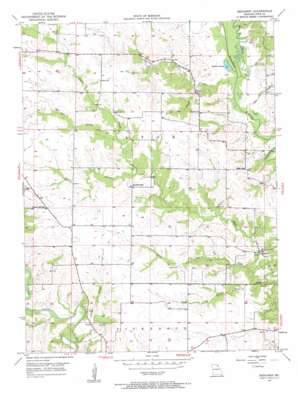
Benjamin Topo Map Missouri
To zoom in, hover over the map of Benjamin
USGS Topo Quad 40091b6 - 1:24,000 scale
| Topo Map Name: | Benjamin |
| USGS Topo Quad ID: | 40091b6 |
| Print Size: | ca. 21 1/4" wide x 27" high |
| Southeast Coordinates: | 40.125° N latitude / 91.625° W longitude |
| Map Center Coordinates: | 40.1875° N latitude / 91.6875° W longitude |
| U.S. State: | MO |
| Filename: | o40091b6.jpg |
| Download Map JPG Image: | Benjamin topo map 1:24,000 scale |
| Map Type: | Topographic |
| Topo Series: | 7.5´ |
| Map Scale: | 1:24,000 |
| Source of Map Images: | United States Geological Survey (USGS) |
| Alternate Map Versions: |
Benjamin MO 1950, updated 1963 Download PDF Buy paper map Benjamin MO 1951, updated 1951 Download PDF Buy paper map Benjamin MO 2012 Download PDF Buy paper map Benjamin MO 2015 Download PDF Buy paper map |
1:24,000 Topo Quads surrounding Benjamin
> Back to 40091a1 at 1:100,000 scale
> Back to 40090a1 at 1:250,000 scale
> Back to U.S. Topo Maps home
Benjamin topo map: Gazetteer
Benjamin: Airports
Caldwell Airport elevation 202m 662′Benjamin: Lakes
Rainbow Slough elevation 170m 557′Benjamin: Populated Places
Benjamin elevation 177m 580′Bunker Hill (historical) elevation 211m 692′
Canton elevation 182m 597′
Derrahs elevation 180m 590′
Benjamin: Streams
Derrahs Branch elevation 170m 557′Fretwell Branch elevation 170m 557′
Hahn Branch elevation 170m 557′
Leg Branch elevation 174m 570′
Little Sugar Creek elevation 175m 574′
Old Channel Wyaconda River elevation 171m 561′
Ramsey Branch elevation 183m 600′
South Branch Little Sugar Creek elevation 175m 574′
Tom Branch elevation 188m 616′
Benjamin digital topo map on disk
Buy this Benjamin topo map showing relief, roads, GPS coordinates and other geographical features, as a high-resolution digital map file on DVD:


