West Point Topo Map Illinois
To zoom in, hover over the map of West Point
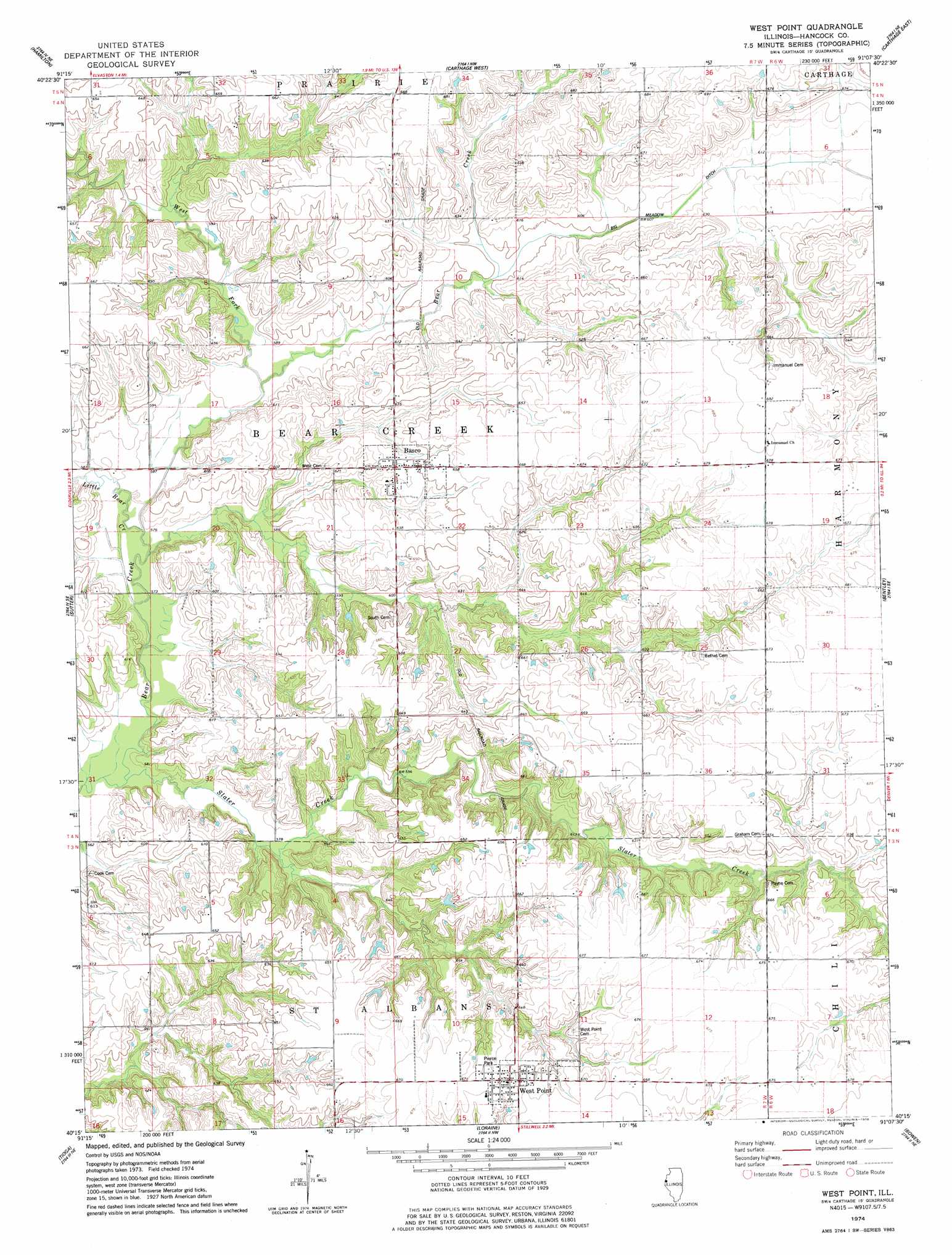
USGS Topo Quad 40091c2 - 1:24,000 scale
| Topo Map Name: | West Point |
| USGS Topo Quad ID: | 40091c2 |
| Print Size: | ca. 21 1/4" wide x 27" high |
| Southeast Coordinates: | 40.25° N latitude / 91.125° W longitude |
| Map Center Coordinates: | 40.3125° N latitude / 91.1875° W longitude |
| U.S. State: | IL |
| Filename: | o40091c2.jpg |
| Download Map JPG Image: | West Point topo map 1:24,000 scale |
| Map Type: | Topographic |
| Topo Series: | 7.5´ |
| Map Scale: | 1:24,000 |
| Source of Map Images: | United States Geological Survey (USGS) |
| Alternate Map Versions: |
West Point IL 1974, updated 1978 Download PDF Buy paper map West Point IL 2012 Download PDF Buy paper map West Point IL 2015 Download PDF Buy paper map |
1:24,000 Topo Quads surrounding West Point
Nauvoo |
Niota |
Colusa |
Burnside |
La Harpe |
Keokuk |
Hamilton |
Carthage West |
Carthage East |
Fountain Green |
Warsaw |
Sutter |
West Point |
Bentley |
Plymouth |
Lima |
Tioga |
Loraine |
Bowen |
Augusta |
Long Island |
Mendon |
Coatsburg |
Camp Point |
Clayton |
> Back to 40091a1 at 1:100,000 scale
> Back to 40090a1 at 1:250,000 scale
> Back to U.S. Topo Maps home
West Point topo map: Gazetteer
West Point: Canals
Meadow Ditch elevation 186m 610′West Point: Parks
Pierce Park elevation 204m 669′West Point: Populated Places
Basco elevation 192m 629′West Point elevation 204m 669′
West Point: Streams
Little Bear Creek elevation 174m 570′Slater Creek elevation 172m 564′
West Fork Bear Creek elevation 176m 577′
West Point digital topo map on disk
Buy this West Point topo map showing relief, roads, GPS coordinates and other geographical features, as a high-resolution digital map file on DVD: