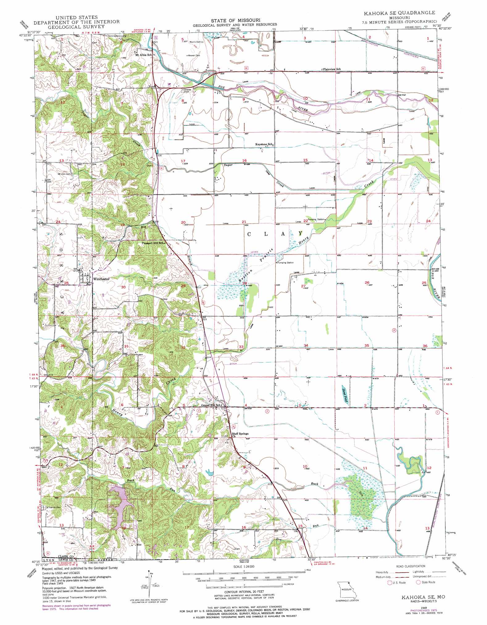
Kahoka Se Topo Map Missouri
To zoom in, hover over the map of Kahoka Se
USGS Topo Quad 40091c5 - 1:24,000 scale
| Topo Map Name: | Kahoka Se |
| USGS Topo Quad ID: | 40091c5 |
| Print Size: | ca. 21 1/4" wide x 27" high |
| Southeast Coordinates: | 40.25° N latitude / 91.5° W longitude |
| Map Center Coordinates: | 40.3125° N latitude / 91.5625° W longitude |
| U.S. State: | MO |
| Filename: | o40091c5.jpg |
| Download Map JPG Image: | Kahoka Se topo map 1:24,000 scale |
| Map Type: | Topographic |
| Topo Series: | 7.5´ |
| Map Scale: | 1:24,000 |
| Source of Map Images: | United States Geological Survey (USGS) |
| Alternate Map Versions: |
Kahoka SE MO 1949, updated 1963 Download PDF Buy paper map Kahoka SE MO 1949, updated 1977 Download PDF Buy paper map Kahoka SE MO 1950 Download PDF Buy paper map Kahoka SE MO 2012 Download PDF Buy paper map Kahoka SE MO 2014 Download PDF Buy paper map |
1:24,000 Topo Quads surrounding Kahoka Se
Anson |
Croton |
Argyle |
Nauvoo |
Niota |
Medill |
Kahoka |
Wayland |
Keokuk |
Hamilton |
Neeper |
Saint Patrick |
Kahoka Se |
Warsaw |
Sutter |
Williamstown |
Benjamin |
Canton |
Lima |
Tioga |
Lewistown |
Monticello |
La Grange |
Long Island |
Mendon |
> Back to 40091a1 at 1:100,000 scale
> Back to 40090a1 at 1:250,000 scale
> Back to U.S. Topo Maps home
Kahoka Se topo map: Gazetteer
Kahoka Se: Areas
Britton Prairie elevation 149m 488′Kahoka Se: Dams
Buck-Doe Run Creeks Watershed 32 Dam elevation 167m 547′Buck-Doe Run Watershed Structure Number 2 Dam elevation 158m 518′
Lake of the Oaks Dam elevation 180m 590′
Kahoka Se: Lakes
Stone Pond elevation 147m 482′Kahoka Se: Populated Places
Winchester elevation 202m 662′Kahoka Se: Reservoirs
Lake of the Oaks elevation 180m 590′Kahoka Se: Streams
Big Branch elevation 152m 498′Doe Run elevation 147m 482′
Sugar Creek elevation 149m 488′
Kahoka Se: Swamps
Rose Pond elevation 148m 485′Kahoka Se digital topo map on disk
Buy this Kahoka Se topo map showing relief, roads, GPS coordinates and other geographical features, as a high-resolution digital map file on DVD: