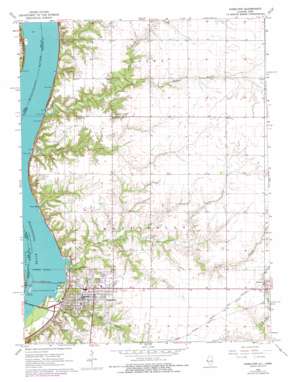
Hamilton Topo Map Illinois
To zoom in, hover over the map of Hamilton
USGS Topo Quad 40091d3 - 1:24,000 scale
| Topo Map Name: | Hamilton |
| USGS Topo Quad ID: | 40091d3 |
| Print Size: | ca. 21 1/4" wide x 27" high |
| Southeast Coordinates: | 40.375° N latitude / 91.25° W longitude |
| Map Center Coordinates: | 40.4375° N latitude / 91.3125° W longitude |
| U.S. States: | IL, IA |
| Filename: | o40091d3.jpg |
| Download Map JPG Image: | Hamilton topo map 1:24,000 scale |
| Map Type: | Topographic |
| Topo Series: | 7.5´ |
| Map Scale: | 1:24,000 |
| Source of Map Images: | United States Geological Survey (USGS) |
| Alternate Map Versions: |
Hamilton IL 1964, updated 1965 Download PDF Buy paper map Hamilton IL 1964, updated 1977 Download PDF Buy paper map Hamilton IL 2012 Download PDF Buy paper map Hamilton IL 2012 Download PDF Buy paper map Hamilton IL 2015 Download PDF Buy paper map |
1:24,000 Topo Quads surrounding Hamilton
> Back to 40091a1 at 1:100,000 scale
> Back to 40090a1 at 1:250,000 scale
> Back to U.S. Topo Maps home
Hamilton topo map: Gazetteer
Hamilton: Bays
Grays Bay elevation 157m 515′Hamilton: Dams
Keokuk Dam elevation 166m 544′Keokuk Dam elevation 158m 518′
Lock and Dam Number Nineteen elevation 204m 669′
Lock Number 19 elevation 155m 508′
Lock Number 19 elevation 153m 501′
Mississippi Lock Number 019 elevation 148m 485′
Hamilton: Mines
Gray Quarry elevation 157m 515′Hamilton: Parks
Montebello State Park elevation 149m 488′Wildcat Springs Park elevation 161m 528′
Hamilton: Populated Places
Hamilton elevation 196m 643′Sonora (historical) elevation 158m 518′
Hamilton: Reservoirs
Keokuk Lake elevation 166m 544′Hamilton: Streams
Chaney Creek elevation 158m 518′Crystal Glen Creek elevation 148m 485′
Larry Creek elevation 158m 518′
North Branch Larry Creek elevation 184m 603′
Railroad Creek elevation 150m 492′
South Branch Larry Creek elevation 184m 603′
Waggoner Creek elevation 159m 521′
Hamilton: Summits
Mount Moriah elevation 194m 636′Hamilton digital topo map on disk
Buy this Hamilton topo map showing relief, roads, GPS coordinates and other geographical features, as a high-resolution digital map file on DVD:


