Croton Topo Map Missouri
To zoom in, hover over the map of Croton
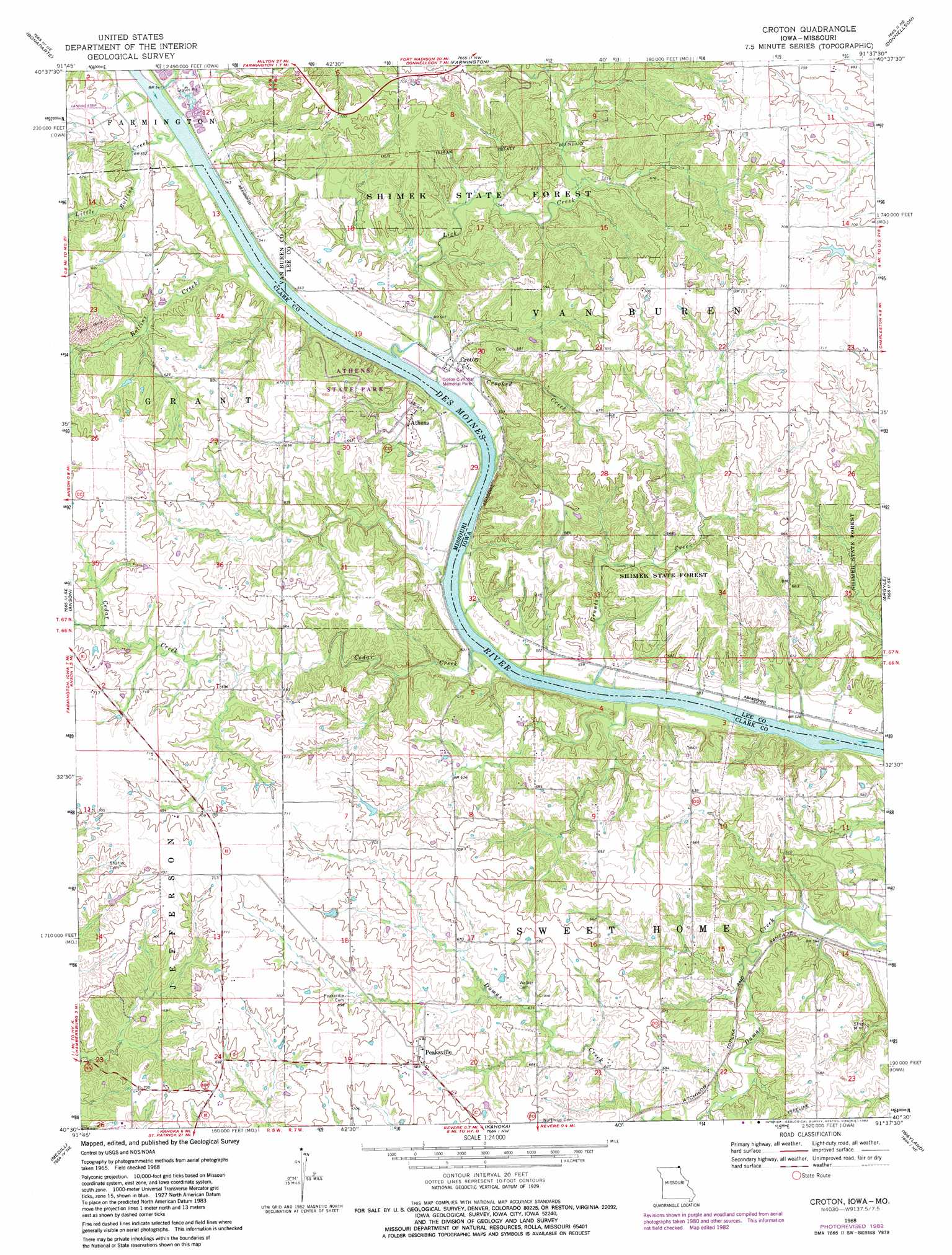
USGS Topo Quad 40091e6 - 1:24,000 scale
| Topo Map Name: | Croton |
| USGS Topo Quad ID: | 40091e6 |
| Print Size: | ca. 21 1/4" wide x 27" high |
| Southeast Coordinates: | 40.5° N latitude / 91.625° W longitude |
| Map Center Coordinates: | 40.5625° N latitude / 91.6875° W longitude |
| U.S. States: | MO, IA |
| Filename: | o40091e6.jpg |
| Download Map JPG Image: | Croton topo map 1:24,000 scale |
| Map Type: | Topographic |
| Topo Series: | 7.5´ |
| Map Scale: | 1:24,000 |
| Source of Map Images: | United States Geological Survey (USGS) |
| Alternate Map Versions: |
Croton IA 1968, updated 1970 Download PDF Buy paper map Croton IA 1968, updated 1983 Download PDF Buy paper map Croton IA 2010 Download PDF Buy paper map Croton IA 2013 Download PDF Buy paper map Croton IA 2015 Download PDF Buy paper map |
1:24,000 Topo Quads surrounding Croton
Mount Zion |
Stockport |
Hillsboro |
Salem |
Lowell |
Keosauqua |
Bonaparte |
Farmington |
Donnellson |
West Point |
Mount Sterling |
Anson |
Croton |
Argyle |
Nauvoo |
Wyaconda |
Medill |
Kahoka |
Wayland |
Keokuk |
Colony |
Neeper |
Saint Patrick |
Kahoka Se |
Warsaw |
> Back to 40091e1 at 1:100,000 scale
> Back to 40090a1 at 1:250,000 scale
> Back to U.S. Topo Maps home
Croton topo map: Gazetteer
Croton: Dams
Shaffer Lake Dam elevation 215m 705′Croton: Forests
Shimek State Forest elevation 172m 564′Croton: Parks
Amos Glover Historical Marker elevation 208m 682′Athens State Park elevation 198m 649′
Croton Civil War Memorial Park elevation 165m 541′
Shimek State Forest Wildlife Management Area - Croton Unit elevation 185m 606′
Shimek State Forest Wildlife Management Area - Lick Creek Unit elevation 184m 603′
Croton: Populated Places
Athens elevation 186m 610′Croton elevation 167m 547′
Dumas elevation 171m 561′
Peaksville elevation 212m 695′
Croton: Post Offices
Croton Post Office (historical) elevation 167m 547′Croton: Streams
Cedar Creek elevation 156m 511′Crooked Creek elevation 157m 515′
Grants Creek elevation 156m 511′
Lick Creek elevation 157m 515′
Little Rollins Creek elevation 161m 528′
Little Rollins Creek elevation 161m 528′
Rollins Creek elevation 160m 524′
Croton digital topo map on disk
Buy this Croton topo map showing relief, roads, GPS coordinates and other geographical features, as a high-resolution digital map file on DVD: