Danville Topo Map Iowa
To zoom in, hover over the map of Danville
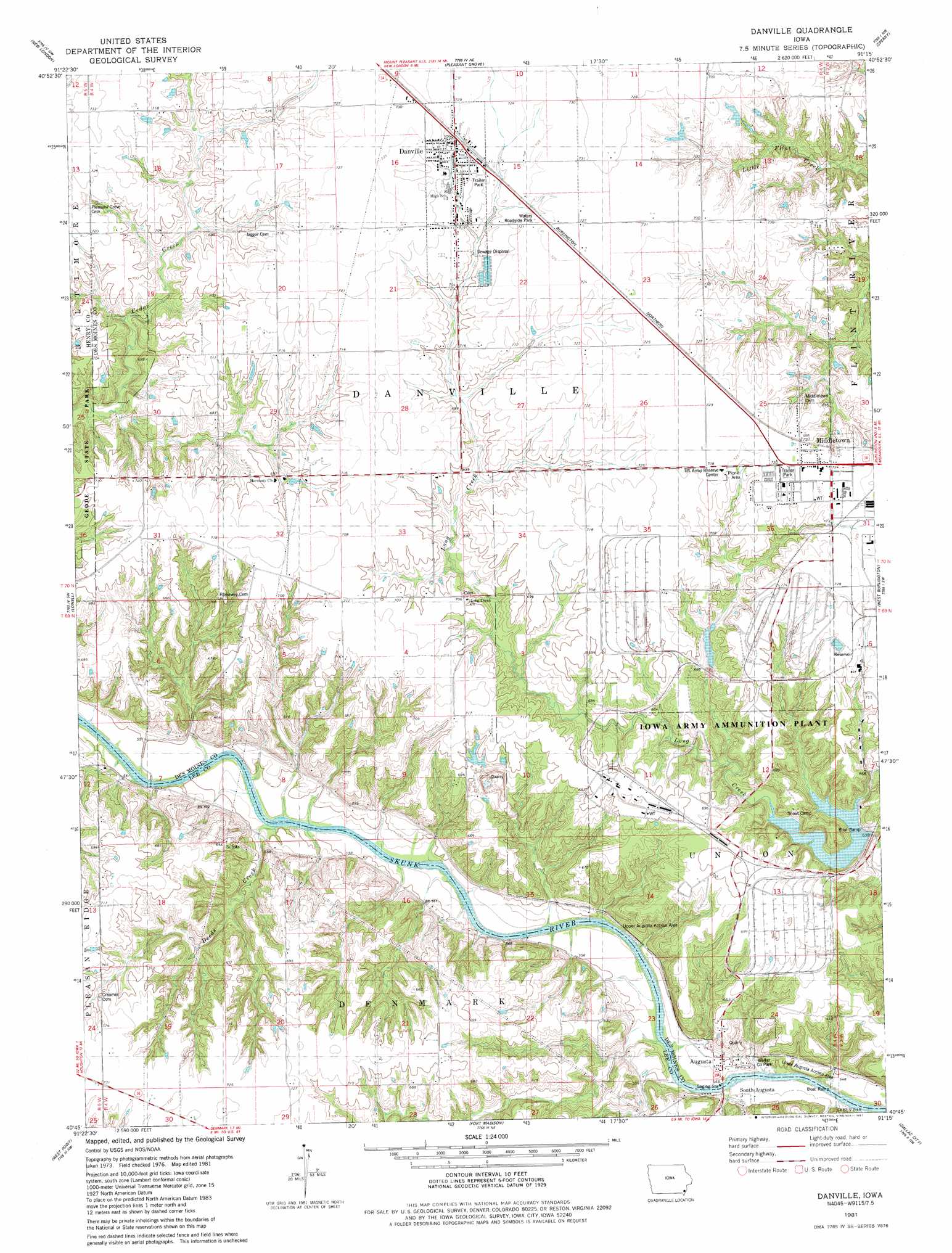
USGS Topo Quad 40091g3 - 1:24,000 scale
| Topo Map Name: | Danville |
| USGS Topo Quad ID: | 40091g3 |
| Print Size: | ca. 21 1/4" wide x 27" high |
| Southeast Coordinates: | 40.75° N latitude / 91.25° W longitude |
| Map Center Coordinates: | 40.8125° N latitude / 91.3125° W longitude |
| U.S. State: | IA |
| Filename: | o40091g3.jpg |
| Download Map JPG Image: | Danville topo map 1:24,000 scale |
| Map Type: | Topographic |
| Topo Series: | 7.5´ |
| Map Scale: | 1:24,000 |
| Source of Map Images: | United States Geological Survey (USGS) |
| Alternate Map Versions: |
Danville IA 1981, updated 1981 Download PDF Buy paper map Danville IA 2010 Download PDF Buy paper map Danville IA 2013 Download PDF Buy paper map Danville IA 2015 Download PDF Buy paper map |
1:24,000 Topo Quads surrounding Danville
Swedesburg |
Winfield South |
Morning Sun |
Mediapolis |
Oakville |
Mount Pleasant |
New London |
Pleasant Grove |
Sperry |
Kingston |
Salem |
Lowell |
Danville |
West Burlington |
Burlington |
Donnellson |
West Point |
Fort Madison |
Dallas City |
Lomax |
Argyle |
Nauvoo |
Niota |
Colusa |
Burnside |
> Back to 40091e1 at 1:100,000 scale
> Back to 40090a1 at 1:250,000 scale
> Back to U.S. Topo Maps home
Danville topo map: Gazetteer
Danville: Dams
Iowa Army Ammunition Plant Dam elevation 183m 600′Danville: Parks
Waters Roadside Park elevation 218m 715′Welter County Park elevation 163m 534′
Danville: Populated Places
Augusta elevation 177m 580′Danville elevation 220m 721′
Danville Center elevation 216m 708′
Middletown elevation 220m 721′
South Augusta elevation 168m 551′
Danville: Post Offices
Augusta Post Office (historical) elevation 177m 580′Danville Post Office elevation 220m 721′
Middleton Post Office elevation 222m 728′
Parrish Post Office (historical) elevation 213m 698′
Danville: Streams
Deeds Creek elevation 164m 538′Danville digital topo map on disk
Buy this Danville topo map showing relief, roads, GPS coordinates and other geographical features, as a high-resolution digital map file on DVD: