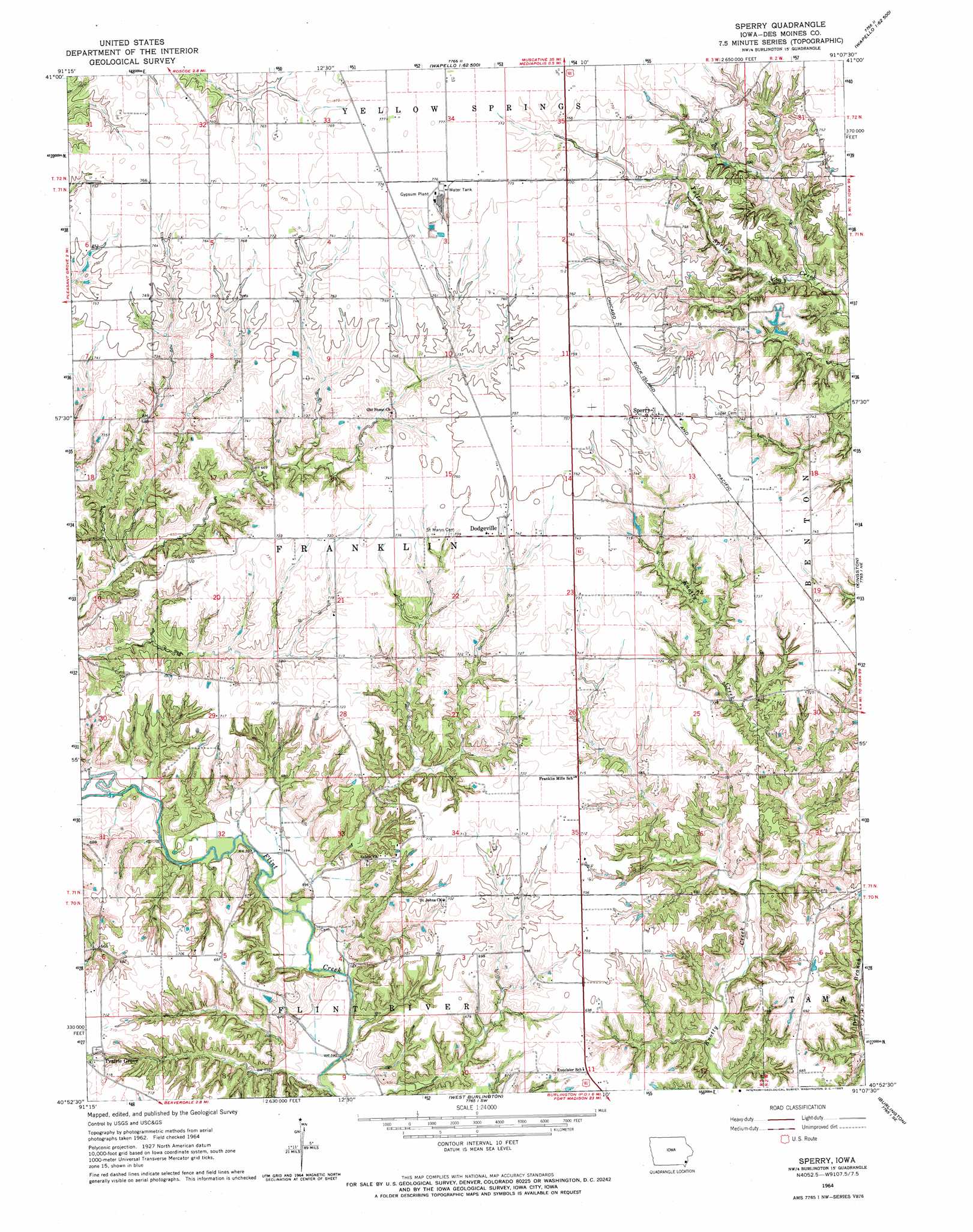
Sperry Topo Map Iowa
To zoom in, hover over the map of Sperry
USGS Topo Quad 40091h2 - 1:24,000 scale
| Topo Map Name: | Sperry |
| USGS Topo Quad ID: | 40091h2 |
| Print Size: | ca. 21 1/4" wide x 27" high |
| Southeast Coordinates: | 40.875° N latitude / 91.125° W longitude |
| Map Center Coordinates: | 40.9375° N latitude / 91.1875° W longitude |
| U.S. State: | IA |
| Filename: | o40091h2.jpg |
| Download Map JPG Image: | Sperry topo map 1:24,000 scale |
| Map Type: | Topographic |
| Topo Series: | 7.5´ |
| Map Scale: | 1:24,000 |
| Source of Map Images: | United States Geological Survey (USGS) |
| Alternate Map Versions: |
Sperry IA 1964, updated 1965 Download PDF Buy paper map Sperry IA 1964, updated 1965 Download PDF Buy paper map Sperry IA 2010 Download PDF Buy paper map Sperry IA 2013 Download PDF Buy paper map Sperry IA 2015 Download PDF Buy paper map |
1:24,000 Topo Quads surrounding Sperry
Winfield North |
Cairo |
Wapello |
Toolesboro |
Joy |
Winfield South |
Morning Sun |
Mediapolis |
Oakville |
Keithsburg |
New London |
Pleasant Grove |
Sperry |
Kingston |
Oquawka |
Lowell |
Danville |
West Burlington |
Burlington |
Gladstone |
West Point |
Fort Madison |
Dallas City |
Lomax |
Stronghurst |
> Back to 40091e1 at 1:100,000 scale
> Back to 40090a1 at 1:250,000 scale
> Back to U.S. Topo Maps home
Sperry topo map: Gazetteer
Sperry: Bridges
Flint River Bridge elevation 180m 590′Sperry: Parks
Big Hollow Creek Recreation Area elevation 205m 672′Seven Ponds Park elevation 217m 711′
Sperry: Populated Places
Dodgeville elevation 226m 741′Kline elevation 220m 721′
Sperry elevation 229m 751′
Sperry: Post Offices
Dodgeville Post Office (historical) elevation 226m 741′Franklin Mills Post Office (historical) elevation 213m 698′
Kline Post Office (historical) elevation 220m 721′
Sperry Post Office elevation 229m 751′
Sperry digital topo map on disk
Buy this Sperry topo map showing relief, roads, GPS coordinates and other geographical features, as a high-resolution digital map file on DVD: