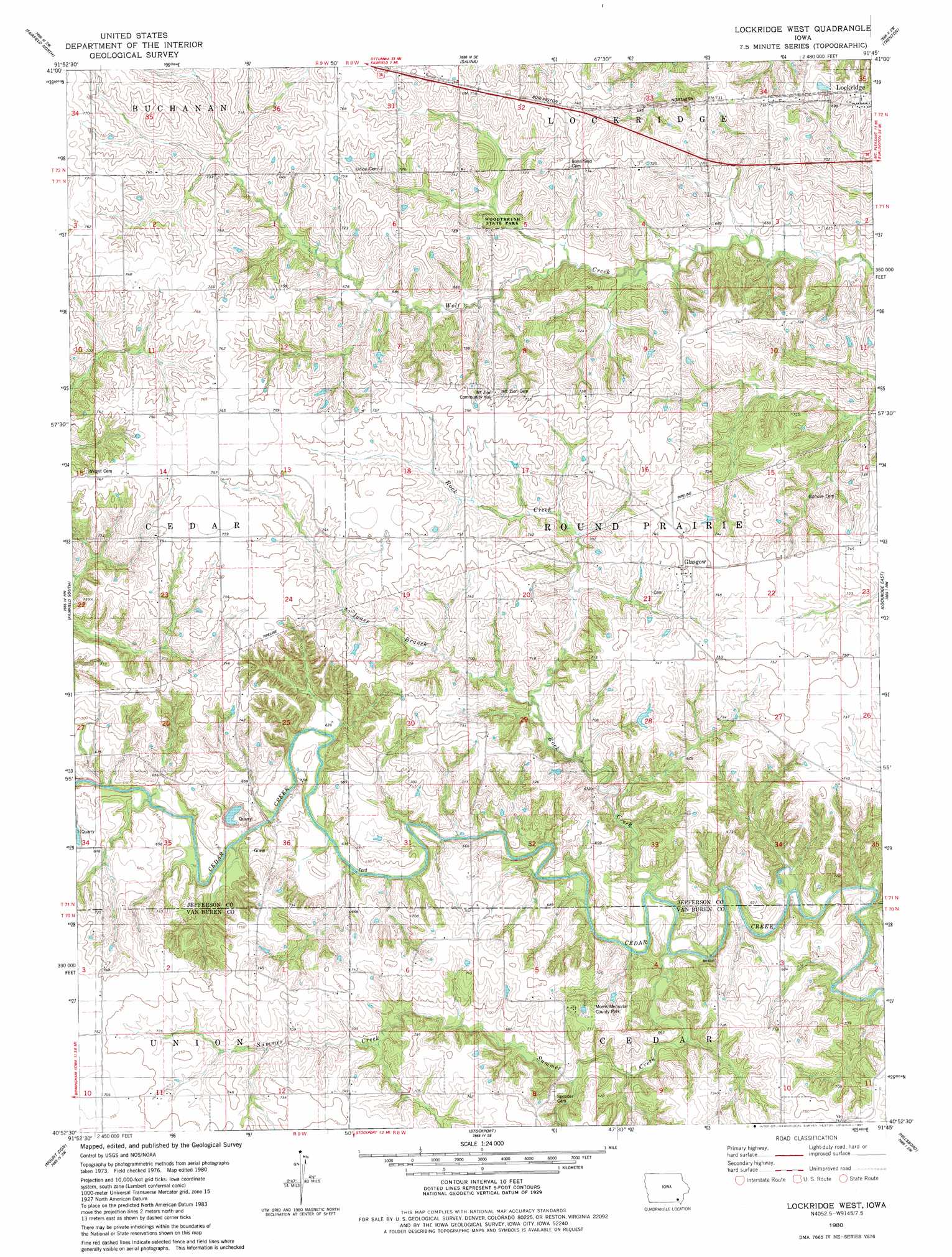
Lockridge West Topo Map Iowa
To zoom in, hover over the map of Lockridge West
USGS Topo Quad 40091h7 - 1:24,000 scale
| Topo Map Name: | Lockridge West |
| USGS Topo Quad ID: | 40091h7 |
| Print Size: | ca. 21 1/4" wide x 27" high |
| Southeast Coordinates: | 40.875° N latitude / 91.75° W longitude |
| Map Center Coordinates: | 40.9375° N latitude / 91.8125° W longitude |
| U.S. State: | IA |
| Filename: | o40091h7.jpg |
| Download Map JPG Image: | Lockridge West topo map 1:24,000 scale |
| Map Type: | Topographic |
| Topo Series: | 7.5´ |
| Map Scale: | 1:24,000 |
| Source of Map Images: | United States Geological Survey (USGS) |
| Alternate Map Versions: |
Lockridge West IA 1980, updated 1981 Download PDF Buy paper map Lockridge West IA 2010 Download PDF Buy paper map Lockridge West IA 2013 Download PDF Buy paper map Lockridge West IA 2015 Download PDF Buy paper map |
1:24,000 Topo Quads surrounding Lockridge West
Ollie |
Richland |
Brighton |
Wayland |
Crawfordsville |
Brookville |
Fairfield North |
Salina |
Trenton |
Swedesburg |
Libertyville |
Fairfield South |
Lockridge West |
Lockridge East |
Mount Pleasant |
Douds |
Mount Zion |
Stockport |
Hillsboro |
Salem |
Cantril |
Keosauqua |
Bonaparte |
Farmington |
Donnellson |
> Back to 40091e1 at 1:100,000 scale
> Back to 40090a1 at 1:250,000 scale
> Back to U.S. Topo Maps home
Lockridge West topo map: Gazetteer
Lockridge West: Parks
Jacob Wiley Historical Marker elevation 203m 666′Morris Memorial County Park elevation 223m 731′
Round Prairie Park elevation 205m 672′
Woodthrush State Park elevation 202m 662′
Lockridge West: Populated Places
Glasgow elevation 229m 751′Lockridge West: Post Offices
Glasgow Post Office (historical) elevation 229m 751′Glendale Post Office (historical) elevation 229m 751′
Wooster Post Office (historical) elevation 231m 757′
Lockridge West: Streams
Jones Branch elevation 201m 659′Rock Creek elevation 188m 616′
Summer Creek elevation 186m 610′
Lockridge West digital topo map on disk
Buy this Lockridge West topo map showing relief, roads, GPS coordinates and other geographical features, as a high-resolution digital map file on DVD: