Novelty Topo Map Missouri
To zoom in, hover over the map of Novelty
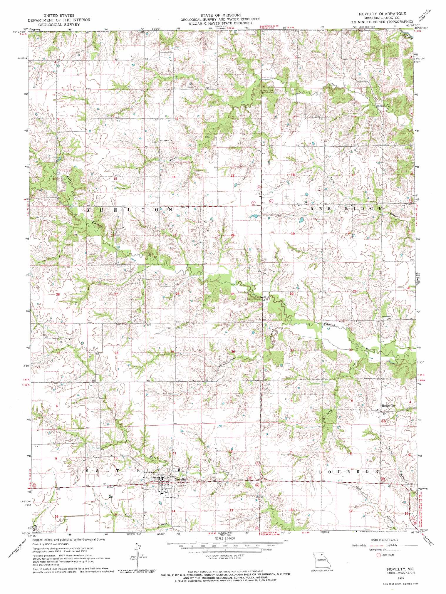
USGS Topo Quad 40092a2 - 1:24,000 scale
| Topo Map Name: | Novelty |
| USGS Topo Quad ID: | 40092a2 |
| Print Size: | ca. 21 1/4" wide x 27" high |
| Southeast Coordinates: | 40° N latitude / 92.125° W longitude |
| Map Center Coordinates: | 40.0625° N latitude / 92.1875° W longitude |
| U.S. State: | MO |
| Filename: | o40092a2.jpg |
| Download Map JPG Image: | Novelty topo map 1:24,000 scale |
| Map Type: | Topographic |
| Topo Series: | 7.5´ |
| Map Scale: | 1:24,000 |
| Source of Map Images: | United States Geological Survey (USGS) |
| Alternate Map Versions: |
Novelty MO 1965, updated 1966 Download PDF Buy paper map Novelty MO 2012 Download PDF Buy paper map Novelty MO 2015 Download PDF Buy paper map |
1:24,000 Topo Quads surrounding Novelty
Willmathsville |
Bible Grove |
Greensburg |
Rutledge |
Colony |
Brashear |
Hurdland |
Edina |
Knox City |
Deer Ridge |
La Plata |
Locust Hill |
Novelty |
Edina Se |
La Belle |
Atlanta |
Sue City |
Leonard |
Bethel |
Newark |
Axtell |
Redman |
Hagers Grove |
Shelbyville |
Burksville |
> Back to 40092a1 at 1:100,000 scale
> Back to 40092a1 at 1:250,000 scale
> Back to U.S. Topo Maps home
Novelty topo map: Gazetteer
Novelty: Dams
Douglas Lake Dam elevation 234m 767′Greenly Farm Lake Dam elevation 238m 780′
Number 76 Dam elevation 248m 813′
Novelty: Parks
Coon Creek Roadside Park elevation 245m 803′Novelty: Populated Places
Hedge City elevation 245m 803′Novelty elevation 255m 836′
Novelty: Reservoirs
Douglas Lake elevation 234m 767′Greenly Farm Lake elevation 238m 780′
Novelty: Streams
Hickory Branch elevation 222m 728′Norwegian Creek elevation 228m 748′
Pleasant Run elevation 231m 757′
Novelty digital topo map on disk
Buy this Novelty topo map showing relief, roads, GPS coordinates and other geographical features, as a high-resolution digital map file on DVD: