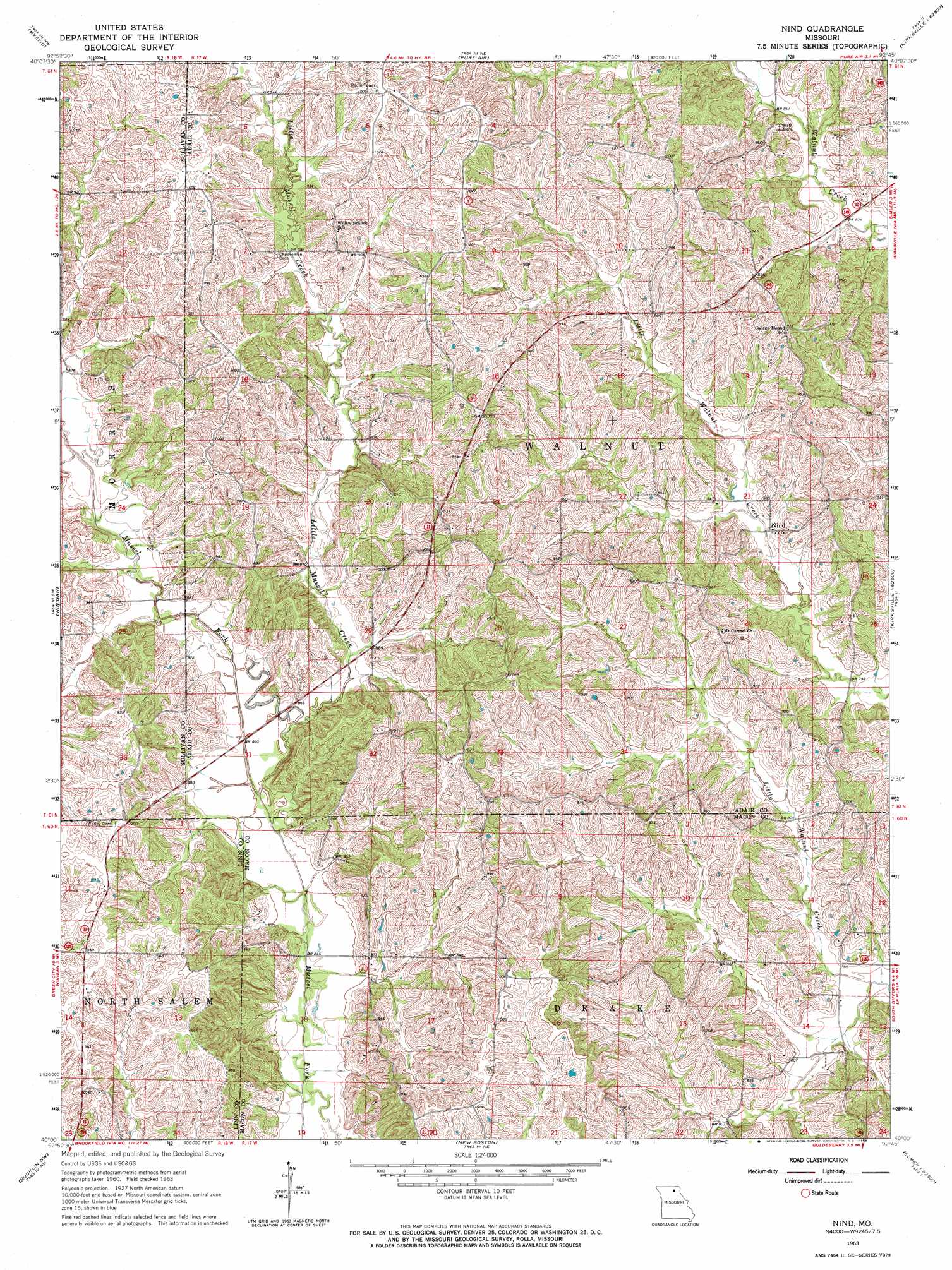
Nind Topo Map Missouri
To zoom in, hover over the map of Nind
USGS Topo Quad 40092a7 - 1:24,000 scale
| Topo Map Name: | Nind |
| USGS Topo Quad ID: | 40092a7 |
| Print Size: | ca. 21 1/4" wide x 27" high |
| Southeast Coordinates: | 40° N latitude / 92.75° W longitude |
| Map Center Coordinates: | 40.0625° N latitude / 92.8125° W longitude |
| U.S. State: | MO |
| Filename: | o40092a7.jpg |
| Download Map JPG Image: | Nind topo map 1:24,000 scale |
| Map Type: | Topographic |
| Topo Series: | 7.5´ |
| Map Scale: | 1:24,000 |
| Source of Map Images: | United States Geological Survey (USGS) |
| Alternate Map Versions: |
Nind MO 1963, updated 1965 Download PDF Buy paper map Nind MO 2012 Download PDF Buy paper map Nind MO 2015 Download PDF Buy paper map |
1:24,000 Topo Quads surrounding Nind
Pollock |
Green City |
Stahl |
Connelsville |
Greentop |
Milan East |
Mystic |
Pure Air |
Novinger |
Kirksville |
Milan Se |
Winigan |
Nind |
Gifford |
Millard |
Shelby |
Bucklin Nw |
New Boston |
Elmer |
Barnesville |
Brookfield |
Bucklin |
New Cambria West |
New Cambria East |
Bevier North |
> Back to 40092a1 at 1:100,000 scale
> Back to 40092a1 at 1:250,000 scale
> Back to U.S. Topo Maps home
Nind topo map: Gazetteer
Nind: Populated Places
Loeffler elevation 305m 1000′Nind elevation 248m 813′
Nind: Post Offices
Loeffler Post Office elevation 305m 1000′Tullvania Post Office elevation 309m 1013′
Nind: Streams
Little Mussel Creek elevation 256m 839′Nind digital topo map on disk
Buy this Nind topo map showing relief, roads, GPS coordinates and other geographical features, as a high-resolution digital map file on DVD: