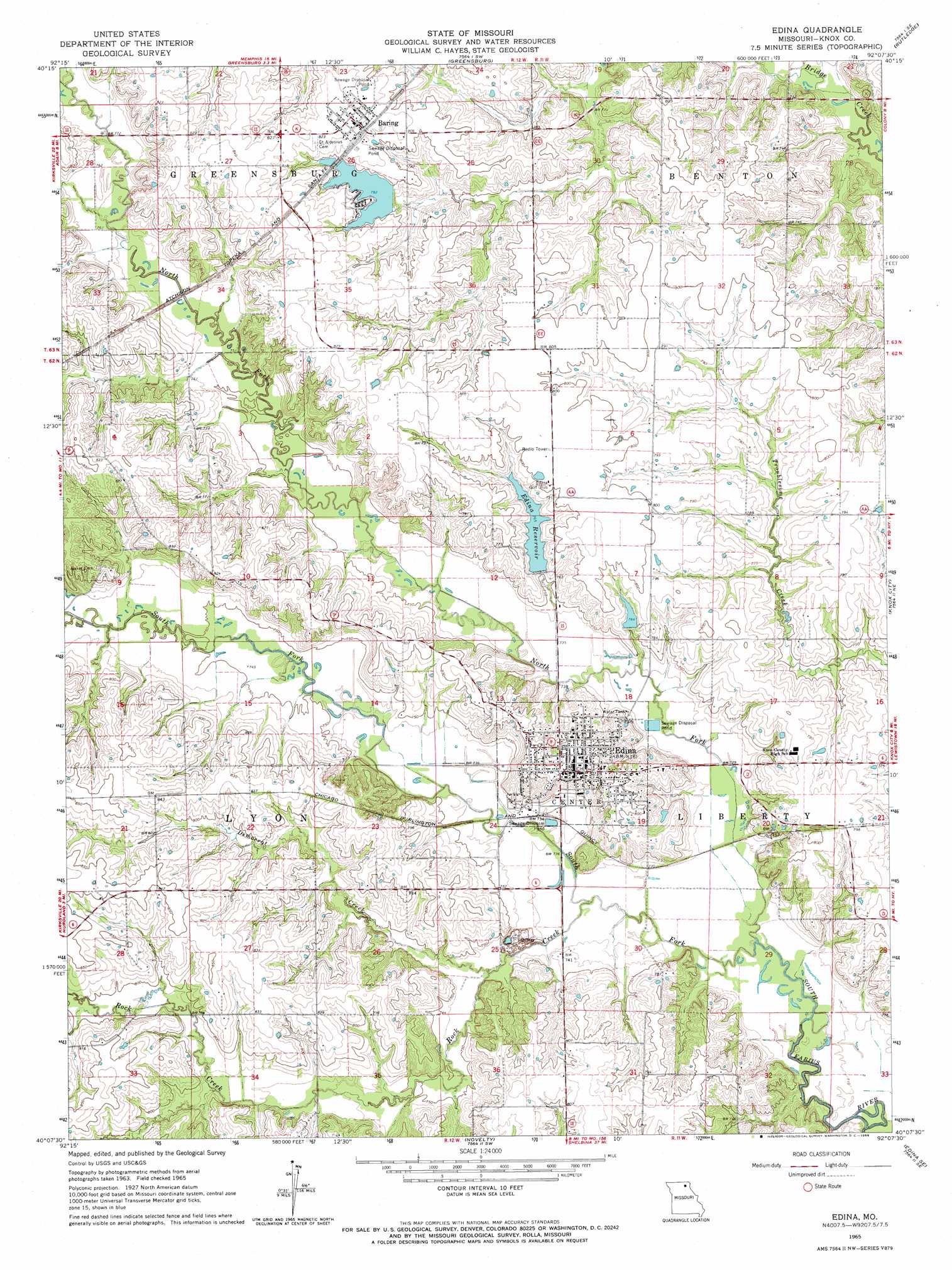
Edina Topo Map Missouri
To zoom in, hover over the map of Edina
USGS Topo Quad 40092b2 - 1:24,000 scale
| Topo Map Name: | Edina |
| USGS Topo Quad ID: | 40092b2 |
| Print Size: | ca. 21 1/4" wide x 27" high |
| Southeast Coordinates: | 40.125° N latitude / 92.125° W longitude |
| Map Center Coordinates: | 40.1875° N latitude / 92.1875° W longitude |
| U.S. State: | MO |
| Filename: | o40092b2.jpg |
| Download Map JPG Image: | Edina topo map 1:24,000 scale |
| Map Type: | Topographic |
| Topo Series: | 7.5´ |
| Map Scale: | 1:24,000 |
| Source of Map Images: | United States Geological Survey (USGS) |
| Alternate Map Versions: |
Edina MO 1965, updated 1966 Download PDF Buy paper map Edina MO 1965, updated 1966 Download PDF Buy paper map Edina MO 2012 Download PDF Buy paper map Edina MO 2015 Download PDF Buy paper map |
1:24,000 Topo Quads surrounding Edina
Downing Nw |
Downing |
Memphis |
Arbela |
Wyaconda |
Willmathsville |
Bible Grove |
Greensburg |
Rutledge |
Colony |
Brashear |
Hurdland |
Edina |
Knox City |
Deer Ridge |
La Plata |
Locust Hill |
Novelty |
Edina Se |
La Belle |
Atlanta |
Sue City |
Leonard |
Bethel |
Newark |
> Back to 40092a1 at 1:100,000 scale
> Back to 40092a1 at 1:250,000 scale
> Back to U.S. Topo Maps home
Edina topo map: Gazetteer
Edina: Dams
Baring Country Club Dam elevation 241m 790′Edina Reservoir Section 12 Dam elevation 233m 764′
Edina Reservoir Section 7 Dam elevation 235m 770′
Edina: Flats
The Lords Bottom elevation 222m 728′Edina: Populated Places
Baring elevation 250m 820′Edina elevation 248m 813′
Milltown elevation 223m 731′
Edina: Reservoirs
Baring Country Club Lake elevation 241m 790′Edina Reservoir elevation 233m 764′
Edina Reservoir Section 7 elevation 235m 770′
Edina: Streams
Democrat Creek elevation 222m 728′North Fork South Fabius River elevation 216m 708′
Rock Creek elevation 219m 718′
South Fork South Fabius River elevation 216m 708′
Edina digital topo map on disk
Buy this Edina topo map showing relief, roads, GPS coordinates and other geographical features, as a high-resolution digital map file on DVD: