Connelsville Topo Map Missouri
To zoom in, hover over the map of Connelsville
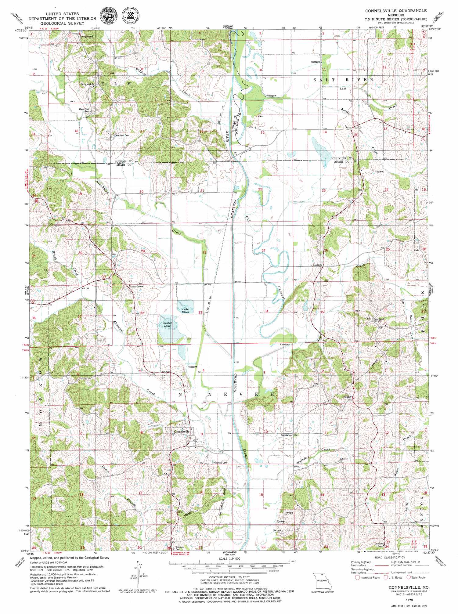
USGS Topo Quad 40092c6 - 1:24,000 scale
| Topo Map Name: | Connelsville |
| USGS Topo Quad ID: | 40092c6 |
| Print Size: | ca. 21 1/4" wide x 27" high |
| Southeast Coordinates: | 40.25° N latitude / 92.625° W longitude |
| Map Center Coordinates: | 40.3125° N latitude / 92.6875° W longitude |
| U.S. State: | MO |
| Filename: | o40092c6.jpg |
| Download Map JPG Image: | Connelsville topo map 1:24,000 scale |
| Map Type: | Topographic |
| Topo Series: | 7.5´ |
| Map Scale: | 1:24,000 |
| Source of Map Images: | United States Geological Survey (USGS) |
| Alternate Map Versions: |
Connelsville MO 2012 Download PDF Buy paper map Connelsville MO 2015 Download PDF Buy paper map |
1:24,000 Topo Quads surrounding Connelsville
Mendota |
Omaha |
Coatsville |
Lancaster |
Bunker Hill |
Unionville East |
Graysville |
Livonia |
Queen City |
Downing Nw |
Green City |
Stahl |
Connelsville |
Greentop |
Willmathsville |
Mystic |
Pure Air |
Novinger |
Kirksville |
Brashear |
Winigan |
Nind |
Gifford |
Millard |
La Plata |
> Back to 40092a1 at 1:100,000 scale
> Back to 40092a1 at 1:250,000 scale
> Back to U.S. Topo Maps home
Connelsville topo map: Gazetteer
Connelsville: Dams
Filkins Lake Dam elevation 251m 823′Connelsville: Populated Places
Connelsville elevation 239m 784′Fegley elevation 288m 944′
Green Grove elevation 276m 905′
Lowground elevation 284m 931′
Nineveh elevation 233m 764′
Connelsville: Reservoirs
Filkins Lake elevation 251m 823′Lake Elsea elevation 234m 767′
Scobee Lake elevation 234m 767′
Connelsville: Streams
Battle Creek elevation 236m 774′Blackbird Creek elevation 228m 748′
Brush Creek elevation 238m 780′
Hazel Creek elevation 232m 761′
Little Hazel Creek elevation 239m 784′
Lost Creek elevation 236m 774′
Mulberry Creek elevation 228m 748′
Shuteye Creek elevation 229m 751′
Wildcat Creek elevation 235m 770′
Connelsville: Trails
Jones Spur elevation 235m 770′Connelsville digital topo map on disk
Buy this Connelsville topo map showing relief, roads, GPS coordinates and other geographical features, as a high-resolution digital map file on DVD: