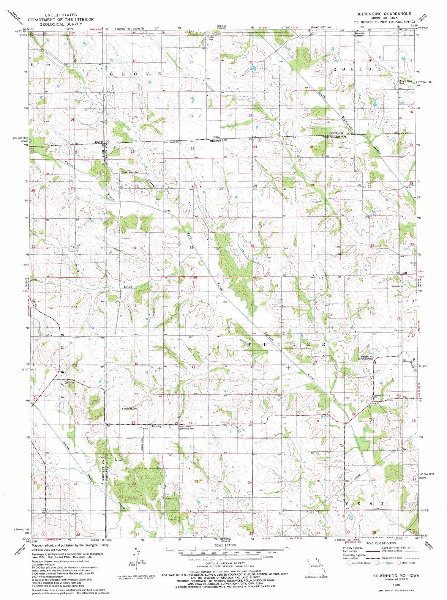
Kilwinning Topo Map Missouri
To zoom in, hover over the map of Kilwinning
USGS Topo Quad 40092e3 - 1:24,000 scale
| Topo Map Name: | Kilwinning |
| USGS Topo Quad ID: | 40092e3 |
| Print Size: | ca. 21 1/4" wide x 27" high |
| Southeast Coordinates: | 40.5° N latitude / 92.25° W longitude |
| Map Center Coordinates: | 40.5625° N latitude / 92.3125° W longitude |
| U.S. States: | MO, IA |
| Filename: | o40092e3.jpg |
| Download Map JPG Image: | Kilwinning topo map 1:24,000 scale |
| Map Type: | Topographic |
| Topo Series: | 7.5´ |
| Map Scale: | 1:24,000 |
| Source of Map Images: | United States Geological Survey (USGS) |
| Alternate Map Versions: |
Kilwinning MO 1980, updated 1980 Download PDF Buy paper map Kilwinning MO 2010 Download PDF Buy paper map Kilwinning MO 2012 Download PDF Buy paper map Kilwinning MO 2015 Download PDF Buy paper map |
1:24,000 Topo Quads surrounding Kilwinning
Paris |
Bloomfield North |
Floris |
Selma |
Douds |
West Grove |
Bloomfield South |
Pulaski |
Milton |
Cantril |
Lancaster |
Bunker Hill |
Kilwinning |
Brock |
Azen |
Queen City |
Downing Nw |
Downing |
Memphis |
Arbela |
Greentop |
Willmathsville |
Bible Grove |
Greensburg |
Rutledge |
> Back to 40092e1 at 1:100,000 scale
> Back to 40092a1 at 1:250,000 scale
> Back to U.S. Topo Maps home
Kilwinning topo map: Gazetteer
Kilwinning: Populated Places
Hitt elevation 236m 774′Kilwinning elevation 262m 859′
Wanetta Corner elevation 254m 833′
Kilwinning: Streams
Brush Creek elevation 226m 741′Carter Creek elevation 226m 741′
Kilwinning digital topo map on disk
Buy this Kilwinning topo map showing relief, roads, GPS coordinates and other geographical features, as a high-resolution digital map file on DVD: