Centerville East Topo Map Iowa
To zoom in, hover over the map of Centerville East
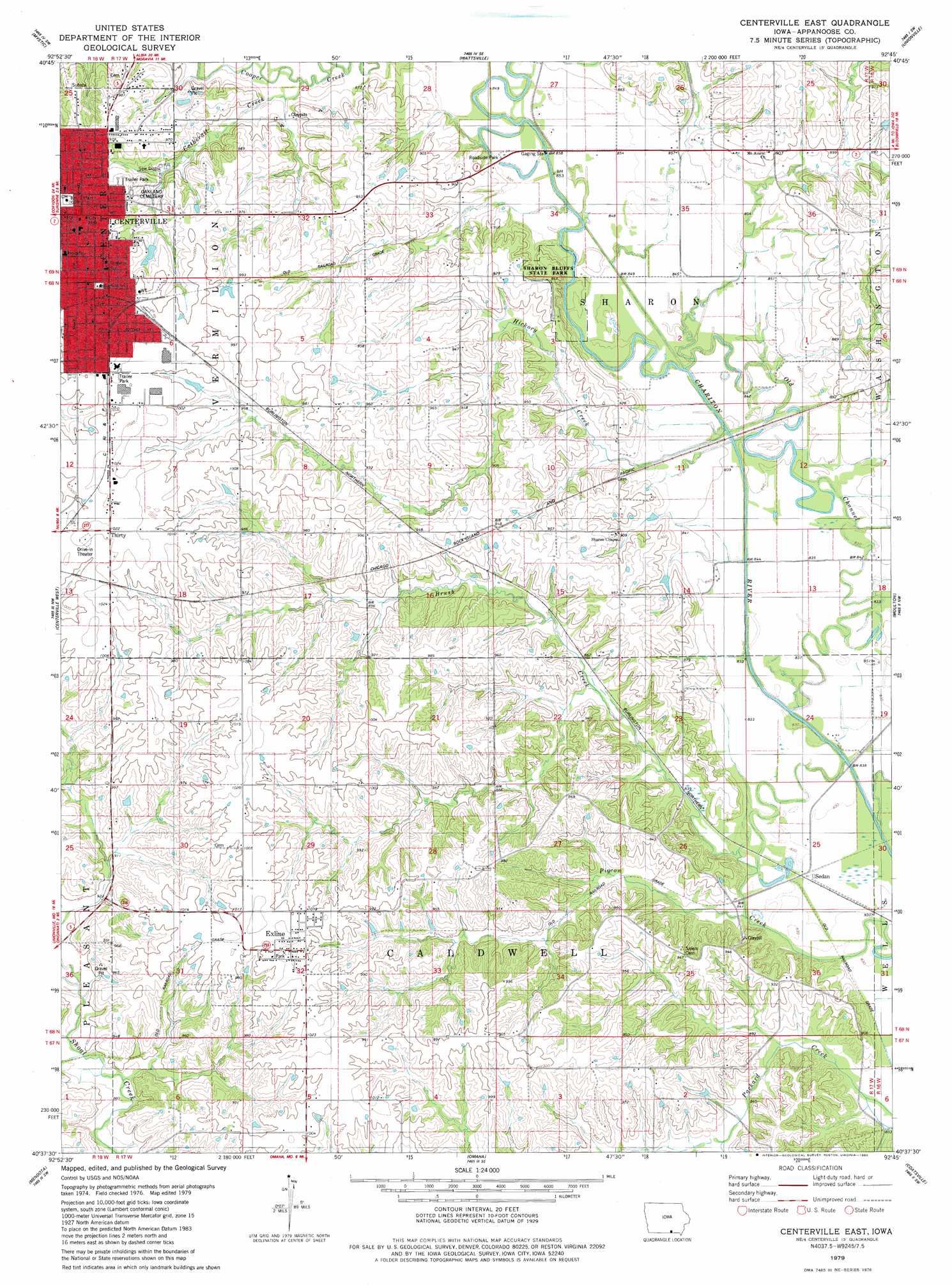
USGS Topo Quad 40092f7 - 1:24,000 scale
| Topo Map Name: | Centerville East |
| USGS Topo Quad ID: | 40092f7 |
| Print Size: | ca. 21 1/4" wide x 27" high |
| Southeast Coordinates: | 40.625° N latitude / 92.75° W longitude |
| Map Center Coordinates: | 40.6875° N latitude / 92.8125° W longitude |
| U.S. State: | IA |
| Filename: | o40092f7.jpg |
| Download Map JPG Image: | Centerville East topo map 1:24,000 scale |
| Map Type: | Topographic |
| Topo Series: | 7.5´ |
| Map Scale: | 1:24,000 |
| Source of Map Images: | United States Geological Survey (USGS) |
| Alternate Map Versions: |
Centerville East IA 1979, updated 1980 Download PDF Buy paper map Centerville East IA 2010 Download PDF Buy paper map Centerville East IA 2013 Download PDF Buy paper map Centerville East IA 2015 Download PDF Buy paper map |
1:24,000 Topo Quads surrounding Centerville East
Melrose |
Iconium |
Moravia |
Blakesburg |
Blakesburg Ne |
Plano |
Mystic |
Hiattsville |
Unionville |
Paris |
Seymour East |
Centerville West |
Centerville East |
Moulton |
West Grove |
Lake Thunderhead |
Mendota |
Omaha |
Coatsville |
Lancaster |
Unionville West |
Unionville East |
Graysville |
Livonia |
Queen City |
> Back to 40092e1 at 1:100,000 scale
> Back to 40092a1 at 1:250,000 scale
> Back to U.S. Topo Maps home
Centerville East topo map: Gazetteer
Centerville East: Bridges
Sixteenth Street Overpass elevation 305m 1000′Centerville East: Channels
Old Channel elevation 256m 839′Centerville East: Parks
Sedan Bottoms elevation 253m 830′Sharon Bluffs State Park elevation 281m 921′
Centerville East: Populated Places
Centerville elevation 307m 1007′Exline elevation 311m 1020′
Highlander Mobile Home Park elevation 311m 1020′
Sedan elevation 285m 935′
Thirty elevation 311m 1020′
Centerville East: Post Offices
Caldwell Post Office (historical) elevation 297m 974′Exline Post Office elevation 311m 1020′
Kirkwood Post Office (historical) elevation 260m 853′
Sedan Post Office (historical) elevation 285m 935′
Sharon Post Office (historical) elevation 274m 898′
Centerville East: Streams
Brush Creek elevation 253m 830′Catherall Creek elevation 259m 849′
Hickory Creek elevation 253m 830′
Centerville East digital topo map on disk
Buy this Centerville East topo map showing relief, roads, GPS coordinates and other geographical features, as a high-resolution digital map file on DVD: