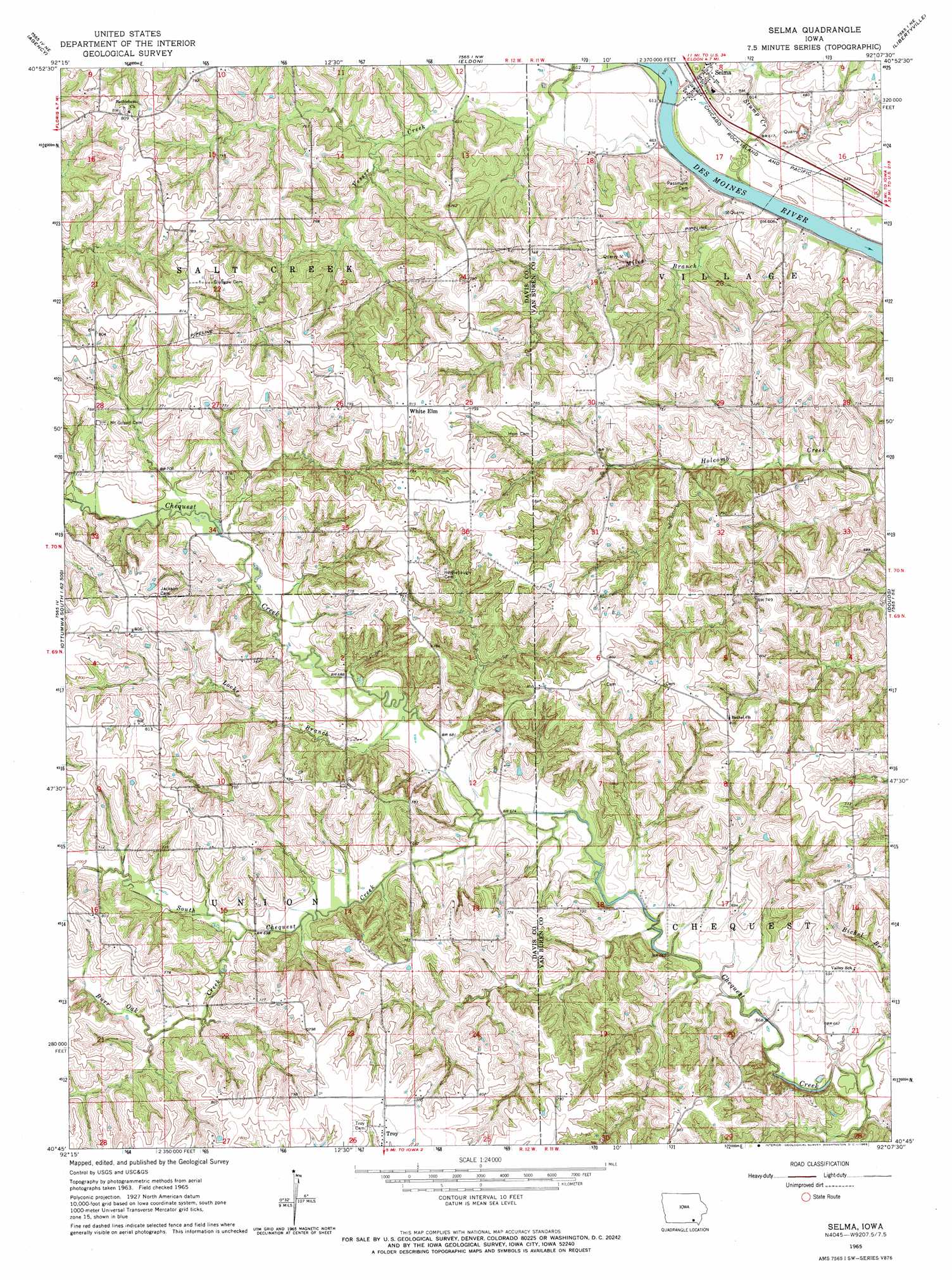
Selma Topo Map Iowa
To zoom in, hover over the map of Selma
USGS Topo Quad 40092g2 - 1:24,000 scale
| Topo Map Name: | Selma |
| USGS Topo Quad ID: | 40092g2 |
| Print Size: | ca. 21 1/4" wide x 27" high |
| Southeast Coordinates: | 40.75° N latitude / 92.125° W longitude |
| Map Center Coordinates: | 40.8125° N latitude / 92.1875° W longitude |
| U.S. State: | IA |
| Filename: | o40092g2.jpg |
| Download Map JPG Image: | Selma topo map 1:24,000 scale |
| Map Type: | Topographic |
| Topo Series: | 7.5´ |
| Map Scale: | 1:24,000 |
| Source of Map Images: | United States Geological Survey (USGS) |
| Alternate Map Versions: |
Selma IA 1965, updated 1966 Download PDF Buy paper map Selma IA 2010 Download PDF Buy paper map Selma IA 2013 Download PDF Buy paper map Selma IA 2015 Download PDF Buy paper map |
1:24,000 Topo Quads surrounding Selma
Ottumwa North |
Farson |
Abingdon |
Brookville |
Fairfield North |
Ottumwa South |
Agency |
Eldon |
Libertyville |
Fairfield South |
Bloomfield North |
Floris |
Selma |
Douds |
Mount Zion |
Bloomfield South |
Pulaski |
Milton |
Cantril |
Keosauqua |
Bunker Hill |
Kilwinning |
Brock |
Azen |
Mount Sterling |
> Back to 40092e1 at 1:100,000 scale
> Back to 40092a1 at 1:250,000 scale
> Back to U.S. Topo Maps home
Selma topo map: Gazetteer
Selma: Parks
Nathan Winton Historical Marker elevation 242m 793′Selma: Populated Places
Business Corners (historical) elevation 215m 705′Chequest elevation 220m 721′
Selma elevation 188m 616′
White Elm elevation 226m 741′
Selma: Post Offices
Chequest Post Office (historical) elevation 247m 810′New Market Post Office (historical) elevation 184m 603′
Selma Post Office elevation 188m 616′
White Elm Post Office (historical) elevation 248m 813′
Selma: Streams
Burr Oak Creek elevation 227m 744′Locke Branch elevation 225m 738′
Miles Branch elevation 199m 652′
South Chequest Creek elevation 207m 679′
Stump Creek elevation 198m 649′
Selma digital topo map on disk
Buy this Selma topo map showing relief, roads, GPS coordinates and other geographical features, as a high-resolution digital map file on DVD: