Agency Topo Map Iowa
To zoom in, hover over the map of Agency
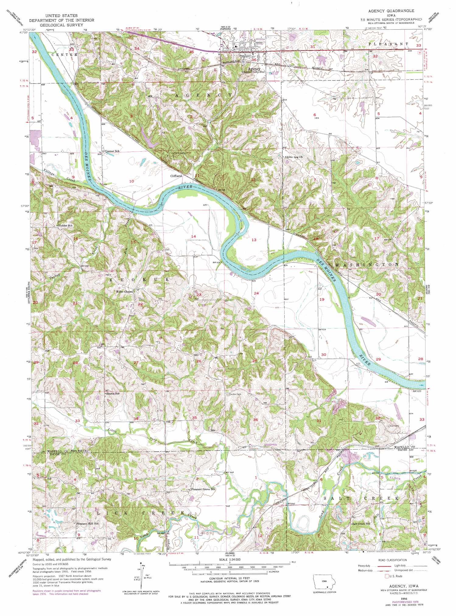
USGS Topo Quad 40092h3 - 1:24,000 scale
| Topo Map Name: | Agency |
| USGS Topo Quad ID: | 40092h3 |
| Print Size: | ca. 21 1/4" wide x 27" high |
| Southeast Coordinates: | 40.875° N latitude / 92.25° W longitude |
| Map Center Coordinates: | 40.9375° N latitude / 92.3125° W longitude |
| U.S. State: | IA |
| Filename: | o40092h3.jpg |
| Download Map JPG Image: | Agency topo map 1:24,000 scale |
| Map Type: | Topographic |
| Topo Series: | 7.5´ |
| Map Scale: | 1:24,000 |
| Source of Map Images: | United States Geological Survey (USGS) |
| Alternate Map Versions: |
Agency IA 1956, updated 1958 Download PDF Buy paper map Agency IA 1956, updated 1978 Download PDF Buy paper map Agency IA 2010 Download PDF Buy paper map Agency IA 2013 Download PDF Buy paper map Agency IA 2015 Download PDF Buy paper map |
1:24,000 Topo Quads surrounding Agency
Kirkville |
Fremont |
Hedrick |
Pekin |
Ollie |
Chillicothe |
Ottumwa North |
Farson |
Abingdon |
Brookville |
Blakesburg Ne |
Ottumwa South |
Agency |
Eldon |
Libertyville |
Paris |
Bloomfield North |
Floris |
Selma |
Douds |
West Grove |
Bloomfield South |
Pulaski |
Milton |
Cantril |
> Back to 40092e1 at 1:100,000 scale
> Back to 40092a1 at 1:250,000 scale
> Back to U.S. Topo Maps home
Agency topo map: Gazetteer
Agency: Parks
Chief Wapello's Grave Historical Marker elevation 246m 807′Fox Hills Wildlife Management Area elevation 218m 715′
Agency: Populated Places
Agency elevation 247m 810′Cliffland elevation 196m 643′
Agency: Post Offices
Agency Post Office elevation 247m 810′Alpine Post Office (historical) elevation 191m 626′
Cliffland Post Office (historical) elevation 194m 636′
Laddsdale Post Office (historical) elevation 193m 633′
Agency: Streams
Little Soap Creek elevation 191m 626′Morgan Branch elevation 194m 636′
Salt Creek elevation 186m 610′
Turkey Creek elevation 187m 613′
Village Creek elevation 187m 613′
Agency digital topo map on disk
Buy this Agency topo map showing relief, roads, GPS coordinates and other geographical features, as a high-resolution digital map file on DVD: