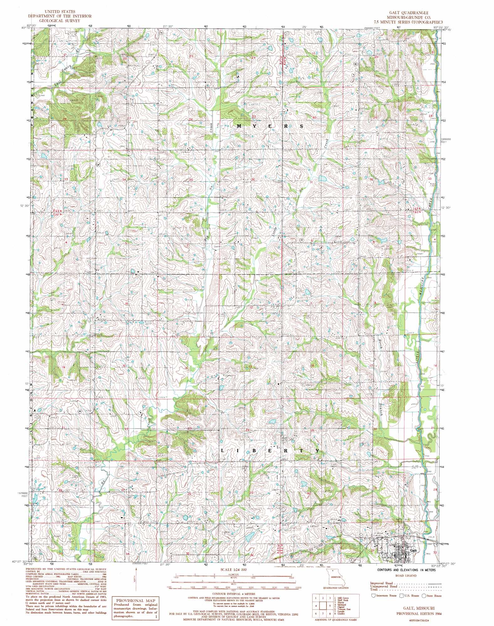
Galt Topo Map Missouri
To zoom in, hover over the map of Galt
USGS Topo Quad 40093b4 - 1:24,000 scale
| Topo Map Name: | Galt |
| USGS Topo Quad ID: | 40093b4 |
| Print Size: | ca. 21 1/4" wide x 27" high |
| Southeast Coordinates: | 40.125° N latitude / 93.375° W longitude |
| Map Center Coordinates: | 40.1875° N latitude / 93.4375° W longitude |
| U.S. State: | MO |
| Filename: | o40093b4.jpg |
| Download Map JPG Image: | Galt topo map 1:24,000 scale |
| Map Type: | Topographic |
| Topo Series: | 7.5´ |
| Map Scale: | 1:24,000 |
| Source of Map Images: | United States Geological Survey (USGS) |
| Alternate Map Versions: |
Galt MO 1984, updated 1985 Download PDF Buy paper map Galt MO 2012 Download PDF Buy paper map Galt MO 2014 Download PDF Buy paper map |
1:24,000 Topo Quads surrounding Galt
Goshen |
Princeton |
Ravanna |
Lucerne |
Pollock Nw |
Modena |
Mill Grove |
Half Rock |
Harris |
Pollock Sw |
Brimson |
Spickard |
Galt |
Osgood |
Milan West |
Trenton West |
Trenton East |
Laredo |
Lindley |
Browning |
Shearwood |
Farmersville |
Chula |
Eversonville |
Linneus |
> Back to 40093a1 at 1:100,000 scale
> Back to 40092a1 at 1:250,000 scale
> Back to U.S. Topo Maps home
Galt topo map: Gazetteer
Galt: Dams
Berry Lake Dam elevation 273m 895′Herrold Lake Dam elevation 278m 912′
Meighn Lake Dam elevation 278m 912′
Parr Dam elevation 267m 875′
Robert Russ Dam elevation 282m 925′
Galt: Populated Places
Galt elevation 256m 839′Galt: Reservoirs
Berry Lake elevation 273m 895′Parr Lake elevation 267m 875′
Robert Russ Lake elevation 282m 925′
Galt: Streams
Big No Creek elevation 255m 836′Birch Branch elevation 240m 787′
Little No Creek elevation 255m 836′
Galt digital topo map on disk
Buy this Galt topo map showing relief, roads, GPS coordinates and other geographical features, as a high-resolution digital map file on DVD: