Pollock Sw Topo Map Missouri
To zoom in, hover over the map of Pollock Sw
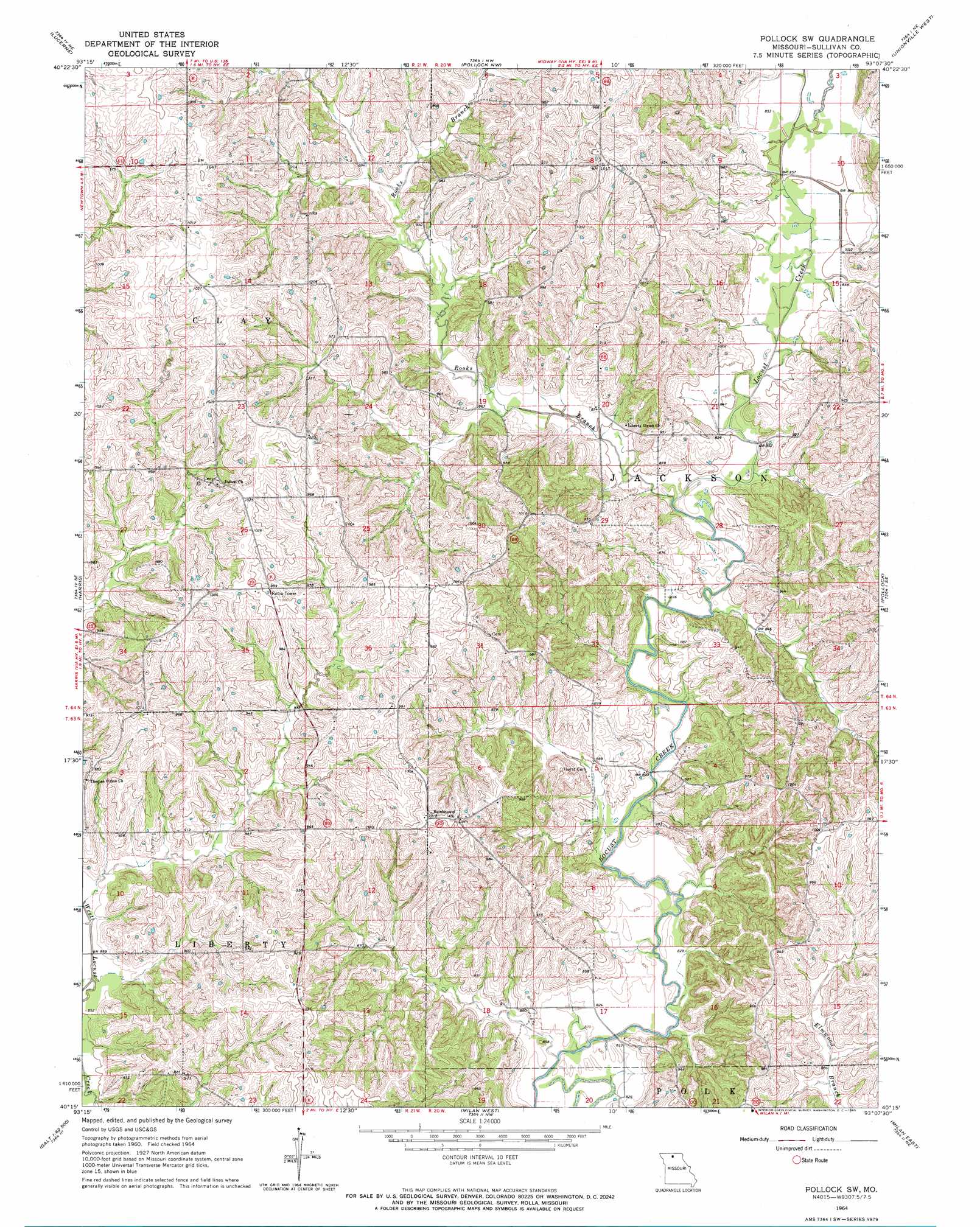
USGS Topo Quad 40093c2 - 1:24,000 scale
| Topo Map Name: | Pollock Sw |
| USGS Topo Quad ID: | 40093c2 |
| Print Size: | ca. 21 1/4" wide x 27" high |
| Southeast Coordinates: | 40.25° N latitude / 93.125° W longitude |
| Map Center Coordinates: | 40.3125° N latitude / 93.1875° W longitude |
| U.S. State: | MO |
| Filename: | o40093c2.jpg |
| Download Map JPG Image: | Pollock Sw topo map 1:24,000 scale |
| Map Type: | Topographic |
| Topo Series: | 7.5´ |
| Map Scale: | 1:24,000 |
| Source of Map Images: | United States Geological Survey (USGS) |
| Alternate Map Versions: |
Pollock SW MO 1964, updated 1965 Download PDF Buy paper map Pollock SW MO 2012 Download PDF Buy paper map Pollock SW MO 2014 Download PDF Buy paper map |
1:24,000 Topo Quads surrounding Pollock Sw
Cleopatra |
Powersville |
Saint John |
Lake Thunderhead |
Mendota |
Ravanna |
Lucerne |
Pollock Nw |
Unionville West |
Unionville East |
Half Rock |
Harris |
Pollock Sw |
Pollock |
Green City |
Galt |
Osgood |
Milan West |
Milan East |
Mystic |
Laredo |
Lindley |
Browning |
Milan Se |
Winigan |
> Back to 40093a1 at 1:100,000 scale
> Back to 40092a1 at 1:250,000 scale
> Back to U.S. Topo Maps home
Pollock Sw topo map: Gazetteer
Pollock Sw: Dams
K and W Farms Lake Dam elevation 288m 944′Pollock Sw: Populated Places
Bairdston elevation 310m 1017′Judson elevation 305m 1000′
Pollock Sw: Streams
Rooks Branch elevation 256m 839′Pollock Sw digital topo map on disk
Buy this Pollock Sw topo map showing relief, roads, GPS coordinates and other geographical features, as a high-resolution digital map file on DVD: