Unionville West Topo Map Missouri
To zoom in, hover over the map of Unionville West
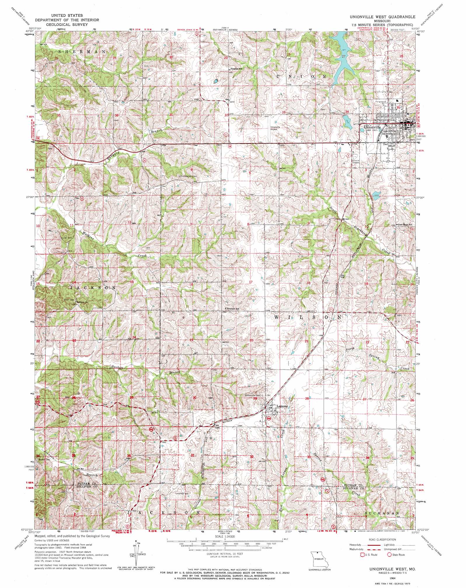
USGS Topo Quad 40093d1 - 1:24,000 scale
| Topo Map Name: | Unionville West |
| USGS Topo Quad ID: | 40093d1 |
| Print Size: | ca. 21 1/4" wide x 27" high |
| Southeast Coordinates: | 40.375° N latitude / 93° W longitude |
| Map Center Coordinates: | 40.4375° N latitude / 93.0625° W longitude |
| U.S. State: | MO |
| Filename: | o40093d1.jpg |
| Download Map JPG Image: | Unionville West topo map 1:24,000 scale |
| Map Type: | Topographic |
| Topo Series: | 7.5´ |
| Map Scale: | 1:24,000 |
| Source of Map Images: | United States Geological Survey (USGS) |
| Alternate Map Versions: |
Unionville West MO 1964, updated 1965 Download PDF Buy paper map Unionville West MO 1964, updated 1965 Download PDF Buy paper map Unionville West MO 2012 Download PDF Buy paper map Unionville West MO 2014 Download PDF Buy paper map |
1:24,000 Topo Quads surrounding Unionville West
Allerton |
Seymour West |
Seymour East |
Centerville West |
Centerville East |
Powersville |
Saint John |
Lake Thunderhead |
Mendota |
Omaha |
Lucerne |
Pollock Nw |
Unionville West |
Unionville East |
Graysville |
Harris |
Pollock Sw |
Pollock |
Green City |
Stahl |
Osgood |
Milan West |
Milan East |
Mystic |
Pure Air |
> Back to 40093a1 at 1:100,000 scale
> Back to 40092a1 at 1:250,000 scale
> Back to U.S. Topo Maps home
Unionville West topo map: Gazetteer
Unionville West: Dams
McCalments Dam elevation 301m 987′Unionville Old City Lake Dam elevation 311m 1020′
Unionville West: Populated Places
Lemons elevation 323m 1059′Unionville elevation 324m 1062′
Unionville West: Reservoirs
Lake McKinley elevation 311m 1020′McCalments Lake elevation 301m 987′
Unionville West: Streams
Tanyard Branch elevation 270m 885′Unionville West digital topo map on disk
Buy this Unionville West topo map showing relief, roads, GPS coordinates and other geographical features, as a high-resolution digital map file on DVD: