Pleasanton Topo Map Missouri
To zoom in, hover over the map of Pleasanton
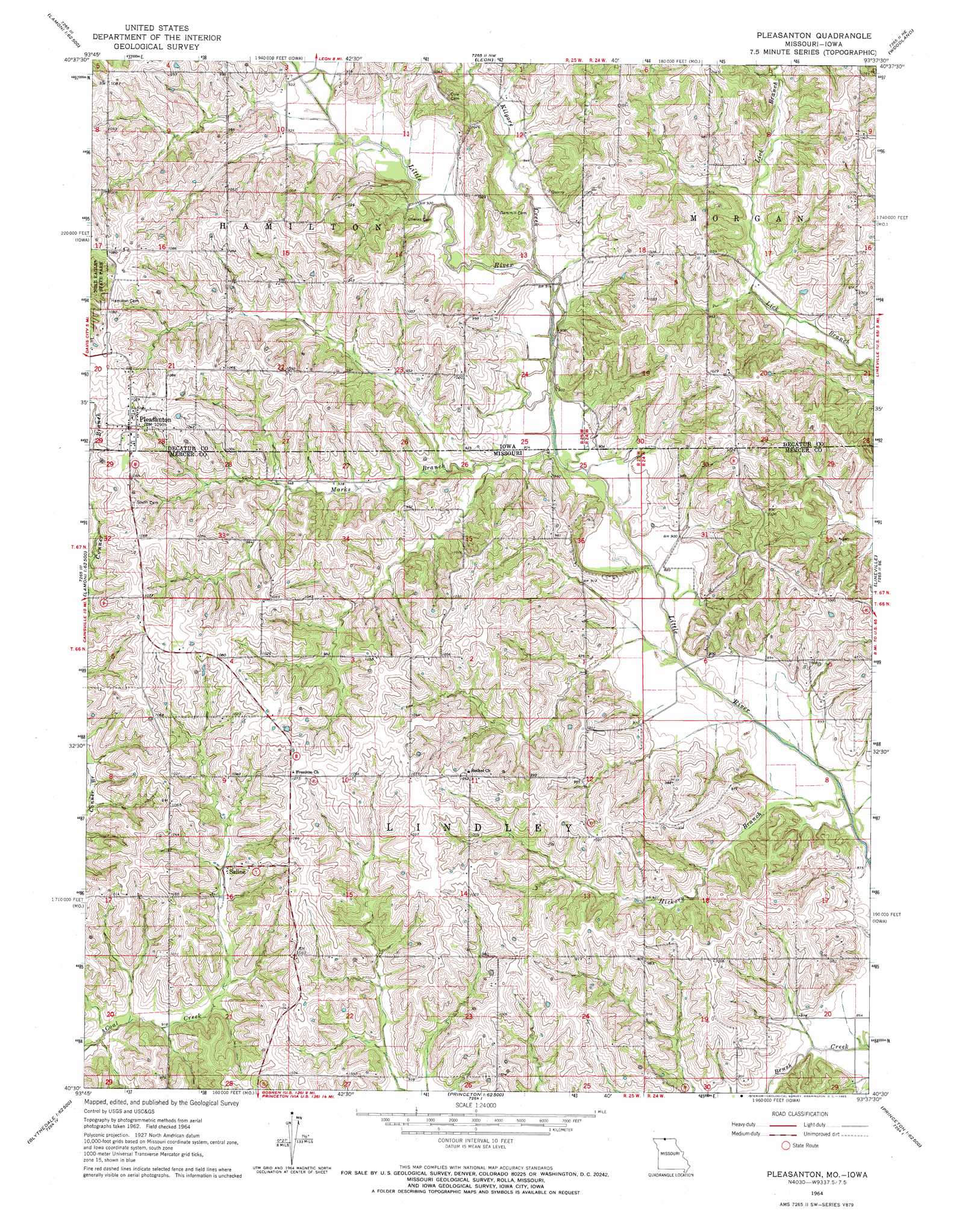
USGS Topo Quad 40093e6 - 1:24,000 scale
| Topo Map Name: | Pleasanton |
| USGS Topo Quad ID: | 40093e6 |
| Print Size: | ca. 21 1/4" wide x 27" high |
| Southeast Coordinates: | 40.5° N latitude / 93.625° W longitude |
| Map Center Coordinates: | 40.5625° N latitude / 93.6875° W longitude |
| U.S. States: | MO, IA |
| Filename: | o40093e6.jpg |
| Download Map JPG Image: | Pleasanton topo map 1:24,000 scale |
| Map Type: | Topographic |
| Topo Series: | 7.5´ |
| Map Scale: | 1:24,000 |
| Source of Map Images: | United States Geological Survey (USGS) |
| Alternate Map Versions: |
Pleasanton IA 1964, updated 1965 Download PDF Buy paper map Pleasanton IA 2010 Download PDF Buy paper map Pleasanton IA 2013 Download PDF Buy paper map Pleasanton IA 2015 Download PDF Buy paper map |
1:24,000 Topo Quads surrounding Pleasanton
Grand River |
Van Wert |
Garden Grove Sw |
Garden Grove |
Humeston |
Lamoni North |
Davis City |
Leon |
Woodland |
Clio |
Lamoni South |
Akron |
Pleasanton |
Lineville |
Cleopatra |
Eagleville |
Cainsville |
Goshen |
Princeton |
Ravanna |
Gardner |
Mount Moriah |
Modena |
Mill Grove |
Half Rock |
> Back to 40093e1 at 1:100,000 scale
> Back to 40092a1 at 1:250,000 scale
> Back to U.S. Topo Maps home
Pleasanton topo map: Gazetteer
Pleasanton: Dams
Shields Lake Dam elevation 308m 1010′Pleasanton: Populated Places
Adel elevation 315m 1033′Pleasanton elevation 333m 1092′
Saline elevation 291m 954′
Wataga elevation 310m 1017′
Pleasanton: Post Offices
Adel Post Office elevation 315m 1033′Little River Post Office (historical) elevation 290m 951′
Pleasanton Post Office (historical) elevation 333m 1092′
Spring Valley Post Office (historical) elevation 276m 905′
Pleasanton: Reservoirs
Shields Lake elevation 308m 1010′Pleasanton: Streams
Hickory Branch elevation 262m 859′Kilgore Creek elevation 271m 889′
Marks Branch elevation 271m 889′
Marks Branch elevation 322m 1056′
Marks Branch elevation 276m 905′
Pleasanton digital topo map on disk
Buy this Pleasanton topo map showing relief, roads, GPS coordinates and other geographical features, as a high-resolution digital map file on DVD: