Akron Topo Map Missouri
To zoom in, hover over the map of Akron
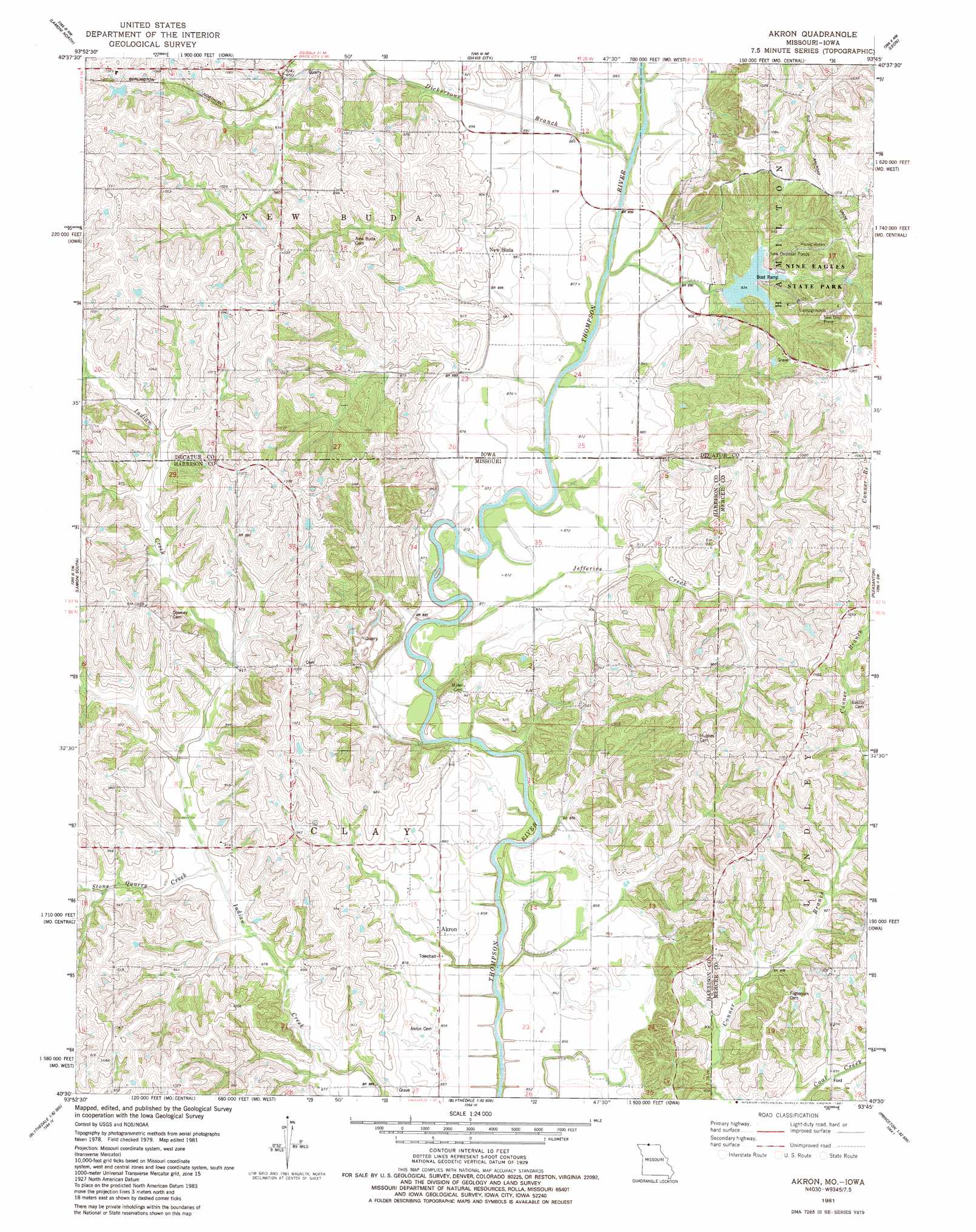
USGS Topo Quad 40093e7 - 1:24,000 scale
| Topo Map Name: | Akron |
| USGS Topo Quad ID: | 40093e7 |
| Print Size: | ca. 21 1/4" wide x 27" high |
| Southeast Coordinates: | 40.5° N latitude / 93.75° W longitude |
| Map Center Coordinates: | 40.5625° N latitude / 93.8125° W longitude |
| U.S. States: | MO, IA |
| Filename: | o40093e7.jpg |
| Download Map JPG Image: | Akron topo map 1:24,000 scale |
| Map Type: | Topographic |
| Topo Series: | 7.5´ |
| Map Scale: | 1:24,000 |
| Source of Map Images: | United States Geological Survey (USGS) |
| Alternate Map Versions: |
Akron MO 1981, updated 1981 Download PDF Buy paper map Akron MO 2010 Download PDF Buy paper map Akron MO 2012 Download PDF Buy paper map Akron MO 2015 Download PDF Buy paper map |
1:24,000 Topo Quads surrounding Akron
Ellston |
Grand River |
Van Wert |
Garden Grove Sw |
Garden Grove |
Kellerton |
Lamoni North |
Davis City |
Leon |
Woodland |
Pawnee |
Lamoni South |
Akron |
Pleasanton |
Lineville |
Brooklyn |
Eagleville |
Cainsville |
Goshen |
Princeton |
Bethany |
Gardner |
Mount Moriah |
Modena |
Mill Grove |
> Back to 40093e1 at 1:100,000 scale
> Back to 40092a1 at 1:250,000 scale
> Back to U.S. Topo Maps home
Akron topo map: Gazetteer
Akron: Parks
Nine Eagles State Park elevation 318m 1043′Akron: Populated Places
Akron elevation 266m 872′Burrows elevation 307m 1007′
New Buda elevation 281m 921′
Akron: Post Offices
New Buda Post Office (historical) elevation 281m 921′Akron: Streams
Dickersons Branch elevation 262m 859′Jefferies Creek elevation 261m 856′
Stone Quarry Creek elevation 270m 885′
Akron digital topo map on disk
Buy this Akron topo map showing relief, roads, GPS coordinates and other geographical features, as a high-resolution digital map file on DVD: