Woodland Topo Map Iowa
To zoom in, hover over the map of Woodland
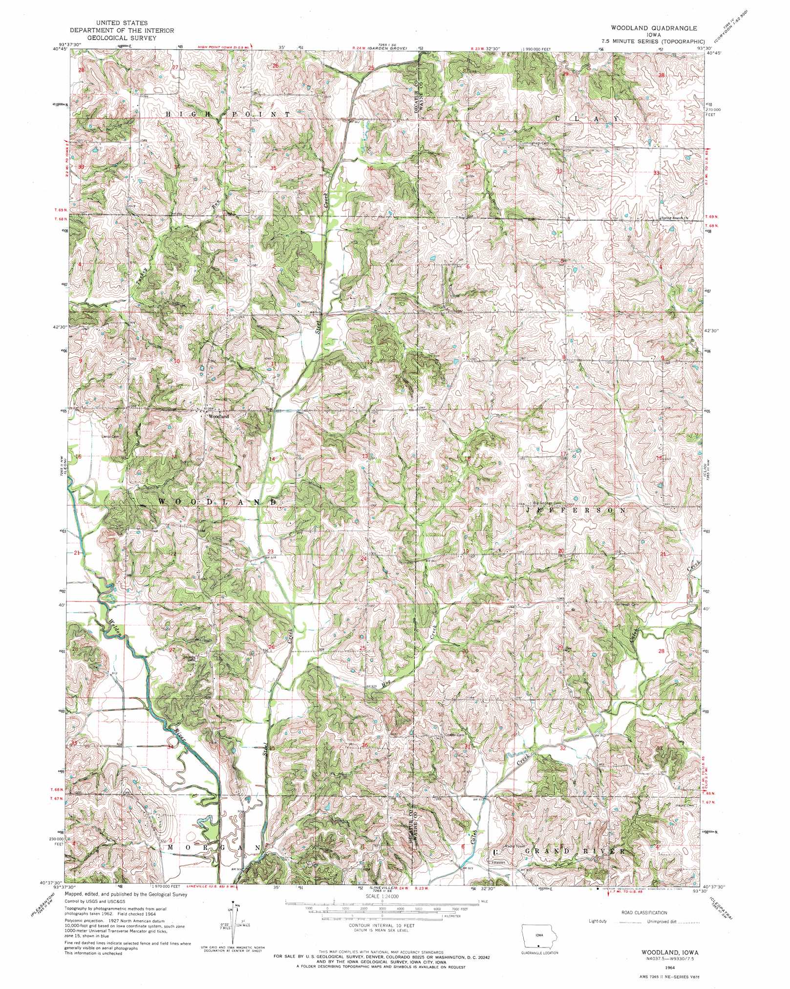
USGS Topo Quad 40093f5 - 1:24,000 scale
| Topo Map Name: | Woodland |
| USGS Topo Quad ID: | 40093f5 |
| Print Size: | ca. 21 1/4" wide x 27" high |
| Southeast Coordinates: | 40.625° N latitude / 93.5° W longitude |
| Map Center Coordinates: | 40.6875° N latitude / 93.5625° W longitude |
| U.S. State: | IA |
| Filename: | o40093f5.jpg |
| Download Map JPG Image: | Woodland topo map 1:24,000 scale |
| Map Type: | Topographic |
| Topo Series: | 7.5´ |
| Map Scale: | 1:24,000 |
| Source of Map Images: | United States Geological Survey (USGS) |
| Alternate Map Versions: |
Woodland IA 1964, updated 1965 Download PDF Buy paper map Woodland IA 2010 Download PDF Buy paper map Woodland IA 2013 Download PDF Buy paper map Woodland IA 2015 Download PDF Buy paper map |
1:24,000 Topo Quads surrounding Woodland
Lacelle |
Weldon |
Le Roy |
Derby |
Corydon Ne |
Van Wert |
Garden Grove Sw |
Garden Grove |
Humeston |
Corydon |
Davis City |
Leon |
Woodland |
Clio |
Allerton |
Akron |
Pleasanton |
Lineville |
Cleopatra |
Powersville |
Cainsville |
Goshen |
Princeton |
Ravanna |
Lucerne |
> Back to 40093e1 at 1:100,000 scale
> Back to 40092a1 at 1:250,000 scale
> Back to U.S. Topo Maps home
Woodland topo map: Gazetteer
Woodland: Populated Places
Big Spring (historical) elevation 326m 1069′Woodland elevation 332m 1089′
Woodland: Post Offices
Big Spring Post Office (historical) elevation 320m 1049′Woodland Post Office (historical) elevation 332m 1089′
Woodland: Streams
Hog Creek elevation 275m 902′Turkey Creek elevation 291m 954′
Woodland digital topo map on disk
Buy this Woodland topo map showing relief, roads, GPS coordinates and other geographical features, as a high-resolution digital map file on DVD: