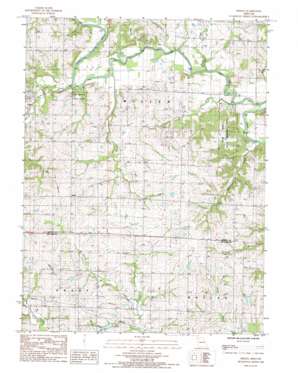
Berlin Topo Map Missouri
To zoom in, hover over the map of Berlin
USGS Topo Quad 40094a3 - 1:24,000 scale
| Topo Map Name: | Berlin |
| USGS Topo Quad ID: | 40094a3 |
| Print Size: | ca. 21 1/4" wide x 27" high |
| Southeast Coordinates: | 40° N latitude / 94.25° W longitude |
| Map Center Coordinates: | 40.0625° N latitude / 94.3125° W longitude |
| U.S. State: | MO |
| Filename: | o40094a3.jpg |
| Download Map JPG Image: | Berlin topo map 1:24,000 scale |
| Map Type: | Topographic |
| Topo Series: | 7.5´ |
| Map Scale: | 1:24,000 |
| Source of Map Images: | United States Geological Survey (USGS) |
| Alternate Map Versions: |
Berlin MO 1985, updated 1985 Download PDF Buy paper map Berlin MO 2011 Download PDF Buy paper map Berlin MO 2014 Download PDF Buy paper map |
1:24,000 Topo Quads surrounding Berlin
> Back to 40094a1 at 1:100,000 scale
> Back to 40094a1 at 1:250,000 scale
> Back to U.S. Topo Maps home
Berlin topo map: Gazetteer
Berlin: Areas
Elam Bend State Wildlife Area elevation 275m 902′Berlin: Bridges
Crawford Bridge elevation 247m 810′Osborne Bridge (historical) elevation 244m 800′
Berlin: Dams
Grindstone-Lost-Muddy Creek Watershed Dam D-22 elevation 284m 931′Grindstone-Lost-Muddy Creek Watershed Dam D-23 elevation 283m 928′
Jestes Lake Dam elevation 281m 921′
Nance Dam elevation 279m 915′
Berlin: Populated Places
Berlin elevation 307m 1007′Berlin: Reservoirs
Jestes Lake elevation 281m 921′Lake Mar-Lou elevation 279m 915′
Berlin: Streams
Beach Branch elevation 244m 800′Brushy Creek elevation 240m 787′
Campbell Creek elevation 242m 793′
Hickory Creek elevation 244m 800′
Jolly Creek elevation 240m 787′
Wheeler Creek elevation 240m 787′
Berlin digital topo map on disk
Buy this Berlin topo map showing relief, roads, GPS coordinates and other geographical features, as a high-resolution digital map file on DVD:


