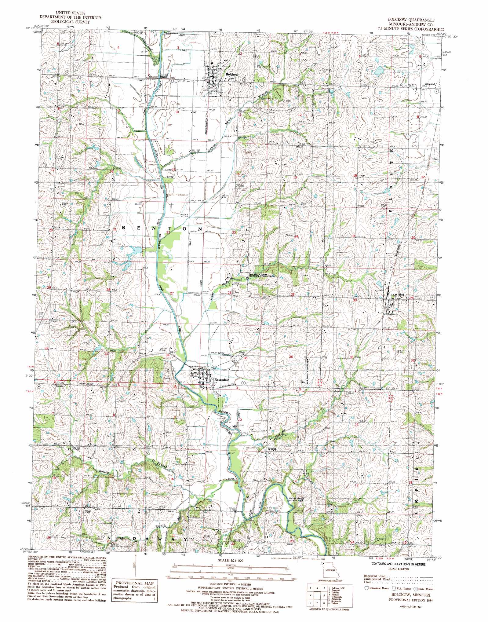
Blockow Topo Map Missouri
To zoom in, hover over the map of Blockow
USGS Topo Quad 40094a7 - 1:24,000 scale
| Topo Map Name: | Blockow |
| USGS Topo Quad ID: | 40094a7 |
| Print Size: | ca. 21 1/4" wide x 27" high |
| Southeast Coordinates: | 40° N latitude / 94.75° W longitude |
| Map Center Coordinates: | 40.0625° N latitude / 94.8125° W longitude |
| U.S. State: | MO |
| Filename: | o40094a7.jpg |
| Download Map JPG Image: | Blockow topo map 1:24,000 scale |
| Map Type: | Topographic |
| Topo Series: | 7.5´ |
| Map Scale: | 1:24,000 |
| Source of Map Images: | United States Geological Survey (USGS) |
| Alternate Map Versions: |
Bolckow MO 1984, updated 1985 Download PDF Buy paper map Bolckow MO 2012 Download PDF Buy paper map Bolckow MO 2014 Download PDF Buy paper map |
1:24,000 Topo Quads surrounding Blockow
Skidmore |
Maryville West |
Maryville East |
Ravenwood |
Alanthus Grove |
Maitland |
Bolckow Nw |
Barnard |
Guilford |
Stanberry |
New Point |
Fillmore |
Blockow |
Whitesville |
King City |
Forbes |
Amazonia |
Savannah |
Helena |
Union Star |
Troy |
Wathena |
Saint Joseph North |
Cosby |
Clarksdale |
> Back to 40094a1 at 1:100,000 scale
> Back to 40094a1 at 1:250,000 scale
> Back to U.S. Topo Maps home
Blockow topo map: Gazetteer
Blockow: Dams
Lake La Verne Dam elevation 305m 1000′Sybert Lake Dam - Lower elevation 278m 912′
Sybert Lake Dam - Upper elevation 288m 944′
Blockow: Forests
Eva Neely Davis Memorial State Forest elevation 297m 974′Blockow: Populated Places
Bolckow elevation 290m 951′Midway elevation 320m 1049′
Rea elevation 328m 1076′
Rosendale elevation 278m 912′
Wyeth elevation 286m 938′
Blockow: Reservoirs
Lake La Verne elevation 305m 1000′Sybert Lake - Lower elevation 278m 912′
Sybert Lake - Upper elevation 288m 944′
Blockow: Streams
Kellog Branch elevation 275m 902′Lower Neely Branch elevation 276m 905′
Riggin Branch elevation 273m 895′
Upper Neely Branch elevation 280m 918′
White Cloud Creek elevation 280m 918′
Blockow digital topo map on disk
Buy this Blockow topo map showing relief, roads, GPS coordinates and other geographical features, as a high-resolution digital map file on DVD: