Maryville West Topo Map Missouri
To zoom in, hover over the map of Maryville West
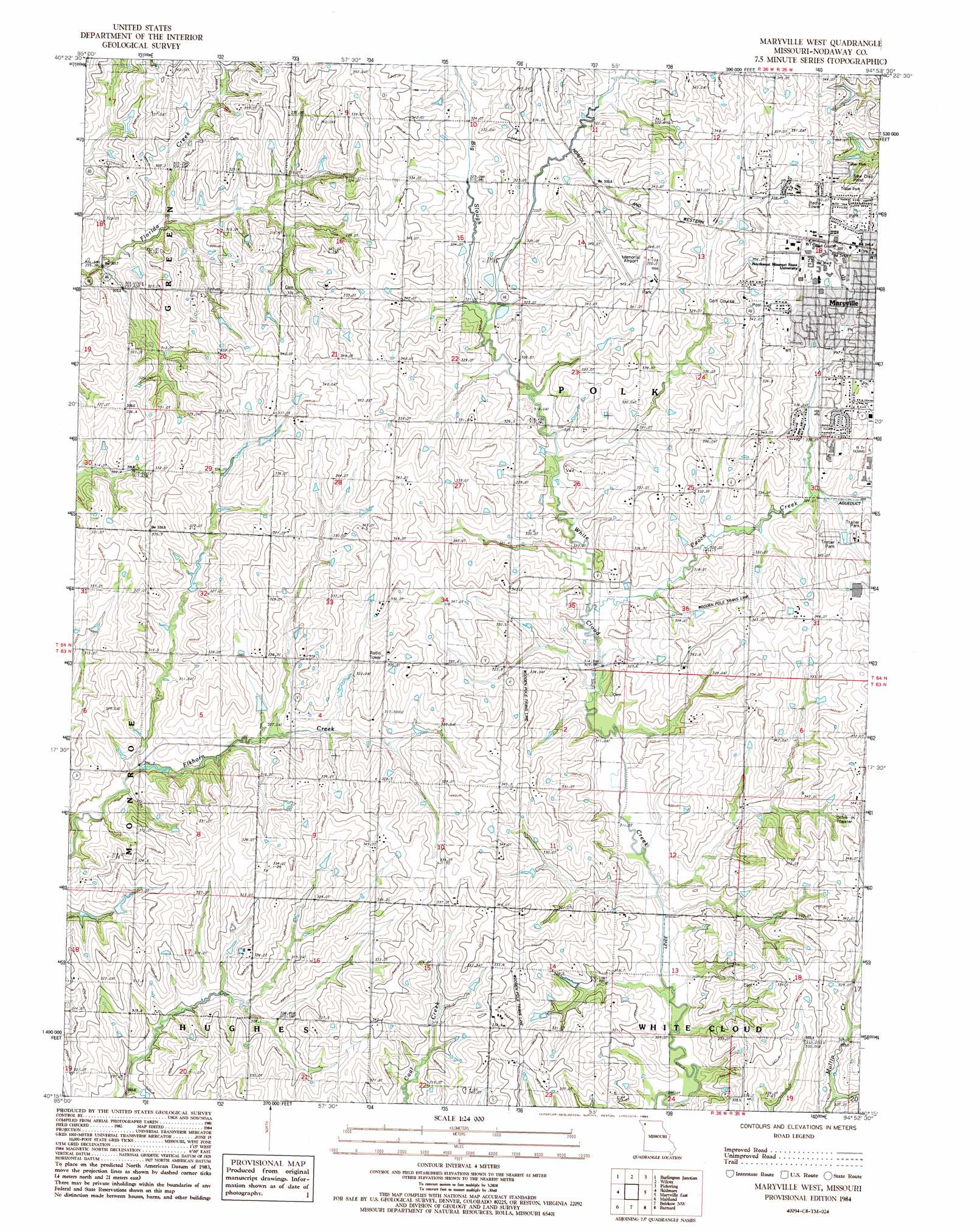
USGS Topo Quad 40094c8 - 1:24,000 scale
| Topo Map Name: | Maryville West |
| USGS Topo Quad ID: | 40094c8 |
| Print Size: | ca. 21 1/4" wide x 27" high |
| Southeast Coordinates: | 40.25° N latitude / 94.875° W longitude |
| Map Center Coordinates: | 40.3125° N latitude / 94.9375° W longitude |
| U.S. State: | MO |
| Filename: | o40094c8.jpg |
| Download Map JPG Image: | Maryville West topo map 1:24,000 scale |
| Map Type: | Topographic |
| Topo Series: | 7.5´ |
| Map Scale: | 1:24,000 |
| Source of Map Images: | United States Geological Survey (USGS) |
| Alternate Map Versions: |
Maryville West MO 1984, updated 1985 Download PDF Buy paper map Maryville West MO 2011 Download PDF Buy paper map Maryville West MO 2014 Download PDF Buy paper map |
1:24,000 Topo Quads surrounding Maryville West
Blanchard |
Clearmont |
Hopkins Sw |
Hopkins |
Bedford Sw |
Skidmore Nw |
Burlington Junction |
Wilcox |
Pickering |
Parnell West |
Dotham |
Skidmore |
Maryville West |
Maryville East |
Ravenwood |
Mound City |
Maitland |
Bolckow Nw |
Barnard |
Guilford |
Kimsey Creek |
New Point |
Fillmore |
Blockow |
Whitesville |
> Back to 40094a1 at 1:100,000 scale
> Back to 40094a1 at 1:250,000 scale
> Back to U.S. Topo Maps home
Maryville West topo map: Gazetteer
Maryville West: Airports
Maryville Memorial Airport elevation 348m 1141′Maryville West: Dams
Houston Lake Dam elevation 310m 1017′Shelton Lake Dam elevation 330m 1082′
Maryville West: Populated Places
Bell Grove elevation 324m 1062′Maryville West: Reservoirs
Houston Lake elevation 310m 1017′Shelton Lake elevation 330m 1082′
Maryville West: Streams
Big Slough elevation 316m 1036′Peach Creek elevation 312m 1023′
Maryville West digital topo map on disk
Buy this Maryville West topo map showing relief, roads, GPS coordinates and other geographical features, as a high-resolution digital map file on DVD: