Allendale Topo Map Missouri
To zoom in, hover over the map of Allendale
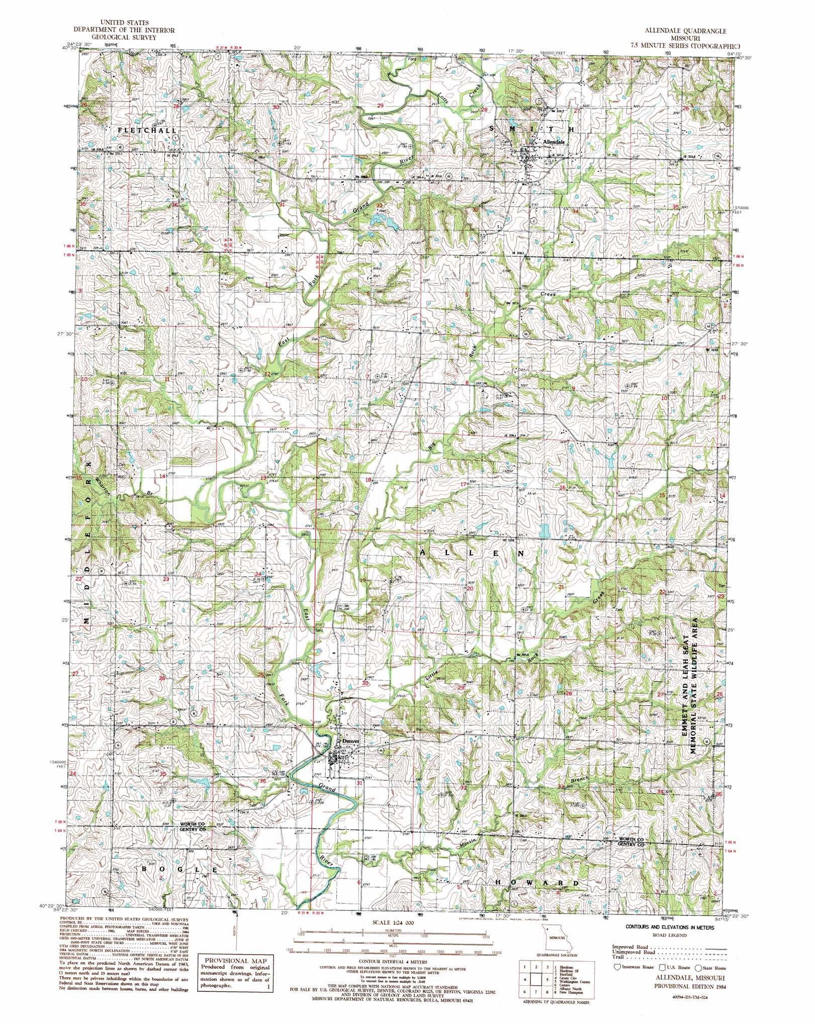
USGS Topo Quad 40094d3 - 1:24,000 scale
| Topo Map Name: | Allendale |
| USGS Topo Quad ID: | 40094d3 |
| Print Size: | ca. 21 1/4" wide x 27" high |
| Southeast Coordinates: | 40.375° N latitude / 94.25° W longitude |
| Map Center Coordinates: | 40.4375° N latitude / 94.3125° W longitude |
| U.S. State: | MO |
| Filename: | o40094d3.jpg |
| Download Map JPG Image: | Allendale topo map 1:24,000 scale |
| Map Type: | Topographic |
| Topo Series: | 7.5´ |
| Map Scale: | 1:24,000 |
| Source of Map Images: | United States Geological Survey (USGS) |
| Alternate Map Versions: |
Allendale MO 1984, updated 1985 Download PDF Buy paper map Allendale MO 2011 Download PDF Buy paper map Allendale MO 2014 Download PDF Buy paper map |
1:24,000 Topo Quads surrounding Allendale
Conway |
Maloy |
Benton |
Mount Ayr |
Kellerton |
Sheridan |
Blockton |
Blockton Se |
Hatfield |
Pawnee |
Parnell East |
Grant City |
Allendale |
Washington Center |
Brooklyn |
Alanthus Grove |
Gentry |
Albany North |
New Hampton |
Bethany |
Stanberry |
Darlington |
Albany South |
Matkin |
Mitchellville |
> Back to 40094a1 at 1:100,000 scale
> Back to 40094a1 at 1:250,000 scale
> Back to U.S. Topo Maps home
Allendale topo map: Gazetteer
Allendale: Dams
Dunfee Lake Dam elevation 309m 1013′Findley Lake Dam elevation 278m 912′
Allendale: Populated Places
Allendale elevation 322m 1056′Denver elevation 285m 935′
Allendale: Reservoirs
Bea Dunfee Lake elevation 309m 1013′Allendale: Streams
Big Rock Creek elevation 272m 892′Little Rock Creek elevation 272m 892′
Lotts Creek elevation 280m 918′
Martin Branch elevation 268m 879′
Wharton Branch elevation 276m 905′
Allendale: Summits
Mount Waller elevation 333m 1092′Allendale digital topo map on disk
Buy this Allendale topo map showing relief, roads, GPS coordinates and other geographical features, as a high-resolution digital map file on DVD: