Parnell West Topo Map Missouri
To zoom in, hover over the map of Parnell West
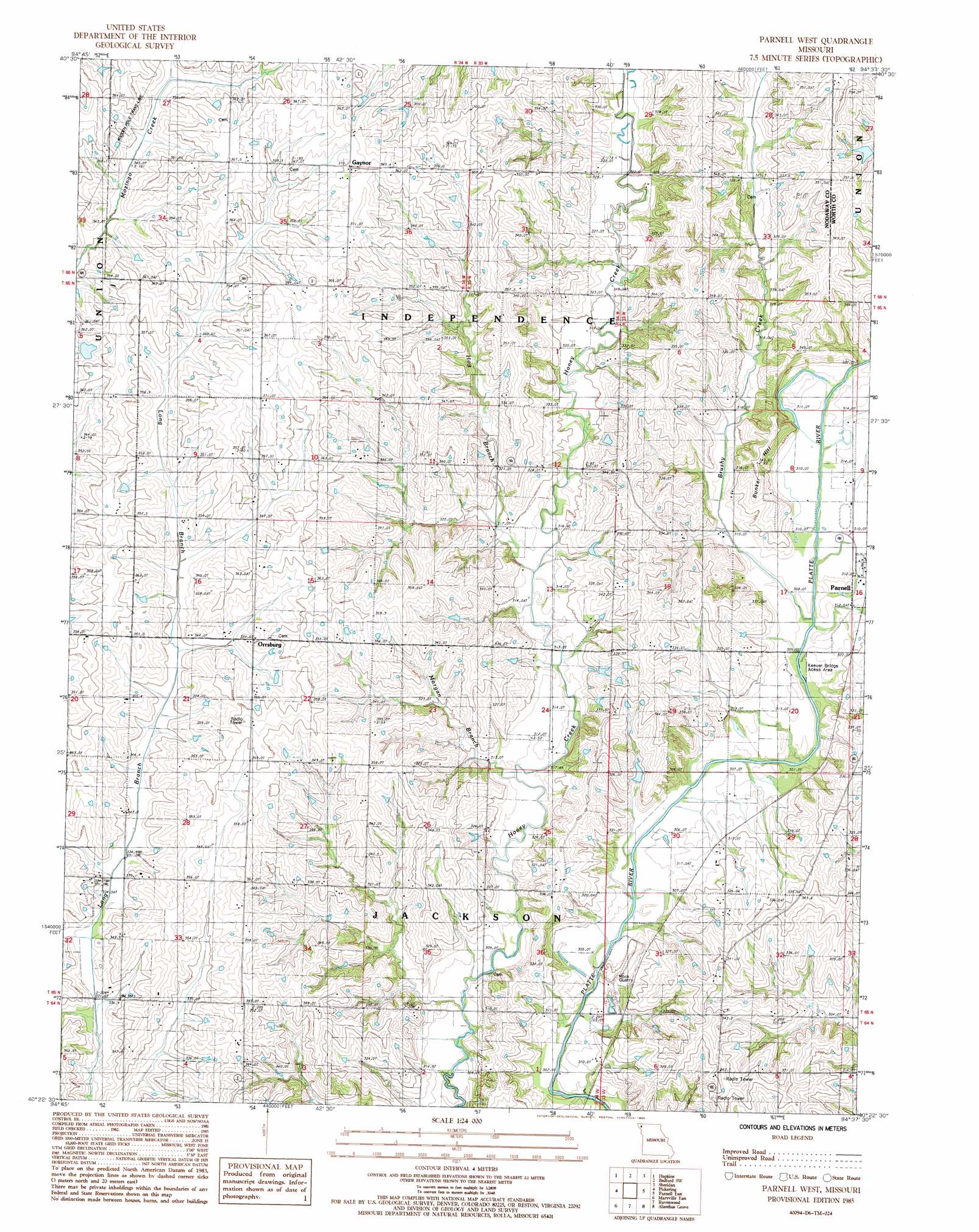
USGS Topo Quad 40094d6 - 1:24,000 scale
| Topo Map Name: | Parnell West |
| USGS Topo Quad ID: | 40094d6 |
| Print Size: | ca. 21 1/4" wide x 27" high |
| Southeast Coordinates: | 40.375° N latitude / 94.625° W longitude |
| Map Center Coordinates: | 40.4375° N latitude / 94.6875° W longitude |
| U.S. State: | MO |
| Filename: | o40094d6.jpg |
| Download Map JPG Image: | Parnell West topo map 1:24,000 scale |
| Map Type: | Topographic |
| Topo Series: | 7.5´ |
| Map Scale: | 1:24,000 |
| Source of Map Images: | United States Geological Survey (USGS) |
| Alternate Map Versions: |
Parnell West MO 1985, updated 1985 Download PDF Buy paper map Parnell West MO 2011 Download PDF Buy paper map Parnell West MO 2014 Download PDF Buy paper map |
1:24,000 Topo Quads surrounding Parnell West
New Market |
Ladoga |
Bedford |
Conway |
Maloy |
Hopkins Sw |
Hopkins |
Bedford Sw |
Sheridan |
Blockton |
Wilcox |
Pickering |
Parnell West |
Parnell East |
Grant City |
Maryville West |
Maryville East |
Ravenwood |
Alanthus Grove |
Gentry |
Bolckow Nw |
Barnard |
Guilford |
Stanberry |
Darlington |
> Back to 40094a1 at 1:100,000 scale
> Back to 40094a1 at 1:250,000 scale
> Back to U.S. Topo Maps home
Parnell West topo map: Gazetteer
Parnell West: Dams
Platte River Tributaries Watershed Dam Number 5-B elevation 333m 1092′Schmitz Brothers Lake Dam elevation 317m 1040′
Parnell West: Populated Places
Gaynor elevation 368m 1207′Orrsburg elevation 352m 1154′
Parnell West: Reservoirs
Number 30 Dam elevation 333m 1092′Schmitz Brothers Lake elevation 317m 1040′
Parnell West: Streams
Brushy Creek elevation 305m 1000′Hog Branch elevation 311m 1020′
Morgan Branch elevation 309m 1013′
Parnell West: Summits
Bunker Hill elevation 337m 1105′Parnell West digital topo map on disk
Buy this Parnell West topo map showing relief, roads, GPS coordinates and other geographical features, as a high-resolution digital map file on DVD: