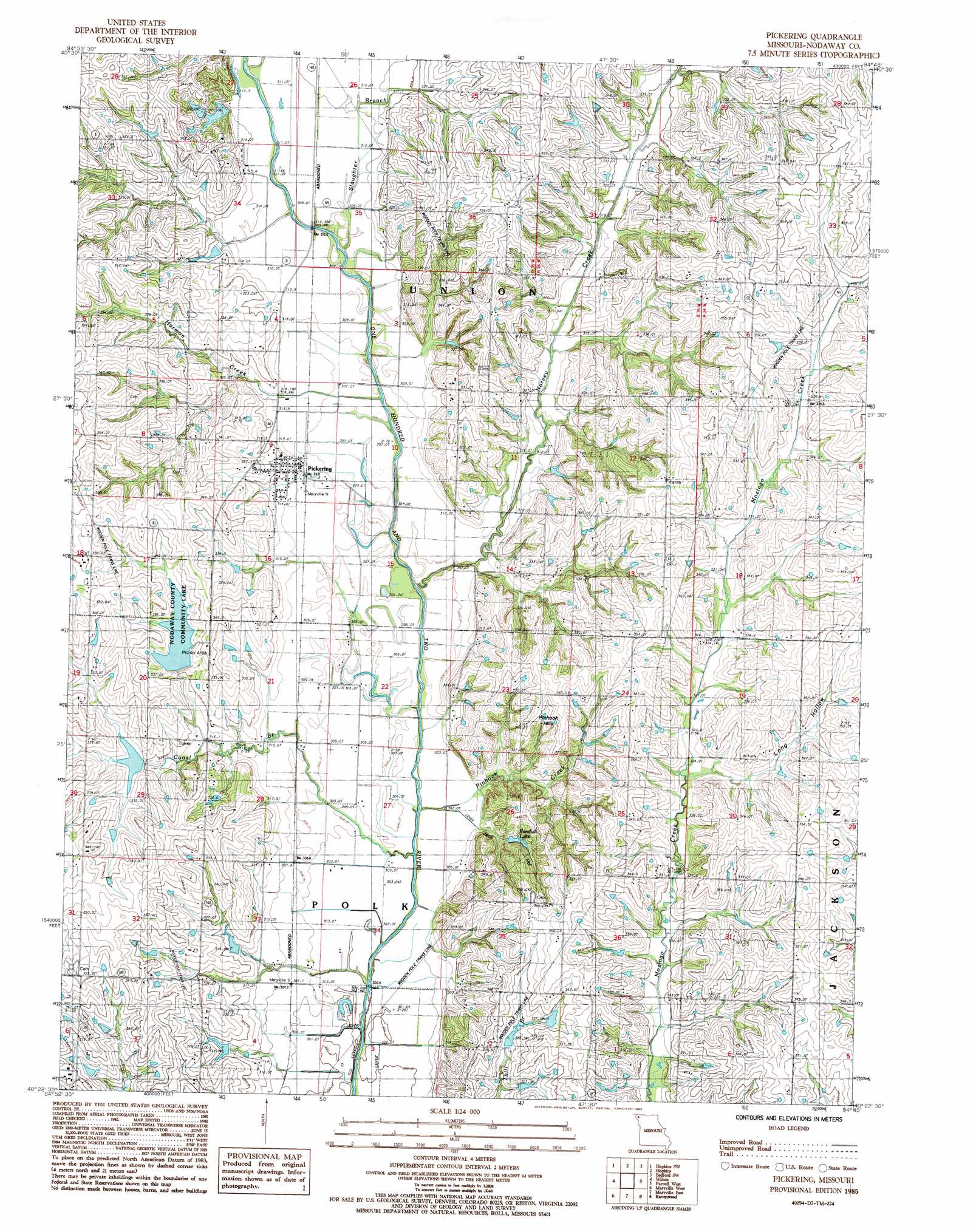
Pickering Topo Map Missouri
To zoom in, hover over the map of Pickering
USGS Topo Quad 40094d7 - 1:24,000 scale
| Topo Map Name: | Pickering |
| USGS Topo Quad ID: | 40094d7 |
| Print Size: | ca. 21 1/4" wide x 27" high |
| Southeast Coordinates: | 40.375° N latitude / 94.75° W longitude |
| Map Center Coordinates: | 40.4375° N latitude / 94.8125° W longitude |
| U.S. State: | MO |
| Filename: | o40094d7.jpg |
| Download Map JPG Image: | Pickering topo map 1:24,000 scale |
| Map Type: | Topographic |
| Topo Series: | 7.5´ |
| Map Scale: | 1:24,000 |
| Source of Map Images: | United States Geological Survey (USGS) |
| Alternate Map Versions: |
Pickering MO 1985, updated 1995 Download PDF Buy paper map Pickering MO 2011 Download PDF Buy paper map Pickering MO 2014 Download PDF Buy paper map |
1:24,000 Topo Quads surrounding Pickering
Clarinda South |
New Market |
Ladoga |
Bedford |
Conway |
Clearmont |
Hopkins Sw |
Hopkins |
Bedford Sw |
Sheridan |
Burlington Junction |
Wilcox |
Pickering |
Parnell West |
Parnell East |
Skidmore |
Maryville West |
Maryville East |
Ravenwood |
Alanthus Grove |
Maitland |
Bolckow Nw |
Barnard |
Guilford |
Stanberry |
> Back to 40094a1 at 1:100,000 scale
> Back to 40094a1 at 1:250,000 scale
> Back to U.S. Topo Maps home
Pickering topo map: Gazetteer
Pickering: Dams
102 River Tributaries Watershed 9 Dam elevation 326m 1069′102 River Tributaries Watershed Dam C-5 elevation 322m 1056′
102 River Tributaries Watershed Number 12 Dam elevation 330m 1082′
102 River Tributaries Watershed Number 4 Dam elevation 338m 1108′
102 River Tributaries Watershed Structure LT-36 Dam elevation 320m 1049′
Nodaway Lake Dam elevation 321m 1053′
Parman Lake Dam elevation 317m 1040′
Robbins Lake Dam elevation 329m 1079′
Robbins Lake Dam Downstream elevation 318m 1043′
Wilson Lake Dam elevation 349m 1145′
Pickering: Populated Places
Pickering elevation 318m 1043′Pickering: Ranges
Pinhook Hills elevation 353m 1158′Pickering: Reservoirs
102 River Tributaries Watershed 9 Lake elevation 326m 1069′Nodaway County Community Lake elevation 330m 1082′
Nodaway Lake elevation 321m 1053′
Nodaway Number 4 Lake elevation 330m 1082′
Parman Lake elevation 317m 1040′
Randall Lake elevation 314m 1030′
Robbins Lake elevation 329m 1079′
Robbins Lake Downstream elevation 318m 1043′
Wilson Lake elevation 349m 1145′
Pickering: Streams
Canal Branch elevation 301m 987′Harmon Creek elevation 307m 1007′
Norvey Creek elevation 300m 984′
Pinhook Creek elevation 300m 984′
Slaughter Branch elevation 309m 1013′
Pickering: Valleys
Jack Hollow elevation 307m 1007′Long Hollow elevation 323m 1059′
Pickering digital topo map on disk
Buy this Pickering topo map showing relief, roads, GPS coordinates and other geographical features, as a high-resolution digital map file on DVD: