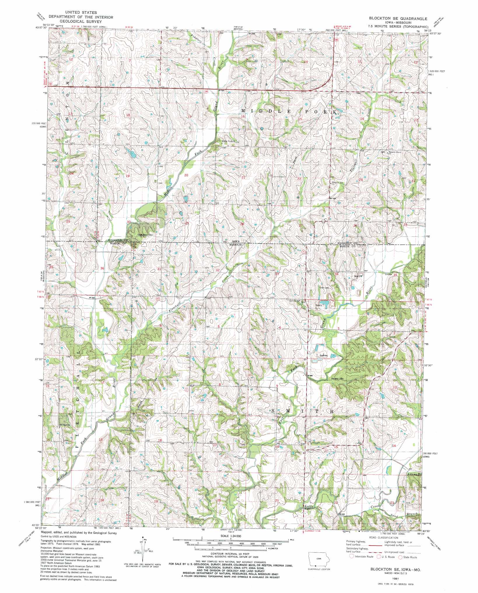
Blockton Se Topo Map Missouri
To zoom in, hover over the map of Blockton Se
USGS Topo Quad 40094e3 - 1:24,000 scale
| Topo Map Name: | Blockton Se |
| USGS Topo Quad ID: | 40094e3 |
| Print Size: | ca. 21 1/4" wide x 27" high |
| Southeast Coordinates: | 40.5° N latitude / 94.25° W longitude |
| Map Center Coordinates: | 40.5625° N latitude / 94.3125° W longitude |
| U.S. States: | MO, IA |
| Filename: | o40094e3.jpg |
| Download Map JPG Image: | Blockton Se topo map 1:24,000 scale |
| Map Type: | Topographic |
| Topo Series: | 7.5´ |
| Map Scale: | 1:24,000 |
| Source of Map Images: | United States Geological Survey (USGS) |
| Alternate Map Versions: |
Blockton SE MO 1981, updated 1981 Download PDF Buy paper map Blockton SE MO 2010 Download PDF Buy paper map Blockton SE MO 2011 Download PDF Buy paper map Blockton SE MO 2014 Download PDF Buy paper map |
1:24,000 Topo Quads surrounding Blockton Se
Merle Junction |
Clearfield |
Diagonal |
Tingley |
Ellston |
Conway |
Maloy |
Benton |
Mount Ayr |
Kellerton |
Sheridan |
Blockton |
Blockton Se |
Hatfield |
Pawnee |
Parnell East |
Grant City |
Allendale |
Washington Center |
Brooklyn |
Alanthus Grove |
Gentry |
Albany North |
New Hampton |
Bethany |
> Back to 40094e1 at 1:100,000 scale
> Back to 40094a1 at 1:250,000 scale
> Back to U.S. Topo Maps home
Blockton Se topo map: Gazetteer
Blockton Se: Dams
Myer Lake Dam elevation 298m 977′Blockton Se: Populated Places
Adams (historical) elevation 294m 964′Blockton Se: Post Offices
Clipper Post Office (historical) elevation 331m 1085′Ingart Post Office (historical) elevation 327m 1072′
Blockton Se: Streams
Adams Branch elevation 292m 958′Fiddlers Creek elevation 308m 1010′
Fletchall Creek elevation 301m 987′
Fletchall Creek elevation 294m 964′
Joes Branch elevation 287m 941′
Mitchells Run elevation 311m 1020′
Sand Branch elevation 289m 948′
Sand Branch elevation 289m 948′
Blockton Se digital topo map on disk
Buy this Blockton Se topo map showing relief, roads, GPS coordinates and other geographical features, as a high-resolution digital map file on DVD: