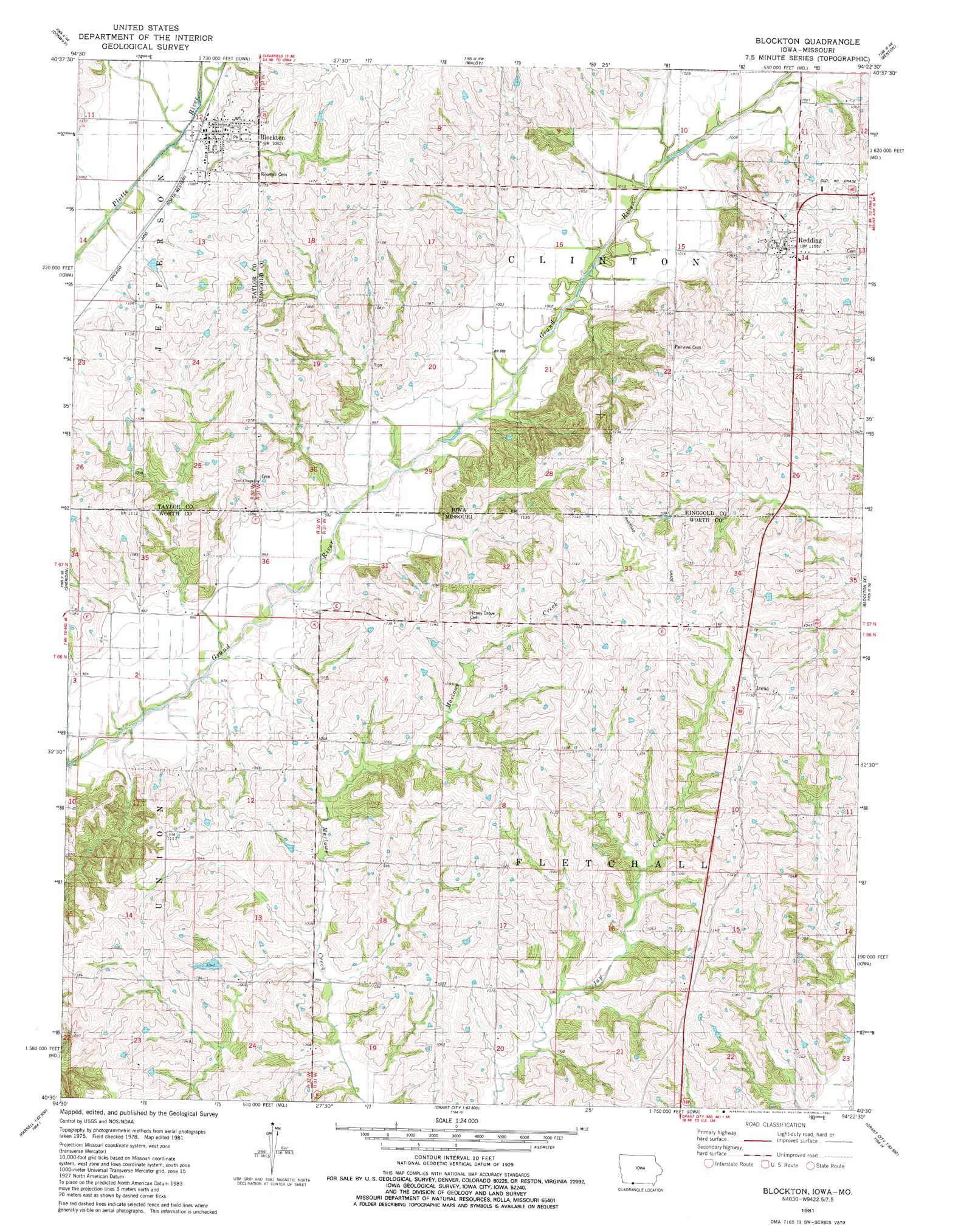
Blockton Topo Map Missouri
To zoom in, hover over the map of Blockton
USGS Topo Quad 40094e4 - 1:24,000 scale
| Topo Map Name: | Blockton |
| USGS Topo Quad ID: | 40094e4 |
| Print Size: | ca. 21 1/4" wide x 27" high |
| Southeast Coordinates: | 40.5° N latitude / 94.375° W longitude |
| Map Center Coordinates: | 40.5625° N latitude / 94.4375° W longitude |
| U.S. States: | MO, IA |
| Filename: | o40094e4.jpg |
| Download Map JPG Image: | Blockton topo map 1:24,000 scale |
| Map Type: | Topographic |
| Topo Series: | 7.5´ |
| Map Scale: | 1:24,000 |
| Source of Map Images: | United States Geological Survey (USGS) |
| Alternate Map Versions: |
Blockton IA 1981, updated 1981 Download PDF Buy paper map Blockton IA 2010 Download PDF Buy paper map Blockton IA 2013 Download PDF Buy paper map Blockton IA 2015 Download PDF Buy paper map |
1:24,000 Topo Quads surrounding Blockton
Gravity |
Merle Junction |
Clearfield |
Diagonal |
Tingley |
Bedford |
Conway |
Maloy |
Benton |
Mount Ayr |
Bedford Sw |
Sheridan |
Blockton |
Blockton Se |
Hatfield |
Parnell West |
Parnell East |
Grant City |
Allendale |
Washington Center |
Ravenwood |
Alanthus Grove |
Gentry |
Albany North |
New Hampton |
> Back to 40094e1 at 1:100,000 scale
> Back to 40094a1 at 1:250,000 scale
> Back to U.S. Topo Maps home
Blockton topo map: Gazetteer
Blockton: Dams
Kemp Lake Dam elevation 311m 1020′Warden Lake Dam - North elevation 330m 1082′
Warden Lake Dam - South elevation 328m 1076′
Zollman Lake Dam elevation 311m 1020′
Blockton: Populated Places
Blockton elevation 342m 1122′Irena elevation 350m 1148′
Redding elevation 349m 1145′
Blockton: Post Offices
Blockton Post Office elevation 342m 1122′Bozzaris Post Office (historical) elevation 313m 1026′
Blockton: Reservoirs
John Andrews Dam Lake elevation 311m 1020′Zollman Lake elevation 311m 1020′
Blockton digital topo map on disk
Buy this Blockton topo map showing relief, roads, GPS coordinates and other geographical features, as a high-resolution digital map file on DVD: