Sheridan Topo Map Missouri
To zoom in, hover over the map of Sheridan
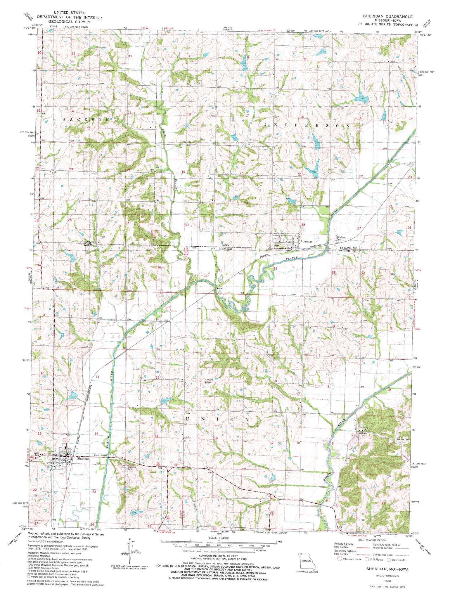
USGS Topo Quad 40094e5 - 1:24,000 scale
| Topo Map Name: | Sheridan |
| USGS Topo Quad ID: | 40094e5 |
| Print Size: | ca. 21 1/4" wide x 27" high |
| Southeast Coordinates: | 40.5° N latitude / 94.5° W longitude |
| Map Center Coordinates: | 40.5625° N latitude / 94.5625° W longitude |
| U.S. States: | MO, IA |
| Filename: | o40094e5.jpg |
| Download Map JPG Image: | Sheridan topo map 1:24,000 scale |
| Map Type: | Topographic |
| Topo Series: | 7.5´ |
| Map Scale: | 1:24,000 |
| Source of Map Images: | United States Geological Survey (USGS) |
| Alternate Map Versions: |
Sheridan MO 1980, updated 1981 Download PDF Buy paper map Sheridan MO 2010 Download PDF Buy paper map Sheridan MO 2011 Download PDF Buy paper map Sheridan MO 2014 Download PDF Buy paper map |
1:24,000 Topo Quads surrounding Sheridan
Guss |
Gravity |
Merle Junction |
Clearfield |
Diagonal |
Ladoga |
Bedford |
Conway |
Maloy |
Benton |
Hopkins |
Bedford Sw |
Sheridan |
Blockton |
Blockton Se |
Pickering |
Parnell West |
Parnell East |
Grant City |
Allendale |
Maryville East |
Ravenwood |
Alanthus Grove |
Gentry |
Albany North |
> Back to 40094e1 at 1:100,000 scale
> Back to 40094a1 at 1:250,000 scale
> Back to U.S. Topo Maps home
Sheridan topo map: Gazetteer
Sheridan: Dams
Arthur Scott Dam elevation 340m 1115′Platte River Tributaries Dam 3-B elevation 340m 1115′
Platte River Tributaries Watershed Dam 1-B elevation 340m 1115′
Platte River Tributaries Watershed Dam 2-A elevation 339m 1112′
Platte River Tributaries Watershed Dam 2-A elevation 331m 1085′
Platte River Tributaries Watershed Dam 8-B elevation 339m 1112′
Platte River Tributaries Watershed Dam 8-C elevation 325m 1066′
Sheridan: Populated Places
Athelstan elevation 328m 1076′Isadora elevation 297m 974′
Sheridan elevation 320m 1049′
Sheridan: Post Offices
Athelstan Post Office (historical) elevation 328m 1076′Sheridan: Reservoirs
Aldrich Lake elevation 340m 1115′Arthur Scott Lake elevation 340m 1115′
Bonnies Lake elevation 331m 1085′
Hoover Lake elevation 339m 1112′
Mononame 29 Lake elevation 339m 1112′
Sanders Lake elevation 325m 1066′
Sheridan: Streams
Platte Branch elevation 316m 1036′Sheridan: Summits
Devils Horn elevation 367m 1204′Sheridan digital topo map on disk
Buy this Sheridan topo map showing relief, roads, GPS coordinates and other geographical features, as a high-resolution digital map file on DVD: