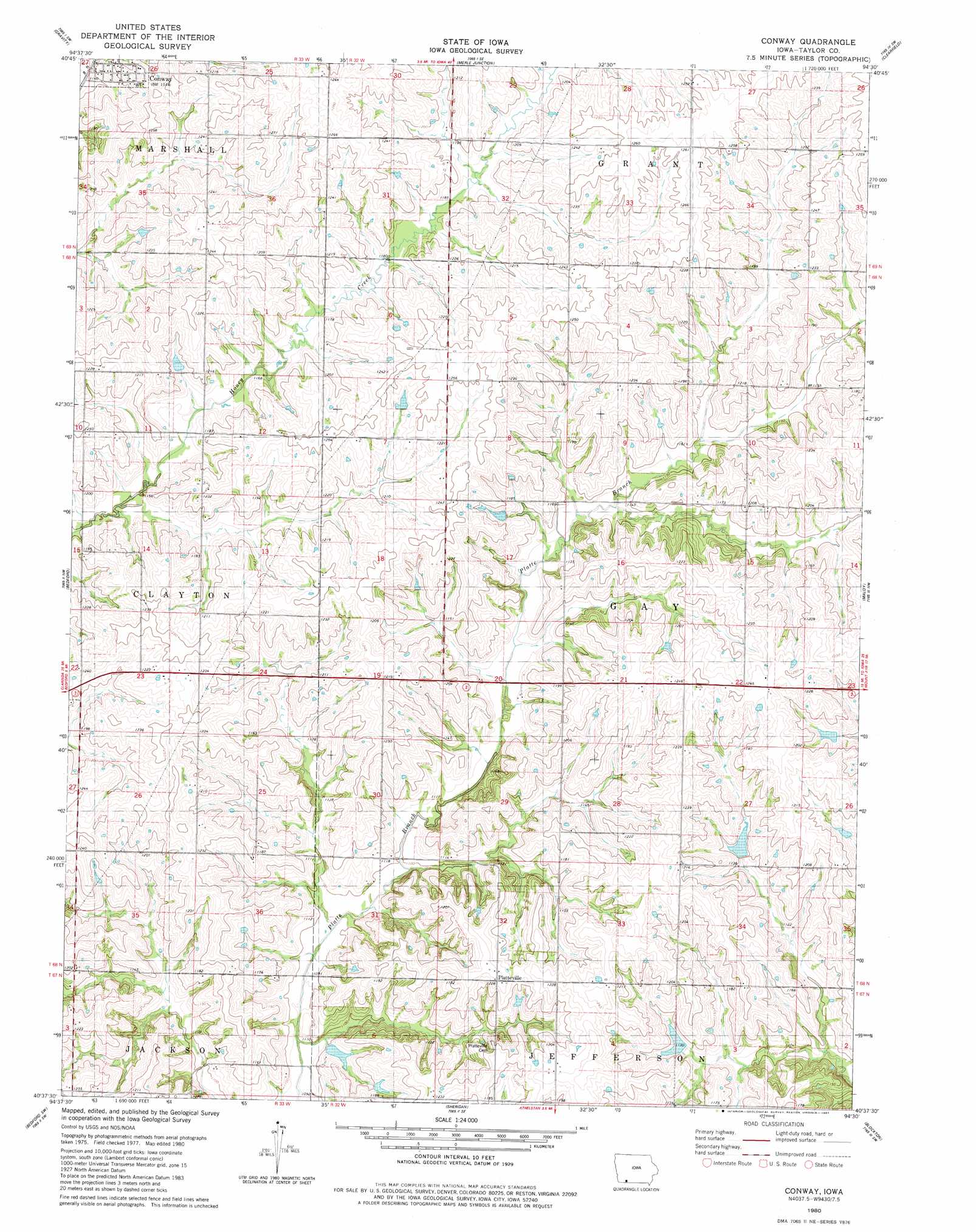
Conway Topo Map Iowa
To zoom in, hover over the map of Conway
USGS Topo Quad 40094f5 - 1:24,000 scale
| Topo Map Name: | Conway |
| USGS Topo Quad ID: | 40094f5 |
| Print Size: | ca. 21 1/4" wide x 27" high |
| Southeast Coordinates: | 40.625° N latitude / 94.5° W longitude |
| Map Center Coordinates: | 40.6875° N latitude / 94.5625° W longitude |
| U.S. State: | IA |
| Filename: | o40094f5.jpg |
| Download Map JPG Image: | Conway topo map 1:24,000 scale |
| Map Type: | Topographic |
| Topo Series: | 7.5´ |
| Map Scale: | 1:24,000 |
| Source of Map Images: | United States Geological Survey (USGS) |
| Alternate Map Versions: |
Conway IA 1980, updated 1981 Download PDF Buy paper map Conway IA 2010 Download PDF Buy paper map Conway IA 2013 Download PDF Buy paper map Conway IA 2015 Download PDF Buy paper map |
1:24,000 Topo Quads surrounding Conway
Brooks |
Corning South |
Lenox |
Kent |
Shannon City |
Guss |
Gravity |
Merle Junction |
Clearfield |
Diagonal |
Ladoga |
Bedford |
Conway |
Maloy |
Benton |
Hopkins |
Bedford Sw |
Sheridan |
Blockton |
Blockton Se |
Pickering |
Parnell West |
Parnell East |
Grant City |
Allendale |
> Back to 40094e1 at 1:100,000 scale
> Back to 40094a1 at 1:250,000 scale
> Back to U.S. Topo Maps home
Conway topo map: Gazetteer
Conway: Parks
French Nature Preserve Wildlife Refuge elevation 365m 1197′Sands Timber and Recreation Area elevation 347m 1138′
Conway: Populated Places
Conway elevation 369m 1210′Platteville elevation 375m 1230′
Conway: Post Offices
Conway Post Office (historical) elevation 369m 1210′Platteville Post Office (historical) elevation 375m 1230′
Conway digital topo map on disk
Buy this Conway topo map showing relief, roads, GPS coordinates and other geographical features, as a high-resolution digital map file on DVD: