Ladoga Topo Map Iowa
To zoom in, hover over the map of Ladoga
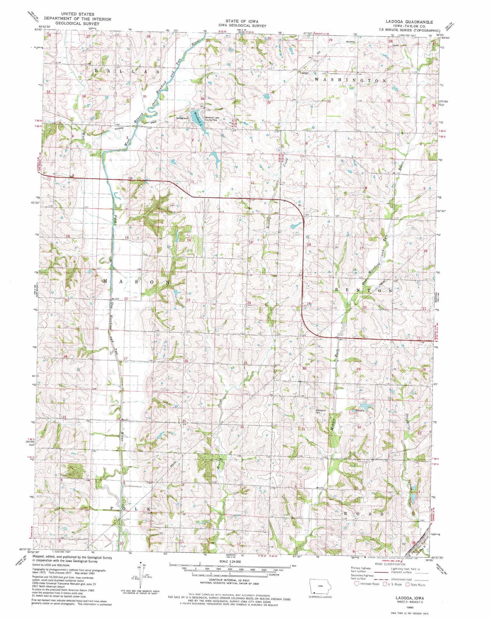
USGS Topo Quad 40094f7 - 1:24,000 scale
| Topo Map Name: | Ladoga |
| USGS Topo Quad ID: | 40094f7 |
| Print Size: | ca. 21 1/4" wide x 27" high |
| Southeast Coordinates: | 40.625° N latitude / 94.75° W longitude |
| Map Center Coordinates: | 40.6875° N latitude / 94.8125° W longitude |
| U.S. State: | IA |
| Filename: | o40094f7.jpg |
| Download Map JPG Image: | Ladoga topo map 1:24,000 scale |
| Map Type: | Topographic |
| Topo Series: | 7.5´ |
| Map Scale: | 1:24,000 |
| Source of Map Images: | United States Geological Survey (USGS) |
| Alternate Map Versions: |
Ladoga IA 1980, updated 1981 Download PDF Buy paper map Ladoga IA 2010 Download PDF Buy paper map Ladoga IA 2013 Download PDF Buy paper map Ladoga IA 2015 Download PDF Buy paper map |
1:24,000 Topo Quads surrounding Ladoga
Stanton |
Villisca |
Brooks |
Corning South |
Lenox |
Clarinda North |
Hawleyville |
Guss |
Gravity |
Merle Junction |
Clarinda South |
New Market |
Ladoga |
Bedford |
Conway |
Clearmont |
Hopkins Sw |
Hopkins |
Bedford Sw |
Sheridan |
Burlington Junction |
Wilcox |
Pickering |
Parnell West |
Parnell East |
> Back to 40094e1 at 1:100,000 scale
> Back to 40094a1 at 1:250,000 scale
> Back to U.S. Topo Maps home
Ladoga topo map: Gazetteer
Ladoga: Dams
Windmill Lake Dam elevation 340m 1115′Ladoga: Mines
Bedford Quarry elevation 346m 1135′Ladoga: Parks
Windmill Lake County Park elevation 349m 1145′Ladoga: Populated Places
Ladoga elevation 374m 1227′Ladoga: Post Offices
Brushy Post Office (historical) elevation 359m 1177′Ladoga Post Office (historical) elevation 374m 1227′
Ladoga: Reservoirs
Windmill Lake elevation 342m 1122′Ladoga: Streams
Daugherty Creek elevation 323m 1059′West Branch One Hundred and Two River elevation 323m 1059′
Ladoga digital topo map on disk
Buy this Ladoga topo map showing relief, roads, GPS coordinates and other geographical features, as a high-resolution digital map file on DVD: