Diagonal Topo Map Iowa
To zoom in, hover over the map of Diagonal
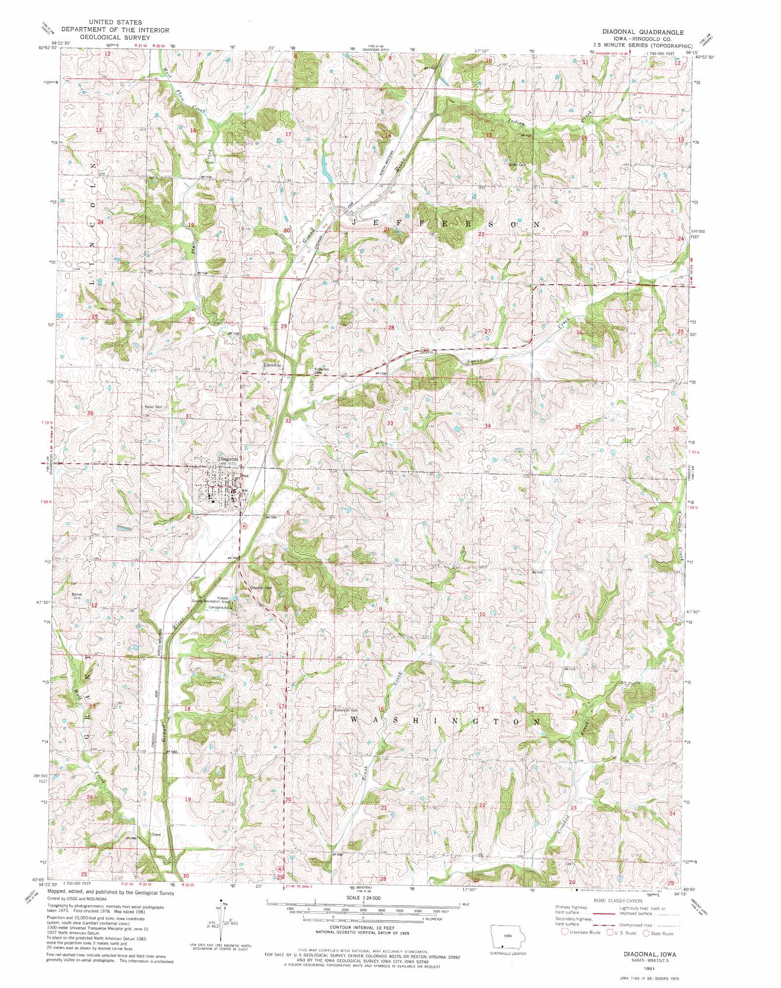
USGS Topo Quad 40094g3 - 1:24,000 scale
| Topo Map Name: | Diagonal |
| USGS Topo Quad ID: | 40094g3 |
| Print Size: | ca. 21 1/4" wide x 27" high |
| Southeast Coordinates: | 40.75° N latitude / 94.25° W longitude |
| Map Center Coordinates: | 40.8125° N latitude / 94.3125° W longitude |
| U.S. State: | IA |
| Filename: | o40094g3.jpg |
| Download Map JPG Image: | Diagonal topo map 1:24,000 scale |
| Map Type: | Topographic |
| Topo Series: | 7.5´ |
| Map Scale: | 1:24,000 |
| Source of Map Images: | United States Geological Survey (USGS) |
| Alternate Map Versions: |
Diagonal IA 1981, updated 1981 Download PDF Buy paper map Diagonal IA 2010 Download PDF Buy paper map Diagonal IA 2013 Download PDF Buy paper map Diagonal IA 2015 Download PDF Buy paper map |
1:24,000 Topo Quads surrounding Diagonal
Prescott |
Creston West |
Creston East |
Afton |
Lorimor South |
Lenox |
Kent |
Shannon City |
Arispe |
Tingley Ne |
Merle Junction |
Clearfield |
Diagonal |
Tingley |
Ellston |
Conway |
Maloy |
Benton |
Mount Ayr |
Kellerton |
Sheridan |
Blockton |
Blockton Se |
Hatfield |
Pawnee |
> Back to 40094e1 at 1:100,000 scale
> Back to 40094a1 at 1:250,000 scale
> Back to U.S. Topo Maps home
Diagonal topo map: Gazetteer
Diagonal: Dams
Sun Valley Lake Dam elevation 339m 1112′Diagonal: Populated Places
Diagonal elevation 350m 1148′Knowlton elevation 345m 1131′
Diagonal: Post Offices
Diagonal Post Office elevation 350m 1148′Flushing Post Office (historical) elevation 348m 1141′
Goshen Post Office (historical) elevation 367m 1204′
Kew Post Office (historical) elevation 375m 1230′
Knowlton Post Office (historical) elevation 345m 1131′
Diagonal: Reservoirs
Sun Valley Lake elevation 339m 1112′Diagonal: Streams
Indian Creek elevation 332m 1089′Plum Creek elevation 329m 1079′
Squaw Creek elevation 325m 1066′
West Plum Creek elevation 340m 1115′
Wolf Creek elevation 321m 1053′
Diagonal digital topo map on disk
Buy this Diagonal topo map showing relief, roads, GPS coordinates and other geographical features, as a high-resolution digital map file on DVD: