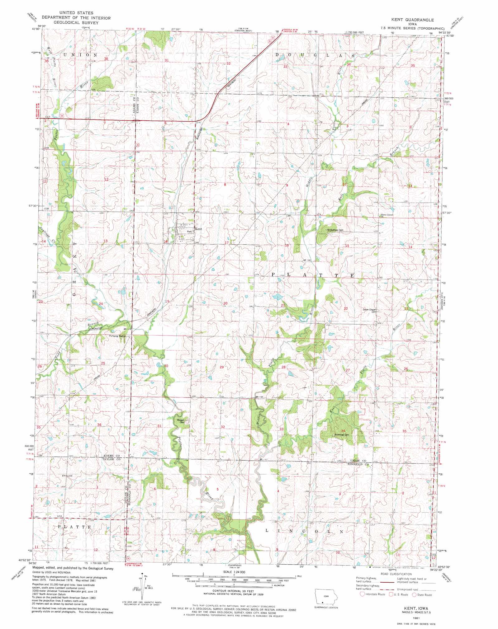
Kent Topo Map Iowa
To zoom in, hover over the map of Kent
USGS Topo Quad 40094h4 - 1:24,000 scale
| Topo Map Name: | Kent |
| USGS Topo Quad ID: | 40094h4 |
| Print Size: | ca. 21 1/4" wide x 27" high |
| Southeast Coordinates: | 40.875° N latitude / 94.375° W longitude |
| Map Center Coordinates: | 40.9375° N latitude / 94.4375° W longitude |
| U.S. State: | IA |
| Filename: | o40094h4.jpg |
| Download Map JPG Image: | Kent topo map 1:24,000 scale |
| Map Type: | Topographic |
| Topo Series: | 7.5´ |
| Map Scale: | 1:24,000 |
| Source of Map Images: | United States Geological Survey (USGS) |
| Alternate Map Versions: |
Kent IA 1981, updated 1981 Download PDF Buy paper map Kent IA 2010 Download PDF Buy paper map Kent IA 2013 Download PDF Buy paper map Kent IA 2015 Download PDF Buy paper map |
1:24,000 Topo Quads surrounding Kent
Bridgewater |
Nevinville |
Orient |
Zion |
Macksburg |
Corning North |
Prescott |
Creston West |
Creston East |
Afton |
Corning South |
Lenox |
Kent |
Shannon City |
Arispe |
Gravity |
Merle Junction |
Clearfield |
Diagonal |
Tingley |
Bedford |
Conway |
Maloy |
Benton |
Mount Ayr |
> Back to 40094e1 at 1:100,000 scale
> Back to 40094a1 at 1:250,000 scale
> Back to U.S. Topo Maps home
Kent topo map: Gazetteer
Kent: Populated Places
Kent elevation 370m 1213′Polen elevation 380m 1246′
Kent: Post Offices
Coelo Post Office (historical) elevation 356m 1167′Kent Post Office elevation 370m 1213′
Polen Post Office (historical) elevation 380m 1246′
Union City Post Office (historical) elevation 389m 1276′
Kent: Streams
East Branch Middle Platte River elevation 357m 1171′East Platte River elevation 348m 1141′
Middle Platte River elevation 347m 1138′
Saylings Creek elevation 356m 1167′
Todd Branch elevation 357m 1171′
West Platte River elevation 359m 1177′
Kent digital topo map on disk
Buy this Kent topo map showing relief, roads, GPS coordinates and other geographical features, as a high-resolution digital map file on DVD: