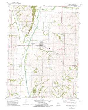
Burlington Junction Topo Map Missouri
To zoom in, hover over the map of Burlington Junction
USGS Topo Quad 40095d1 - 1:24,000 scale
| Topo Map Name: | Burlington Junction |
| USGS Topo Quad ID: | 40095d1 |
| Print Size: | ca. 21 1/4" wide x 27" high |
| Southeast Coordinates: | 40.375° N latitude / 95° W longitude |
| Map Center Coordinates: | 40.4375° N latitude / 95.0625° W longitude |
| U.S. State: | MO |
| Filename: | o40095d1.jpg |
| Download Map JPG Image: | Burlington Junction topo map 1:24,000 scale |
| Map Type: | Topographic |
| Topo Series: | 7.5´ |
| Map Scale: | 1:24,000 |
| Source of Map Images: | United States Geological Survey (USGS) |
| Alternate Map Versions: |
Burlington Junction MO 1981, updated 1982 Download PDF Buy paper map Burlington Junction MO 2012 Download PDF Buy paper map Burlington Junction MO 2014 Download PDF Buy paper map |
1:24,000 Topo Quads surrounding Burlington Junction
> Back to 40095a1 at 1:100,000 scale
> Back to 40094a1 at 1:250,000 scale
> Back to U.S. Topo Maps home
Burlington Junction topo map: Gazetteer
Burlington Junction: Airports
Hester Airport elevation 299m 980′Burlington Junction: Dams
Hoover Frankum Watershed B-23 Dam elevation 291m 954′Hoover Frankum Watershed Structure B-20 Dam elevation 300m 984′
Burlington Junction: Populated Places
Burlington Junction elevation 296m 971′Dawsonville elevation 291m 954′
Possum Walk elevation 336m 1102′
Roseberry elevation 307m 1007′
Burlington Junction: Reservoirs
Hoover Frankum Watershed B 20 Reservoir elevation 300m 984′Hoover Frankum Watershed B-23 Lake elevation 291m 954′
Burlington Junction: Streams
Clear Creek elevation 281m 921′Cuyhoga Creek elevation 278m 912′
Hagey Branch elevation 276m 905′
Headrick Branch elevation 274m 898′
Mill Creek elevation 275m 902′
Muddy Creek elevation 279m 915′
Burlington Junction digital topo map on disk
Buy this Burlington Junction topo map showing relief, roads, GPS coordinates and other geographical features, as a high-resolution digital map file on DVD:


