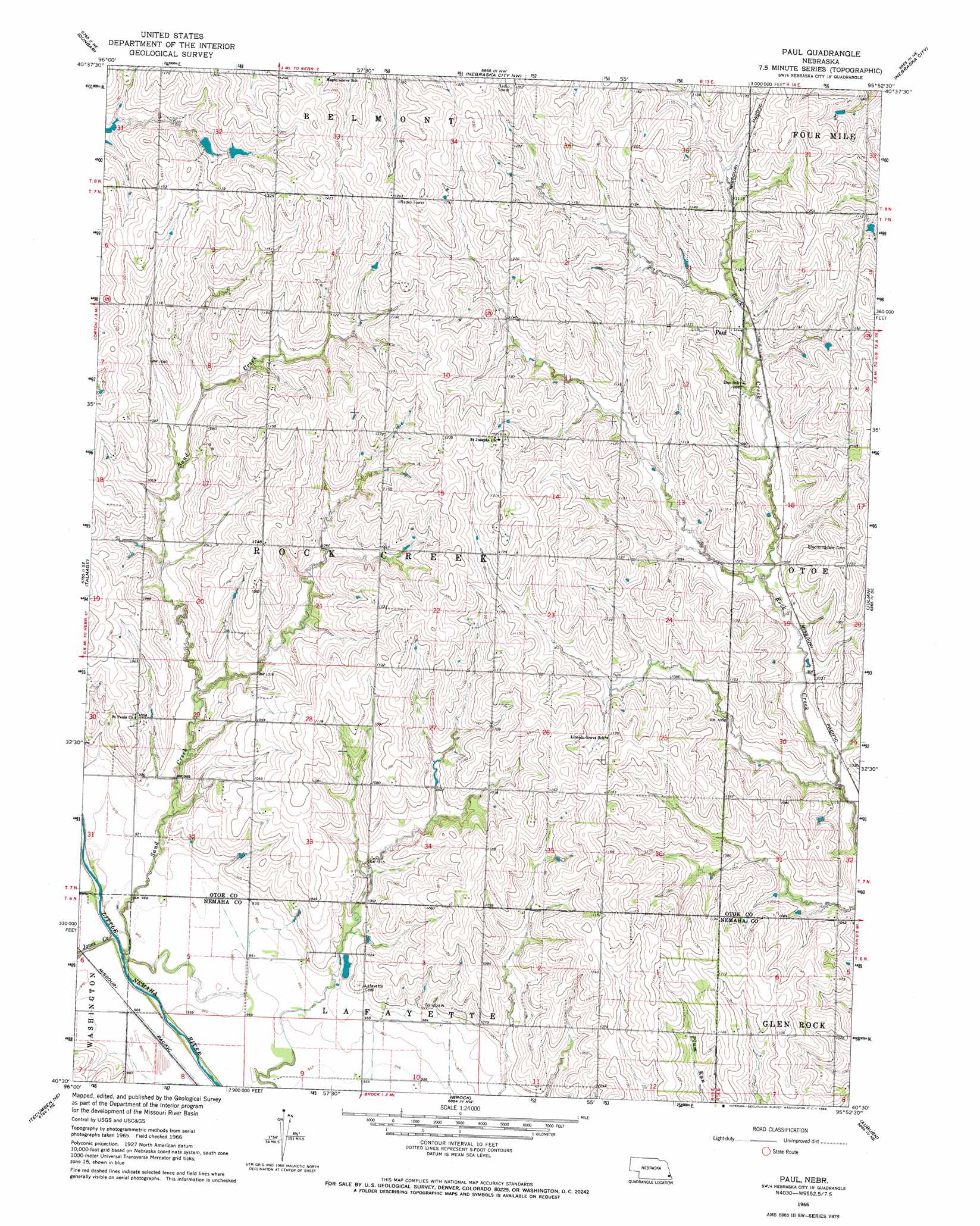
Paul Topo Map Nebraska
To zoom in, hover over the map of Paul
USGS Topo Quad 40095e8 - 1:24,000 scale
| Topo Map Name: | Paul |
| USGS Topo Quad ID: | 40095e8 |
| Print Size: | ca. 21 1/4" wide x 27" high |
| Southeast Coordinates: | 40.5° N latitude / 95.875° W longitude |
| Map Center Coordinates: | 40.5625° N latitude / 95.9375° W longitude |
| U.S. State: | NE |
| Filename: | O40095E8.jpg |
| Download Map JPG Image: | Paul topo map 1:24,000 scale |
| Map Type: | Topographic |
| Topo Series: | 7.5´ |
| Map Scale: | 1:24,000 |
| Source of Map Images: | United States Geological Survey (USGS) |
| Alternate Map Versions: |
Paul NE 1966, updated 1968 Download PDF Buy paper map Paul NE 2011 Download PDF Buy paper map Paul NE 2014 Download PDF Buy paper map |
1:24,000 Topo Quads surrounding Paul
Weeping Water |
Avoca |
Nehawka |
Mcpaul |
Tabor Sw |
Syracuse |
Dunbar |
Nebraska City Nw |
Nebraska City |
Sidney |
Cook |
Talmage |
Paul |
Julian |
Hamburg |
Tecumseh Nw |
Tecumseh Ne |
Brock |
Auburn |
Peru |
Tecumseh |
Tecumseh Se |
Howe Sw |
Howe |
Nemaha |
> Back to 40095e1 at 1:100,000 scale
> Back to 40094a1 at 1:250,000 scale
> Back to U.S. Topo Maps home
Paul topo map: Gazetteer
Paul: Dams
Demey Dam elevation 316m 1036′Heirs Dam elevation 340m 1115′
Wilson Creek Dam 1-10 elevation 354m 1161′
Paul: Populated Places
Paul elevation 330m 1082′Paul: Post Offices
Paul Post Office (historical) elevation 330m 1082′Paul: Reservoirs
Demey Reservoir elevation 316m 1036′Wilson Creek Reservoir 1-10 elevation 354m 1161′
Wilson Creek Reservoir 1-9 elevation 340m 1115′
Paul: Streams
Jones Creek elevation 286m 938′Sand Creek elevation 286m 938′
Paul digital topo map on disk
Buy this Paul topo map showing relief, roads, GPS coordinates and other geographical features, as a high-resolution digital map file on DVD: