Bingham Topo Map Iowa
To zoom in, hover over the map of Bingham
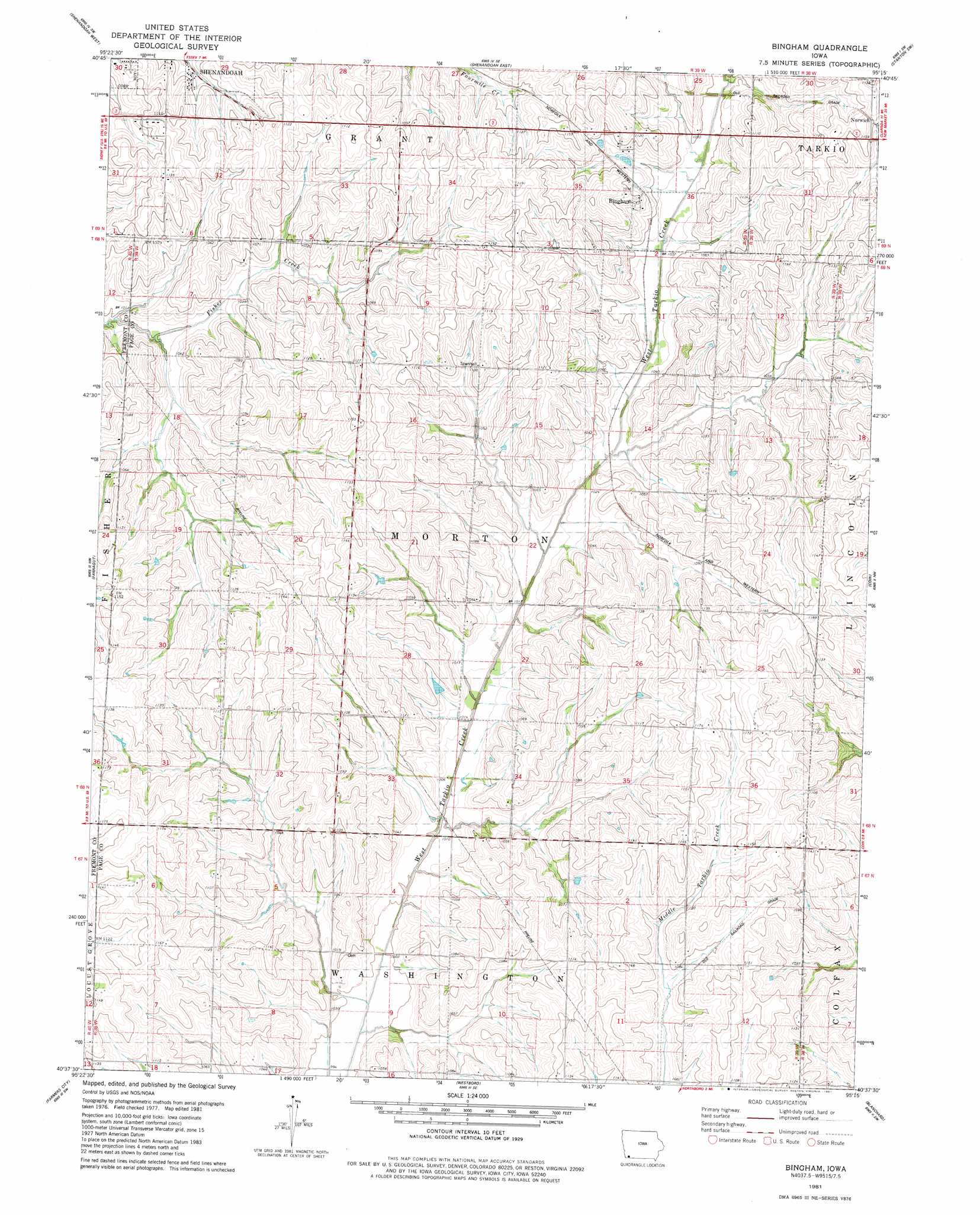
USGS Topo Quad 40095f3 - 1:24,000 scale
| Topo Map Name: | Bingham |
| USGS Topo Quad ID: | 40095f3 |
| Print Size: | ca. 21 1/4" wide x 27" high |
| Southeast Coordinates: | 40.625° N latitude / 95.25° W longitude |
| Map Center Coordinates: | 40.6875° N latitude / 95.3125° W longitude |
| U.S. State: | IA |
| Filename: | o40095f3.jpg |
| Download Map JPG Image: | Bingham topo map 1:24,000 scale |
| Map Type: | Topographic |
| Topo Series: | 7.5´ |
| Map Scale: | 1:24,000 |
| Source of Map Images: | United States Geological Survey (USGS) |
| Alternate Map Versions: |
Bingham IA 1981, updated 1981 Download PDF Buy paper map Bingham IA 2010 Download PDF Buy paper map Bingham IA 2013 Download PDF Buy paper map Bingham IA 2015 Download PDF Buy paper map |
1:24,000 Topo Quads surrounding Bingham
Tabor Ne |
Imogene |
Coburg |
Red Oak South |
Stanton |
Randolph |
Shenandoah West |
Shenandoah East |
Stanton Sw |
Clarinda North |
Riverton |
Farragut |
Bingham |
Coin |
Clarinda South |
Mcelroy Creek |
Farmers City |
Westboro |
Blanchard |
Clearmont |
Rockport |
Tarkio West |
Tarkio East |
Skidmore Nw |
Burlington Junction |
> Back to 40095e1 at 1:100,000 scale
> Back to 40094a1 at 1:250,000 scale
> Back to U.S. Topo Maps home
Bingham topo map: Gazetteer
Bingham: Populated Places
Bingham elevation 335m 1099′Norwich elevation 354m 1161′
Bingham: Post Offices
Bingham Post Office (historical) elevation 335m 1099′Norwich Post Office (historical) elevation 352m 1154′
Bingham digital topo map on disk
Buy this Bingham topo map showing relief, roads, GPS coordinates and other geographical features, as a high-resolution digital map file on DVD: