Liberty Se Topo Map Nebraska
To zoom in, hover over the map of Liberty Se
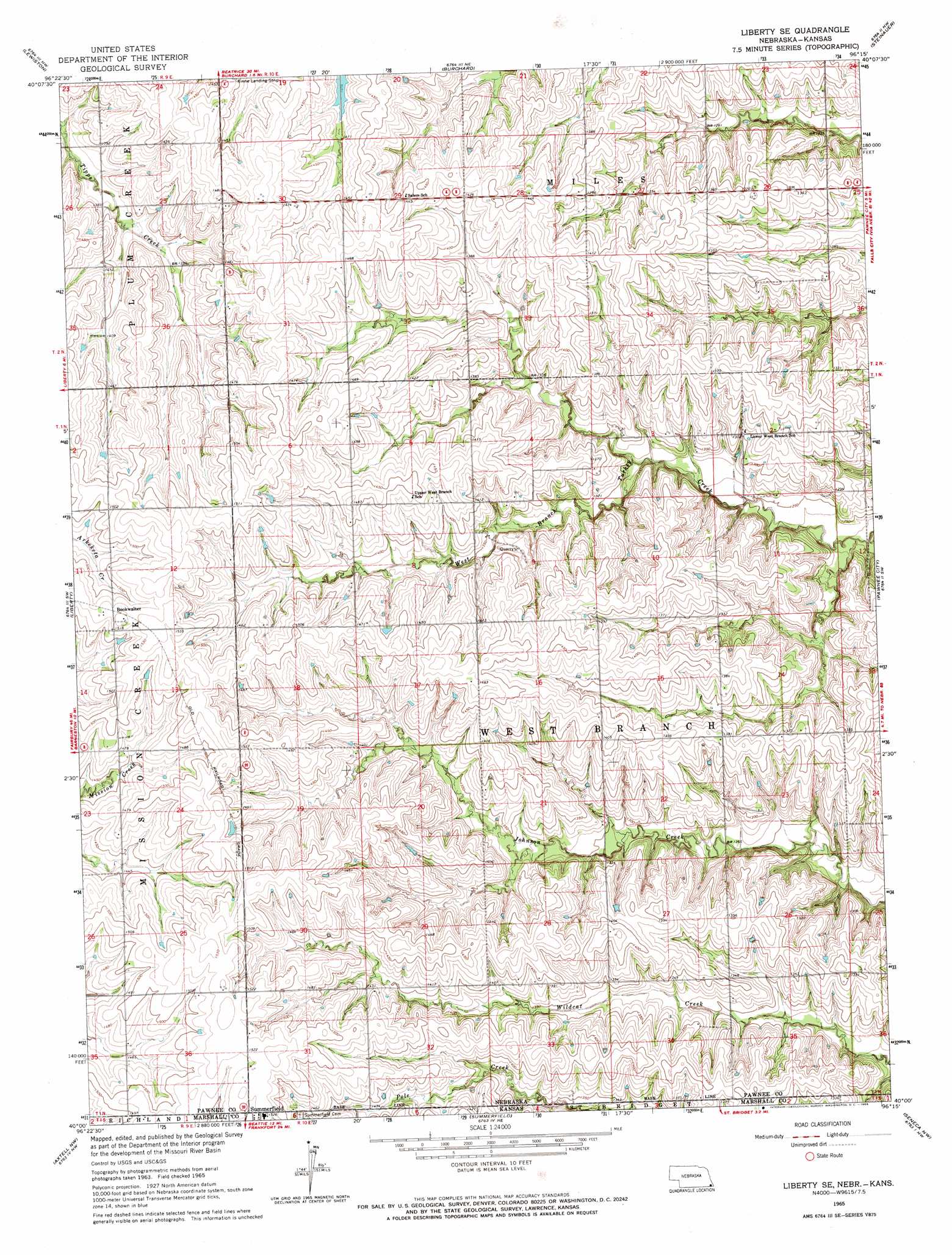
USGS Topo Quad 40096a3 - 1:24,000 scale
| Topo Map Name: | Liberty Se |
| USGS Topo Quad ID: | 40096a3 |
| Print Size: | ca. 21 1/4" wide x 27" high |
| Southeast Coordinates: | 40° N latitude / 96.25° W longitude |
| Map Center Coordinates: | 40.0625° N latitude / 96.3125° W longitude |
| U.S. States: | NE, KS |
| Filename: | O40096A3.jpg |
| Download Map JPG Image: | Liberty Se topo map 1:24,000 scale |
| Map Type: | Topographic |
| Topo Series: | 7.5´ |
| Map Scale: | 1:24,000 |
| Source of Map Images: | United States Geological Survey (USGS) |
| Alternate Map Versions: |
Liberty SE NE 1965, updated 1966 Download PDF Buy paper map Liberty SE NE 2011 Download PDF Buy paper map Liberty SE NE 2014 Download PDF Buy paper map |
1:24,000 Topo Quads surrounding Liberty Se
Filley |
Crab Orchard |
Vesta |
Tecumseh |
Tecumseh Se |
Wymore Ne |
Lewiston |
Burchard |
Steinauer |
Table Rock |
Barneston |
Liberty |
Liberty Se |
Pawnee City |
Du Bois |
Oketo |
Axtell Nw |
Summerfield |
Seneca Nw |
Saint Benedict |
Home |
Beattie |
Axtell |
Baileyville |
Seneca |
> Back to 40096a1 at 1:100,000 scale
> Back to 40096a1 at 1:250,000 scale
> Back to U.S. Topo Maps home
Liberty Se topo map: Gazetteer
Liberty Se: Parks
Pawnee Prairie State Wildlife Management Area elevation 438m 1437′Liberty Se: Populated Places
Bookwalter elevation 465m 1525′Liberty Se: Post Offices
Bookwalter Post Office (historical) elevation 465m 1525′Liberty Se digital topo map on disk
Buy this Liberty Se topo map showing relief, roads, GPS coordinates and other geographical features, as a high-resolution digital map file on DVD: