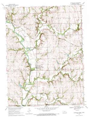
Barneston Topo Map Nebraska
To zoom in, hover over the map of Barneston
USGS Topo Quad 40096a5 - 1:24,000 scale
| Topo Map Name: | Barneston |
| USGS Topo Quad ID: | 40096a5 |
| Print Size: | ca. 21 1/4" wide x 27" high |
| Southeast Coordinates: | 40° N latitude / 96.5° W longitude |
| Map Center Coordinates: | 40.0625° N latitude / 96.5625° W longitude |
| U.S. States: | NE, KS |
| Filename: | O40096A5.jpg |
| Download Map JPG Image: | Barneston topo map 1:24,000 scale |
| Map Type: | Topographic |
| Topo Series: | 7.5´ |
| Map Scale: | 1:24,000 |
| Source of Map Images: | United States Geological Survey (USGS) |
| Alternate Map Versions: |
Barneston NE 1970, updated 1972 Download PDF Buy paper map Barneston NE 2011 Download PDF Buy paper map Barneston NE 2014 Download PDF Buy paper map |
1:24,000 Topo Quads surrounding Barneston
> Back to 40096a1 at 1:100,000 scale
> Back to 40096a1 at 1:250,000 scale
> Back to U.S. Topo Maps home
Barneston topo map: Gazetteer
Barneston: Dams
Barneston Power Plant Dam elevation 363m 1190′Mission Creek Dam 3-A elevation 396m 1299′
Plum Creek Dam 2-2 elevation 388m 1272′
Plum Creek Dam 2-A elevation 387m 1269′
Plum Creek Dam 2-D elevation 384m 1259′
Plum Creek Dam 2-E elevation 383m 1256′
Plum Creek Dam 2-F elevation 393m 1289′
Warford Dam elevation 368m 1207′
Barneston: Parks
Oto and Missouri Agency Historical Marker elevation 363m 1190′Barneston: Populated Places
Badger elevation 367m 1204′Barneston elevation 366m 1200′
Barneston: Post Offices
Barneston Post Office elevation 366m 1200′Barneston: Reservoirs
Barneston Power Plant Reservoir elevation 363m 1190′Mission Creek Reservoir 3-A elevation 396m 1299′
Plum Creek Reservoir 2-2 elevation 388m 1272′
Plum Creek Reservoir 2-A elevation 387m 1269′
Plum Creek Reservoir 2-D elevation 384m 1259′
Plum Creek Reservoir 2-E elevation 383m 1256′
Plum Creek Reservoir 2-F elevation 393m 1289′
Warford Reservoir elevation 368m 1207′
Barneston: Streams
Arkeketa Creek elevation 368m 1207′Mission Creek elevation 358m 1174′
Mission Creek elevation 358m 1174′
Wildcat Creek elevation 362m 1187′
Wolf Creek elevation 369m 1210′
Barneston digital topo map on disk
Buy this Barneston topo map showing relief, roads, GPS coordinates and other geographical features, as a high-resolution digital map file on DVD:


