Tecumseh Topo Map Nebraska
To zoom in, hover over the map of Tecumseh
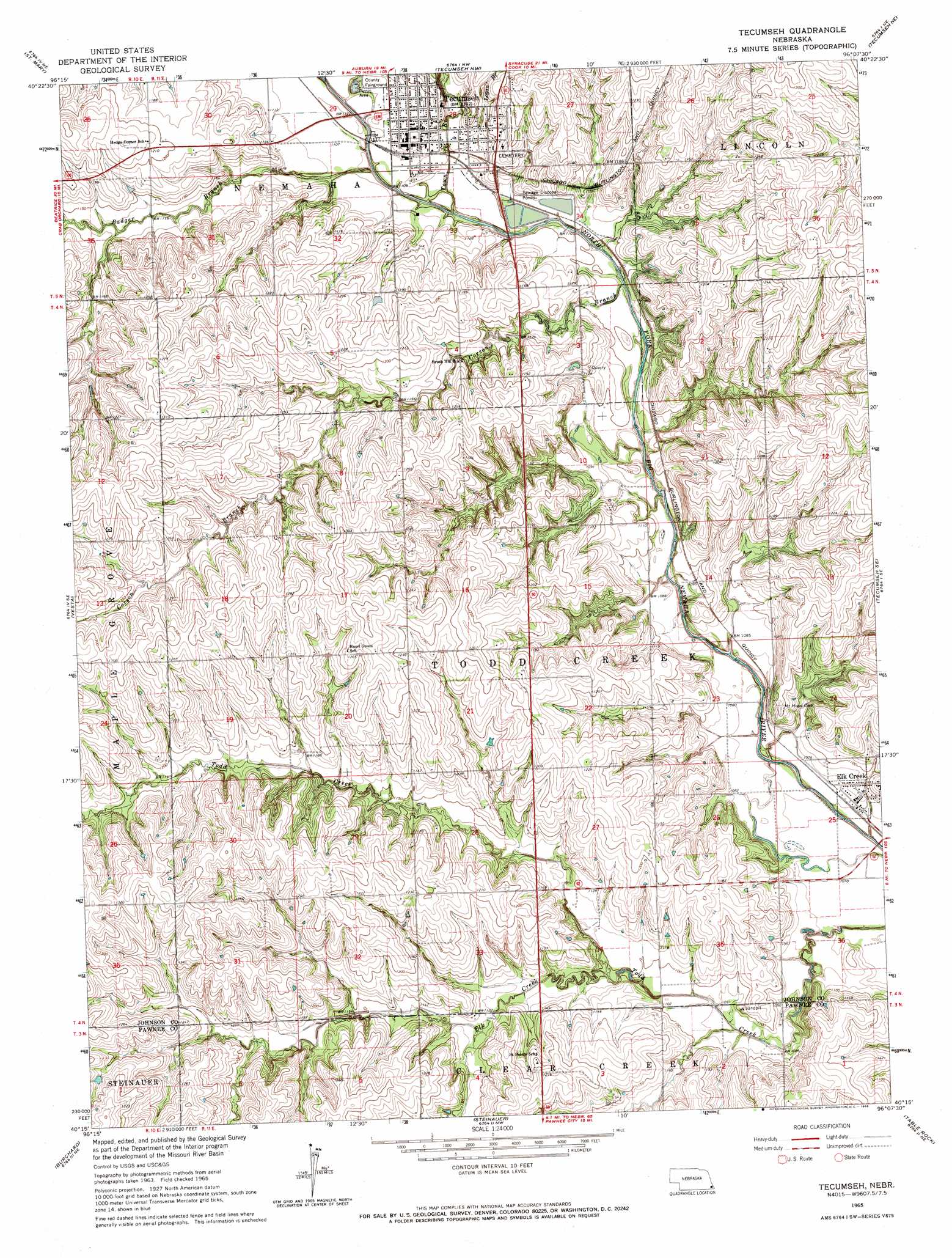
USGS Topo Quad 40096c2 - 1:24,000 scale
| Topo Map Name: | Tecumseh |
| USGS Topo Quad ID: | 40096c2 |
| Print Size: | ca. 21 1/4" wide x 27" high |
| Southeast Coordinates: | 40.25° N latitude / 96.125° W longitude |
| Map Center Coordinates: | 40.3125° N latitude / 96.1875° W longitude |
| U.S. State: | NE |
| Filename: | O40096c2.jpg |
| Download Map JPG Image: | Tecumseh topo map 1:24,000 scale |
| Map Type: | Topographic |
| Topo Series: | 7.5´ |
| Map Scale: | 1:24,000 |
| Source of Map Images: | United States Geological Survey (USGS) |
| Alternate Map Versions: |
Tecumseh NE 1965, updated 1966 Download PDF Buy paper map Tecumseh NE 2012 Download PDF Buy paper map Tecumseh NE 2014 Download PDF Buy paper map |
1:24,000 Topo Quads surrounding Tecumseh
Douglas |
Burr |
Cook |
Talmage |
Paul |
Sterling |
Saint Mary |
Tecumseh Nw |
Tecumseh Ne |
Brock |
Crab Orchard |
Vesta |
Tecumseh |
Tecumseh Se |
Howe Sw |
Lewiston |
Burchard |
Steinauer |
Table Rock |
Humboldt |
Liberty |
Liberty Se |
Pawnee City |
Du Bois |
Humboldt Sw |
> Back to 40096a1 at 1:100,000 scale
> Back to 40096a1 at 1:250,000 scale
> Back to U.S. Topo Maps home
Tecumseh topo map: Gazetteer
Tecumseh: Dams
Spring Creek Dam 9-2 elevation 375m 1230′Tecumseh: Parks
Johnson County Fairgrounds Park elevation 341m 1118′Tecumseh City Park elevation 337m 1105′
Tecumseh Historical Marker elevation 346m 1135′
Twin Oaks State Wildlife Management Area elevation 372m 1220′
Tecumseh: Populated Places
Elk Creek elevation 328m 1076′Tecumseh elevation 346m 1135′
Tecumseh: Post Offices
Elk Creek Post Office elevation 328m 1076′Tecumseh Post Office elevation 347m 1138′
Tecumseh: Reservoirs
Spring Creek Reservoir 9-2 elevation 375m 1230′Tecumseh: Streams
Badger Branch elevation 331m 1085′Corson Branch elevation 327m 1072′
Elk Creek elevation 332m 1089′
Logan Branch elevation 338m 1108′
Town Branch elevation 330m 1082′
Tecumseh digital topo map on disk
Buy this Tecumseh topo map showing relief, roads, GPS coordinates and other geographical features, as a high-resolution digital map file on DVD: