Vesta Topo Map Nebraska
To zoom in, hover over the map of Vesta
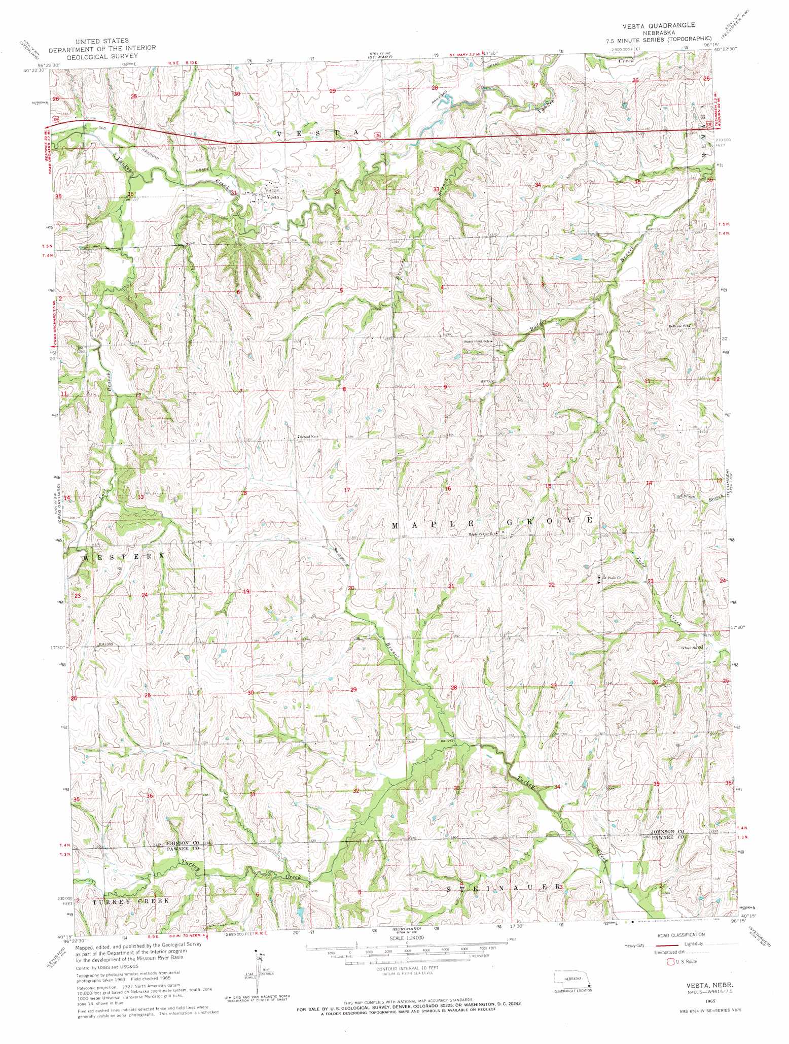
USGS Topo Quad 40096c3 - 1:24,000 scale
| Topo Map Name: | Vesta |
| USGS Topo Quad ID: | 40096c3 |
| Print Size: | ca. 21 1/4" wide x 27" high |
| Southeast Coordinates: | 40.25° N latitude / 96.25° W longitude |
| Map Center Coordinates: | 40.3125° N latitude / 96.3125° W longitude |
| U.S. State: | NE |
| Filename: | O40096c3.jpg |
| Download Map JPG Image: | Vesta topo map 1:24,000 scale |
| Map Type: | Topographic |
| Topo Series: | 7.5´ |
| Map Scale: | 1:24,000 |
| Source of Map Images: | United States Geological Survey (USGS) |
| Alternate Map Versions: |
Vesta NE 1965, updated 1966 Download PDF Buy paper map Vesta NE 2011 Download PDF Buy paper map Vesta NE 2014 Download PDF Buy paper map |
1:24,000 Topo Quads surrounding Vesta
Firth |
Douglas |
Burr |
Cook |
Talmage |
Adams |
Sterling |
Saint Mary |
Tecumseh Nw |
Tecumseh Ne |
Filley |
Crab Orchard |
Vesta |
Tecumseh |
Tecumseh Se |
Wymore Ne |
Lewiston |
Burchard |
Steinauer |
Table Rock |
Barneston |
Liberty |
Liberty Se |
Pawnee City |
Du Bois |
> Back to 40096a1 at 1:100,000 scale
> Back to 40096a1 at 1:250,000 scale
> Back to U.S. Topo Maps home
Vesta topo map: Gazetteer
Vesta: Parks
Hickory Ridge State Wildlife Management Area elevation 412m 1351′Vesta: Populated Places
Vesta elevation 375m 1230′Vesta: Post Offices
Turkey Creek Post Office (historical) elevation 396m 1299′Vesta Post Office (historical) elevation 375m 1230′
Vesta: Streams
Brewers Branch elevation 353m 1158′Lost Branch elevation 369m 1210′
Sampson Branch elevation 383m 1256′
Vesta digital topo map on disk
Buy this Vesta topo map showing relief, roads, GPS coordinates and other geographical features, as a high-resolution digital map file on DVD: