Saint Mary Topo Map Nebraska
To zoom in, hover over the map of Saint Mary
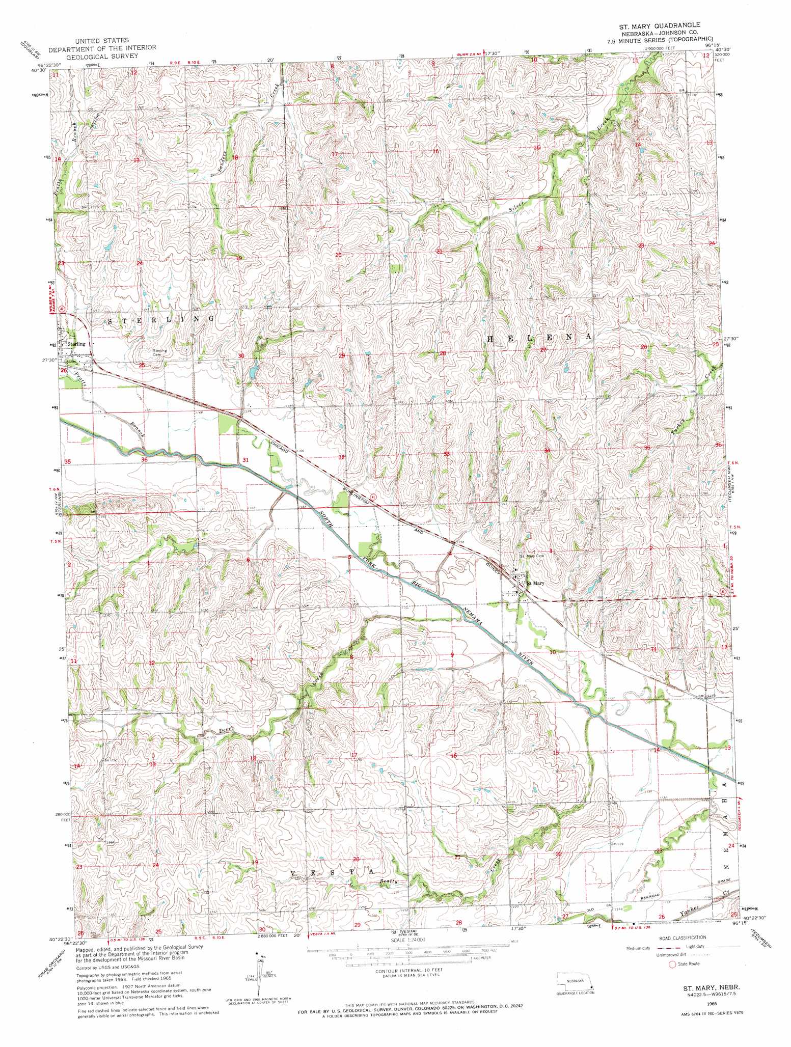
USGS Topo Quad 40096d3 - 1:24,000 scale
| Topo Map Name: | Saint Mary |
| USGS Topo Quad ID: | 40096d3 |
| Print Size: | ca. 21 1/4" wide x 27" high |
| Southeast Coordinates: | 40.375° N latitude / 96.25° W longitude |
| Map Center Coordinates: | 40.4375° N latitude / 96.3125° W longitude |
| U.S. State: | NE |
| Filename: | O40096d3.jpg |
| Download Map JPG Image: | Saint Mary topo map 1:24,000 scale |
| Map Type: | Topographic |
| Topo Series: | 7.5´ |
| Map Scale: | 1:24,000 |
| Source of Map Images: | United States Geological Survey (USGS) |
| Alternate Map Versions: |
St. Mary NE 1965, updated 1968 Download PDF Buy paper map Saint Mary NE 2012 Download PDF Buy paper map Saint Mary NE 2014 Download PDF Buy paper map |
1:24,000 Topo Quads surrounding Saint Mary
Bennet |
Palmyra |
Unadilla |
Syracuse |
Dunbar |
Firth |
Douglas |
Burr |
Cook |
Talmage |
Adams |
Sterling |
Saint Mary |
Tecumseh Nw |
Tecumseh Ne |
Filley |
Crab Orchard |
Vesta |
Tecumseh |
Tecumseh Se |
Wymore Ne |
Lewiston |
Burchard |
Steinauer |
Table Rock |
> Back to 40096a1 at 1:100,000 scale
> Back to 40096a1 at 1:250,000 scale
> Back to U.S. Topo Maps home
Saint Mary topo map: Gazetteer
Saint Mary: Dams
Heusman Dam elevation 362m 1187′Saint Mary: Populated Places
Saint Mary elevation 352m 1154′Saint Mary: Post Offices
Saint Mary Post Office elevation 352m 1154′Saint Mary: Reservoirs
Heusman Reservoir elevation 362m 1187′Saint Mary: Streams
Beatty Creek elevation 340m 1115′Deer Creek elevation 344m 1128′
Pratts Branch elevation 348m 1141′
Saint Mary digital topo map on disk
Buy this Saint Mary topo map showing relief, roads, GPS coordinates and other geographical features, as a high-resolution digital map file on DVD: